Photograph as originally submitted to
this page in the Historical Marker Database
www.HMdb.org.
Click on photo to resize in browser. Scroll down to see metadata.
Photographer: Internet Archive
Caption:
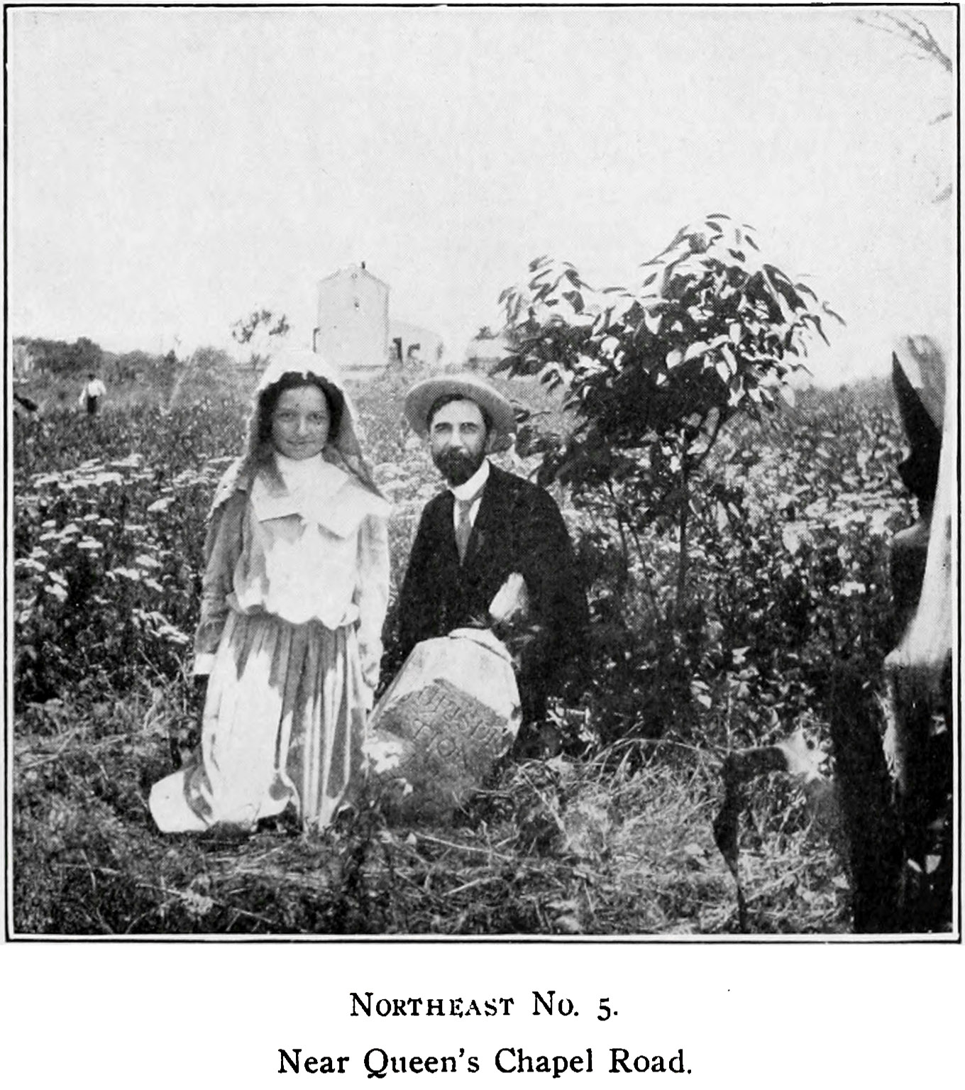
Northeast 5 Near Queens Chapel Road | Additional Description: “N. E. No. 5 is about one fourth of a mile from any travelled road and stands in the edge of a truck garden owned by Mr. Lewis Strckfus on a part of the old Klein estate. It is southwest from the Queen 's Chapel road, near the point where the C. & P. Telephone Company have established a repair station for long distance work. As will be seen from our illustration, which also shows Mr. Strckfus' daughter, Katy, the stone leans at an angle of 45 degrees; otherwise this stone is in good condition and the inscription is easily read. One wonders when and how, under the existing conditions, this massive stone more than two feet under ground, should thus change its position. One of the old residents assured us from his personal observation that for at least thirty years it had been in that same position.
More than likely some tremendous storm of years gone by like that which destroyed Minot's Ledge Lighthouse in 1851 or the great September gale of 1869, swelled the little ditch on the edge of which it stands, to a powerful, rushing stream, and in its course, washed away enough of the sand to topple the stone.” -- Fred Woodward.
From A Ramble Along the Boundary Stones of the District of Columbia with a Camera by Fred E. Woodward, 1907, Plate XIV.Submitted: April 9, 2021, by Allen C. Browne of Silver Spring, Maryland.
Database Locator Identification Number: p578296
File Size: 0.386 Megabytes
To see the metadata that may be embedded in this photo, sign in and then return to this page.