Photograph as originally submitted to
this page in the Historical Marker Database
www.HMdb.org.
Click on photo to resize in browser. Scroll down to see metadata.
Photographer: Craig Swain
Taken: July 21, 2007
Caption:
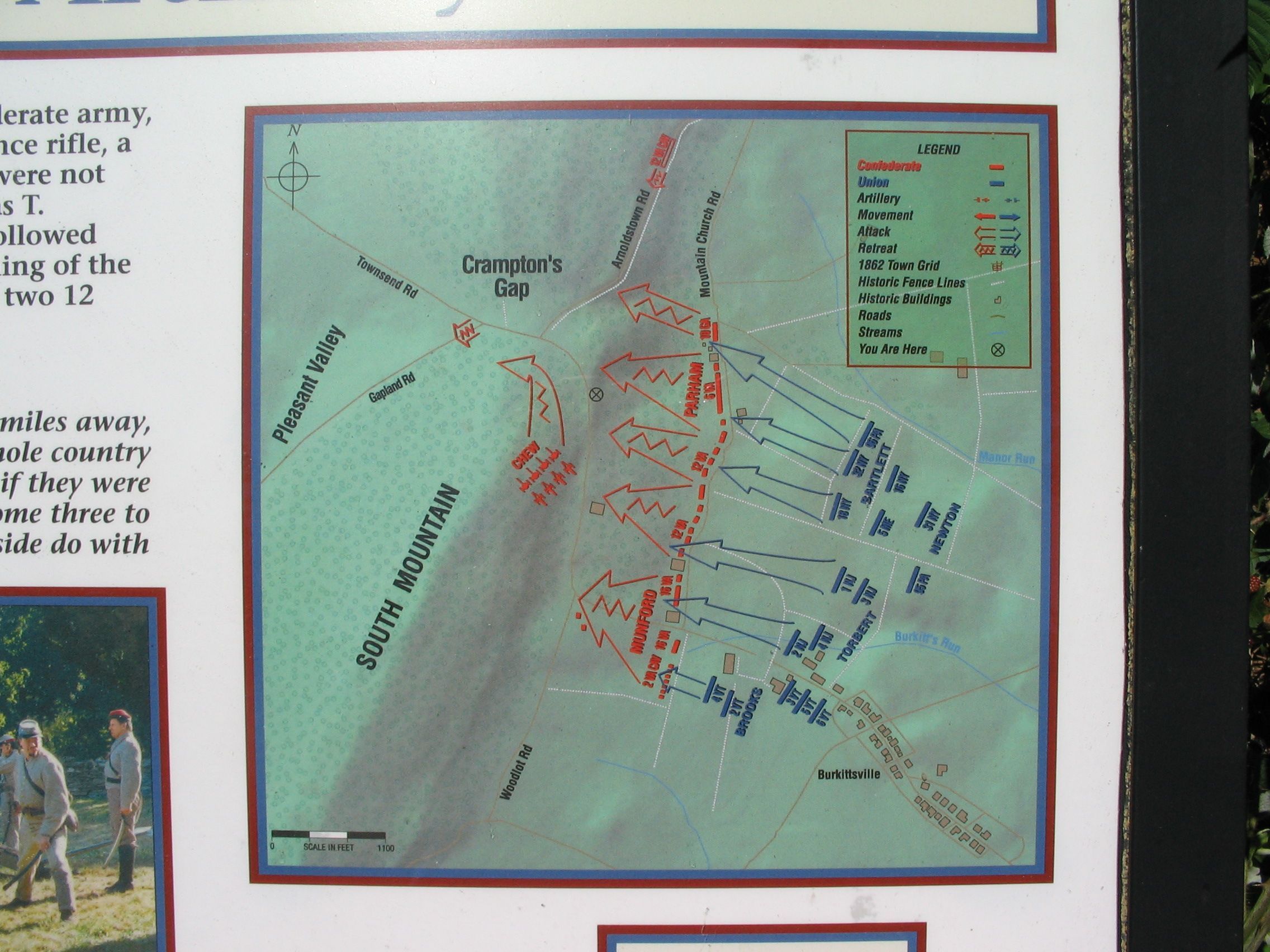
Close Up View of the Map | Additional Description: As noted on the map, the battery's position was slightly up-hill from the marker location.
Submitted: August 12, 2007, by Craig Swain of Leesburg, Virginia.
Database Locator Identification Number: p5795
File Size: 0.970 Megabytes
To see the metadata that may be embedded in this photo, sign in and then return to this page.