Photograph as originally submitted to
this page in the Historical Marker Database
www.HMdb.org.
Click on photo to resize in browser. Scroll down to see metadata.
Photographer: Larry Gertner
Taken: June 17, 2020
Caption:
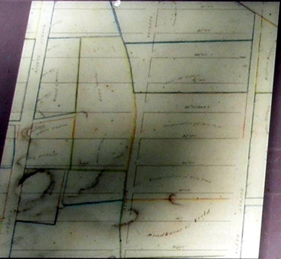
Inset | Additional Description:
This map created around 1820 shows the street grid laid out over the existing landscape of farms in the area that would become Seneca Village. To mark the future streets, surveyors placed a marble marker or “monument” at the southeast corner of each block; where a corner coincided with exposed bedrock, they drilled a hole and set an iron bolt instead.
Submitted: April 25, 2021, by Larry Gertner of New York, New York.
Database Locator Identification Number: p581576
File Size: 0.061 Megabytes
To see the metadata that may be embedded in this photo, sign in and then return to this page.