Photograph as originally submitted to
this page in the Historical Marker Database
www.HMdb.org.
Click on photo to resize in browser. Scroll down to see metadata.
Photographer: Source: 1817 maps from Oakland County.
Caption:
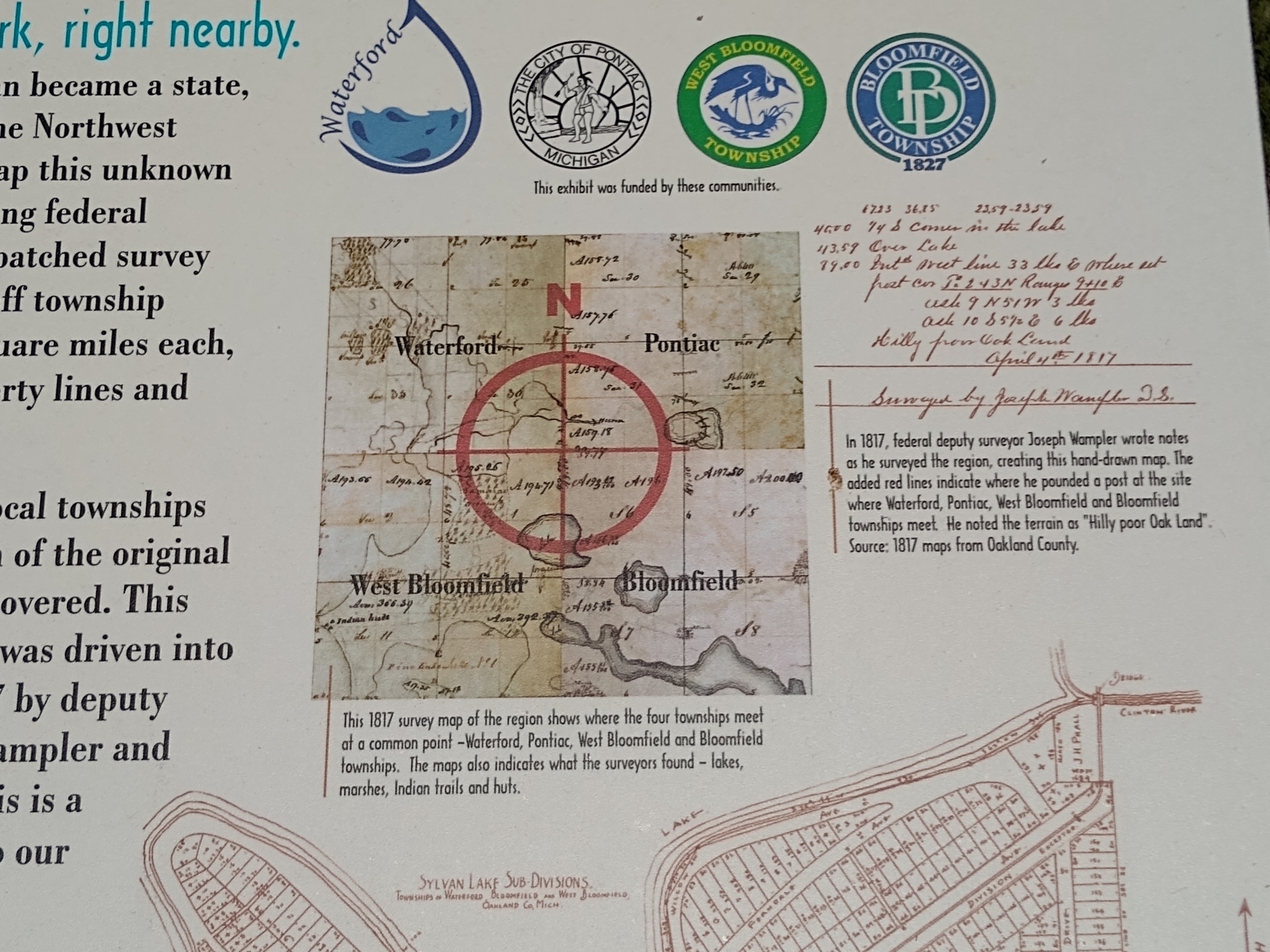
"X" Marks the Spot: A Tale of Four Townships Marker — upper right images | Additional Description: Left: This 1817 survey map of the region shows where the four townships meet at a common point —Waterford, Pontiac, West Bloomfield and Bloomfield townships. The maps [
sic] also indicates what the surveyors found — lakes, marshes, Indian trails and huts.
Right: In 1817, federal deputy surveyor Joseph Wampler wrote notes as he surveyed the region, creating this hand-drawn map. The added red lines indicate where he pounded a post at the site where Waterford, Pontiac, West Bloomfield and Bloomfield townships meet. He noted the terrain as "Hilly poor Oak Land".
Submitted: May 22, 2021, by Joel Seewald of Madison Heights, Michigan.
Database Locator Identification Number: p587057
File Size: 2.912 Megabytes
To see the metadata that may be embedded in this photo, sign in and then return to this page.