Photograph as originally submitted to
this page in the Historical Marker Database
www.HMdb.org.
Click on photo to resize in browser. Scroll down to see metadata.
Photographer: Craig Swain
Caption:
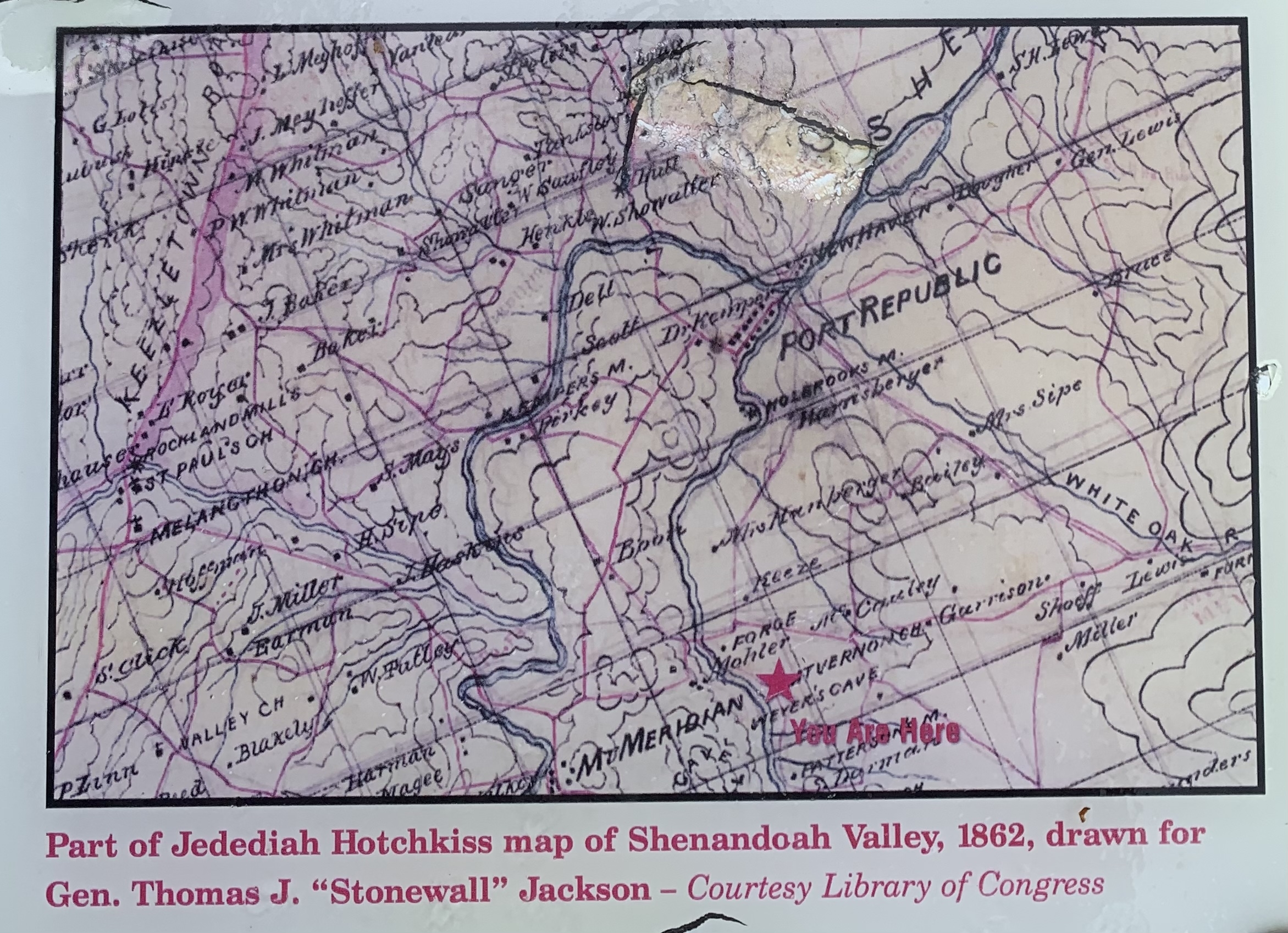
Hotchkiss Map | Additional Description: Part of Jedediah hotchkiss map of Shenandoah Valley, 1862, drawn for Gen. Thomas J. "Stonewall" Jackson.
- Courtesy Library of Congress. The star indicates the location of Weyers Cave.
Submitted: June 19, 2021, by Craig Swain of Leesburg, Virginia.
Database Locator Identification Number: p592347
File Size: 1.474 Megabytes
To see the metadata that may be embedded in this photo, sign in and then return to this page.