Photograph as originally submitted to
this page in the Historical Marker Database
www.HMdb.org.
Click on photo to resize in browser. Scroll down to see metadata.
Photographer: Larry Gertner
Taken: June 17, 2020
Caption:
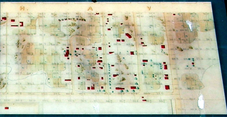
Inset | Additional Description: This map of Seneca Village from 1855, made just before Central Park was created, shows what appear to be small cultivated plots, enclosed areas for livestock, and trees scattered throughout the village. As some of these plots are large, it is possible that they were tended communally.
Submitted: June 26, 2021, by Larry Gertner of New York, New York.
Database Locator Identification Number: p593623
File Size: 0.113 Megabytes
To see the metadata that may be embedded in this photo, sign in and then return to this page.