Photograph as originally submitted to
this page in the Historical Marker Database
www.HMdb.org.
Click on photo to resize in browser. Scroll down to see metadata.
Photographer: Tennessee State Library and Archives
Caption:
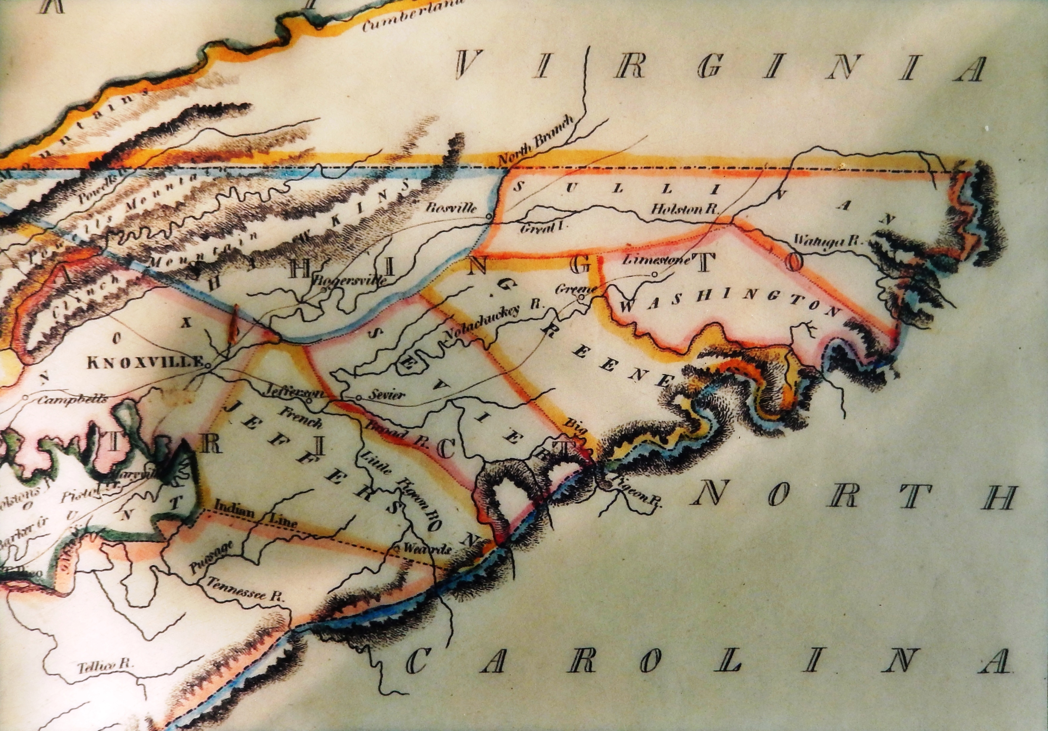
Marker detail: 1814 map of northeast Tennessee at the time of the state’s formation in 1796 | Submitted: October 18, 2021, by Cosmos Mariner of Cape Canaveral, Florida.
Database Locator Identification Number: p616734
File Size: 7.614 Megabytes
To see the metadata that may be embedded in this photo, sign in and then return to this page.