Photograph as originally submitted to
this page in the Historical Marker Database
www.HMdb.org.
Click on photo to resize in browser. Scroll down to see metadata.
Taken: 1863
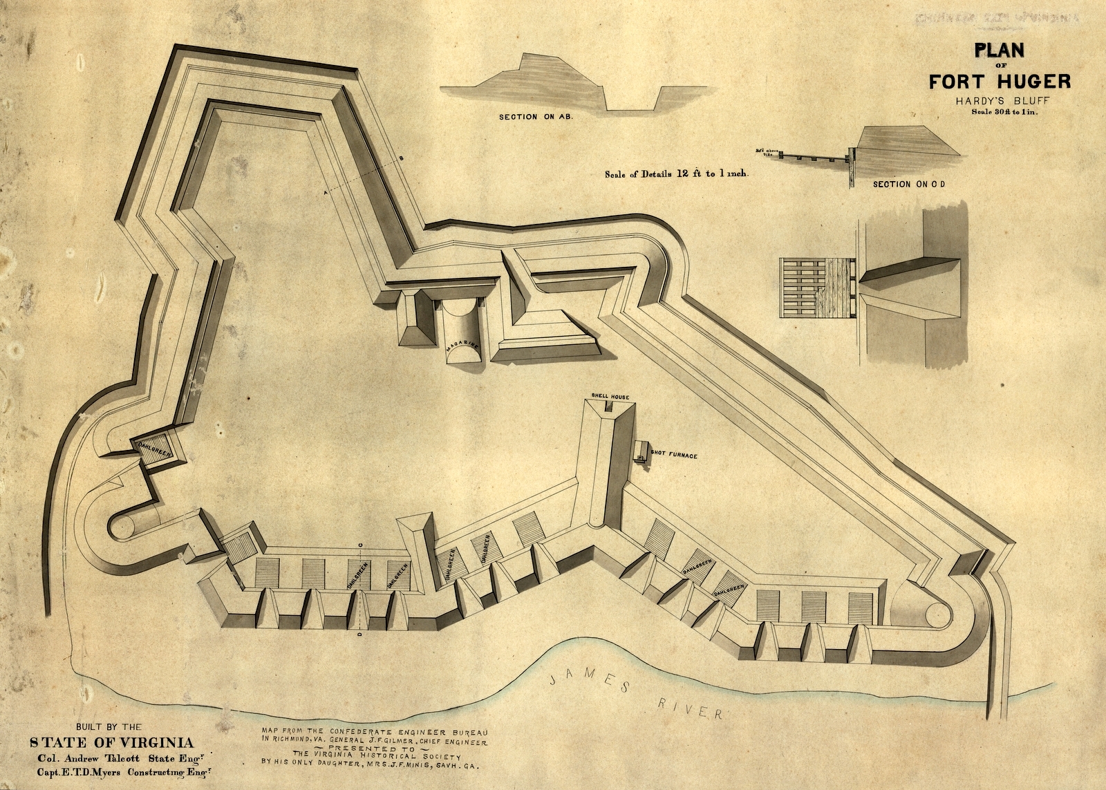
Caption:
Plan of Fort Huger at Hardy's Bluff. | Additional Description:
Library of Congress, Geography and Map Division [Map F232 Is8 1863:1]Submitted: May 5, 2009, by Bernard Fisher of Richmond, Virginia.
Database Locator Identification Number: p62065
File Size: 1.581 Megabytes
To see the metadata that may be embedded in this photo, sign in and then return to this page.