Photograph as originally submitted to
this page in the Historical Marker Database
www.HMdb.org.
Click on photo to resize in browser. Scroll down to see metadata.
Photographer: Dale K. Benington
Taken: April 28, 2009
Caption:
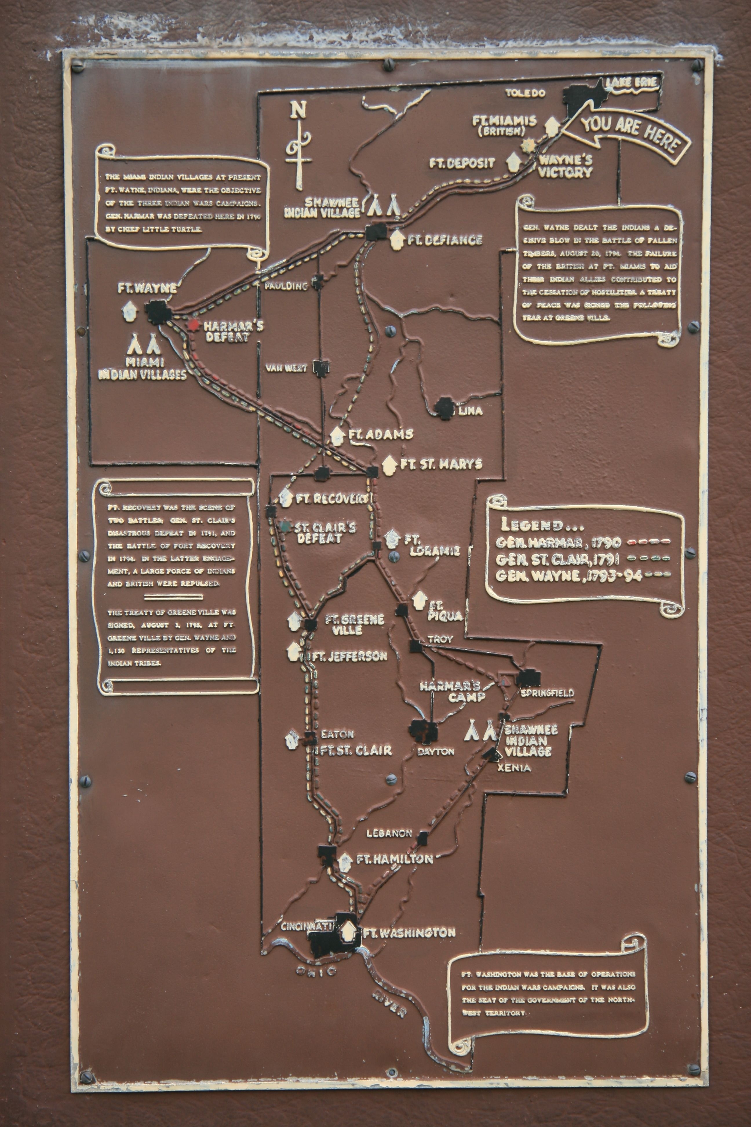
Fort Miamis Marker | Additional Description: A close-up view of the historical marker's map showing the various military campaign routes and sites of military fortifications and battles during the Indian Wars of 1790 - 1795.
Submitted: May 8, 2009, by Dale K. Benington of Toledo, Ohio.
Database Locator Identification Number: p62378
File Size: 3.688 Megabytes
To see the metadata that may be embedded in this photo, sign in and then return to this page.