Photograph as originally submitted to
this page in the Historical Marker Database
www.HMdb.org.
Click on photo to resize in browser. Scroll down to see metadata.
Photographer: Nat. Park Serv.
Caption:
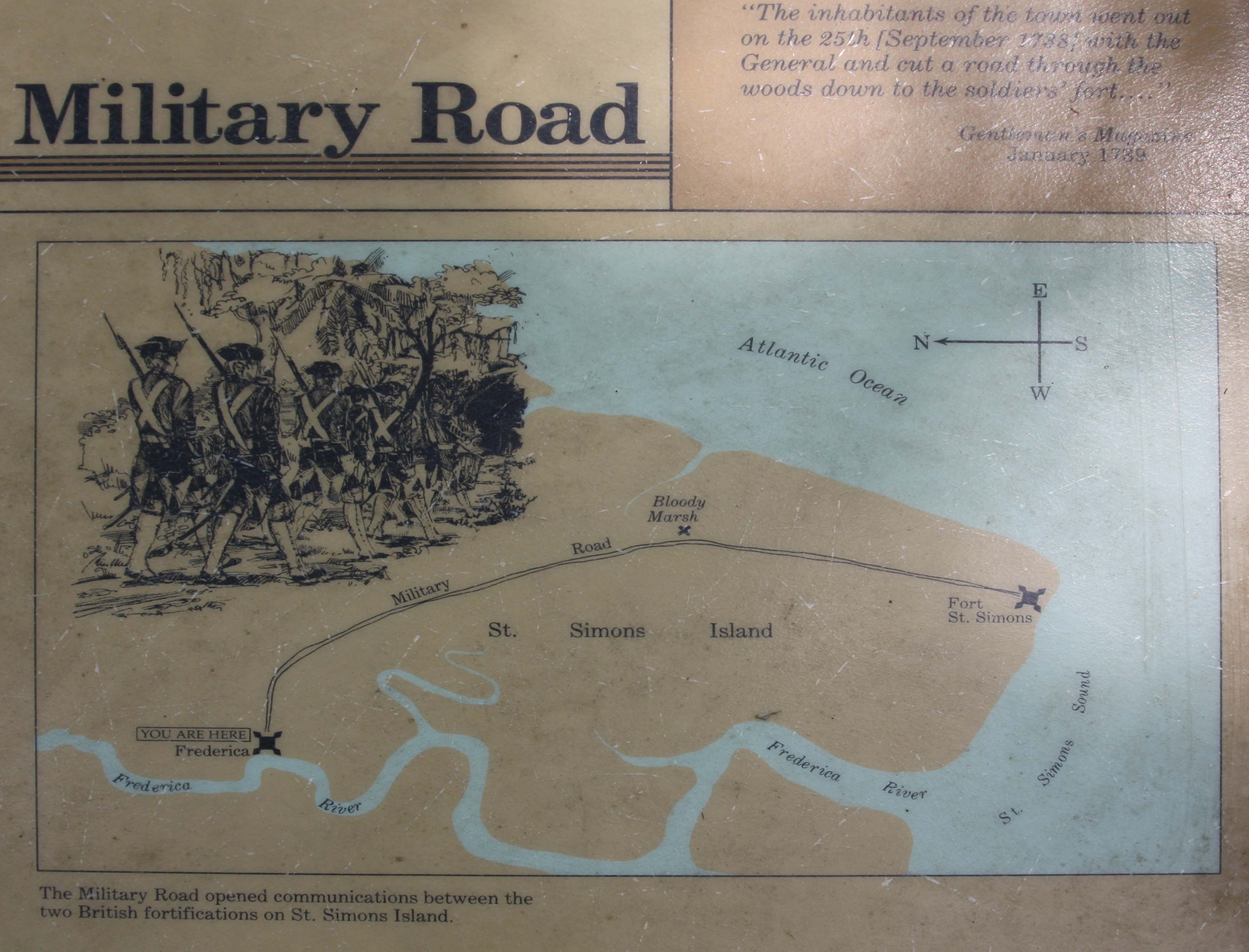
Frederica - Military Road Marker | Additional Description: The Military Road opened communications between the two British fortifications on St. Simons Island.
Submitted: May 13, 2009, by Mike Stroud of Bluffton, South Carolina.
Database Locator Identification Number: p63096
File Size: 0.615 Megabytes
To see the metadata that may be embedded in this photo, sign in and then return to this page.