Photograph as originally submitted to
this page in the Historical Marker Database
www.HMdb.org.
Click on photo to resize in browser. Scroll down to see metadata.
Photographer: Barry Swackhamer
Taken: July 24, 2021
Caption:
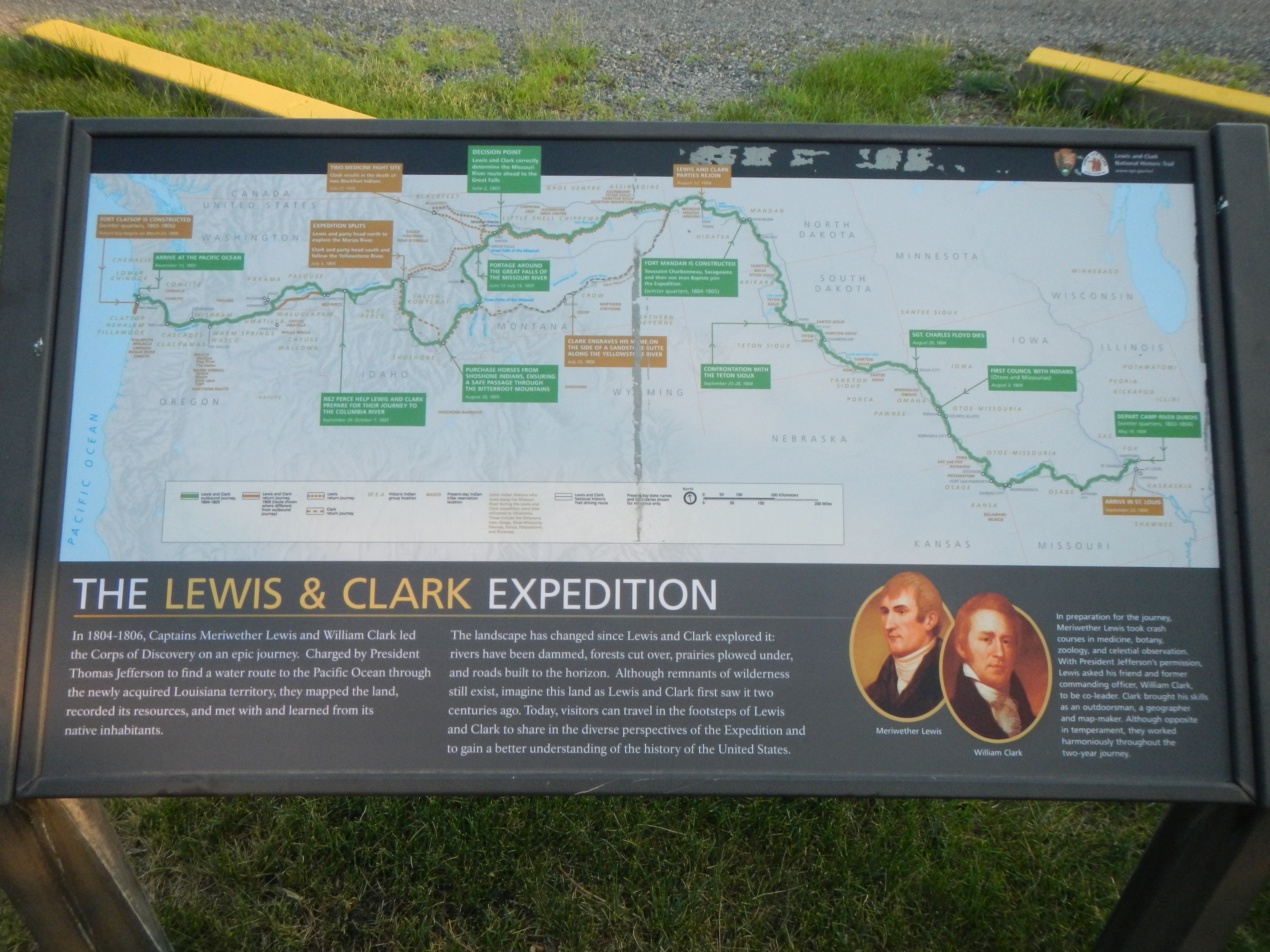
The Lewis & Clark Expedition Marker | Additional Description: NOTABLE OUTBOUND POINTS (green, east to west): Depart Camp River Dubois, (winter quarters, 1803-1804) May 14, 1804; First Council with Indians (Otoes and Missourias) August 3, 1804; Sgt. Charles Floyd Dies, August 10, 1804; Confrontation with the Teton Sioux, September 25-28, 1804; Fort Mandan is Constructed, Toussaint Charbonneau, Sacagawea and their son Jean Bapiste join the Expedition. (winter quarters, 1804-1805; Decision Point, Lewis and Clark correctly determine the Missouri River route ahead to the Great Falls, June 2, 1805; Portage Around the Great Falls of the Missouri River, June 13 - July 15, 1805; Purchase Horses from Shoshone Indians, ensuring a Safe Passage through the Bitterroot Mountains, August 30, 1805; Nez Perce help Lewis and Clark prepare for their Journey to the Columbia River, September 26 - October 7, 1805; Arrive at the Pacific Ocean, November 15, 1805.
NOTABLE INBOUND POINTS (orange, west to east): Fort Clatsop is Constructed, (winter quarters, 1805-1806), Return trip begins on March 23, 1806; Expedition Splits, Lewis and party head north to explore the Marias River. Clark and party head south and follow the Yellowstone River., July 3, 1806, Clark Engraves his name on the side of a Sandstone Butte along the Yellowstone River, July 25, 1806; Lewis and Clark Parties Rejoin, August 17, 1806; Arrive in St. Louis, September 23, 1806.
Submitted: January 28, 2022, by Barry Swackhamer of Brentwood, California.
Database Locator Identification Number: p636603
File Size: 3.368 Megabytes
To see the metadata that may be embedded in this photo, sign in and then return to this page.