Photograph as originally submitted to
this page in the Historical Marker Database
www.HMdb.org.
Click on photo to resize in browser. Scroll down to see metadata.
Photographer: Barry Swackhamer
Taken: July 26, 2021
Caption:
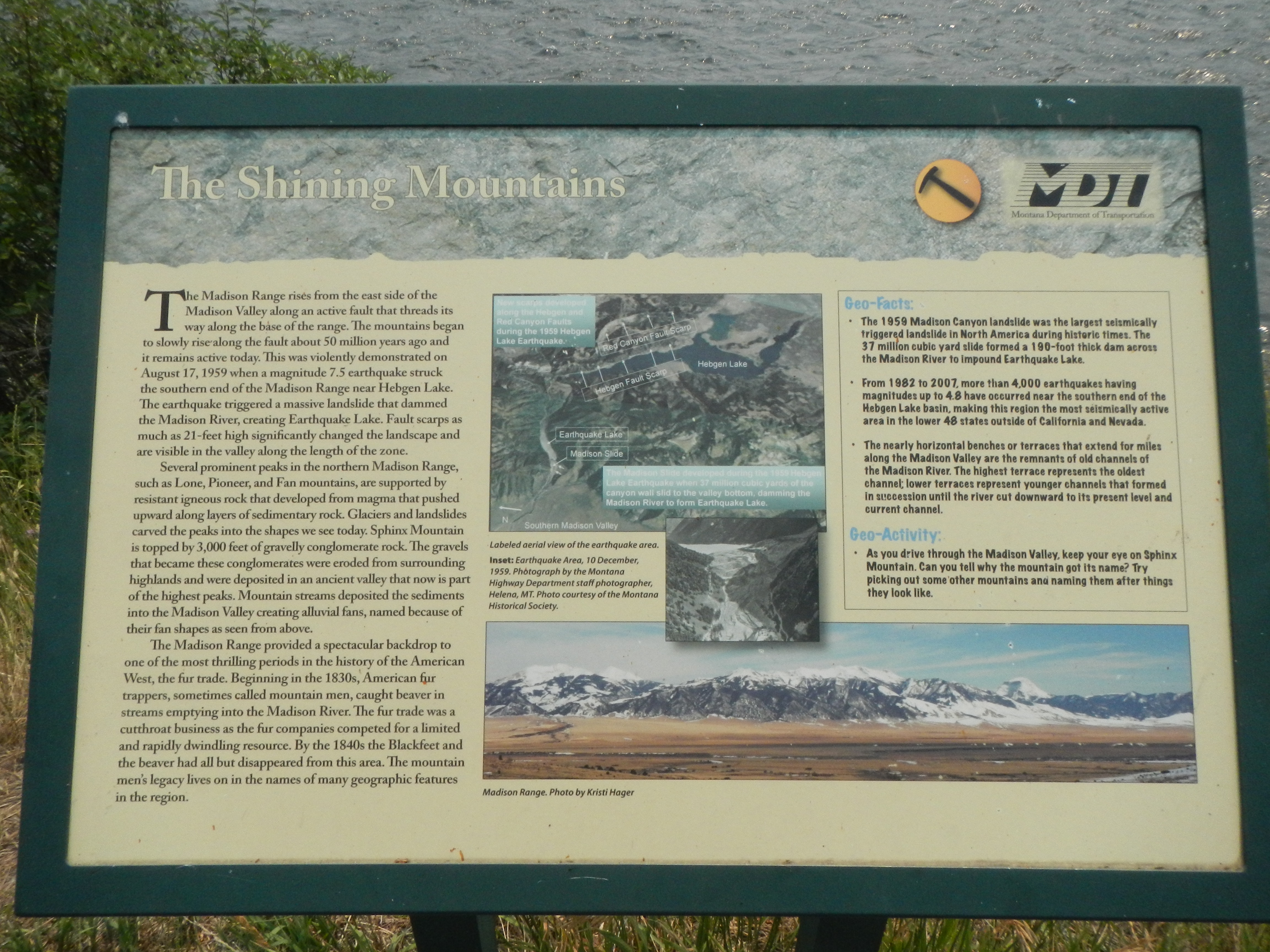
The Shining Mountains Marker | Additional Description: Captions: (upper center) Labeled aerial view of the earthquake area. New scarps developed along the Heggen and Red Canyon Faults during the 1959 Hebgen Lake Earthquake. The Madison Slide developed during the 1959 Hebgen Lake Earthquake when 37 million cubic yards of the canyon wall slid to the valley bottom, dating the Madison River to from Earthquake Lake.; (insert:) Earthquake Area, 10 December 1959.; (bottom right) Madison Range
Submitted: February 27, 2022, by Barry Swackhamer of Brentwood, California.
Database Locator Identification Number: p640941
File Size: 3.141 Megabytes
To see the metadata that may be embedded in this photo, sign in and then return to this page.