Photograph as originally submitted to
this page in the Historical Marker Database
www.HMdb.org.
Click on photo to resize in browser. Scroll down to see metadata.
Caption:
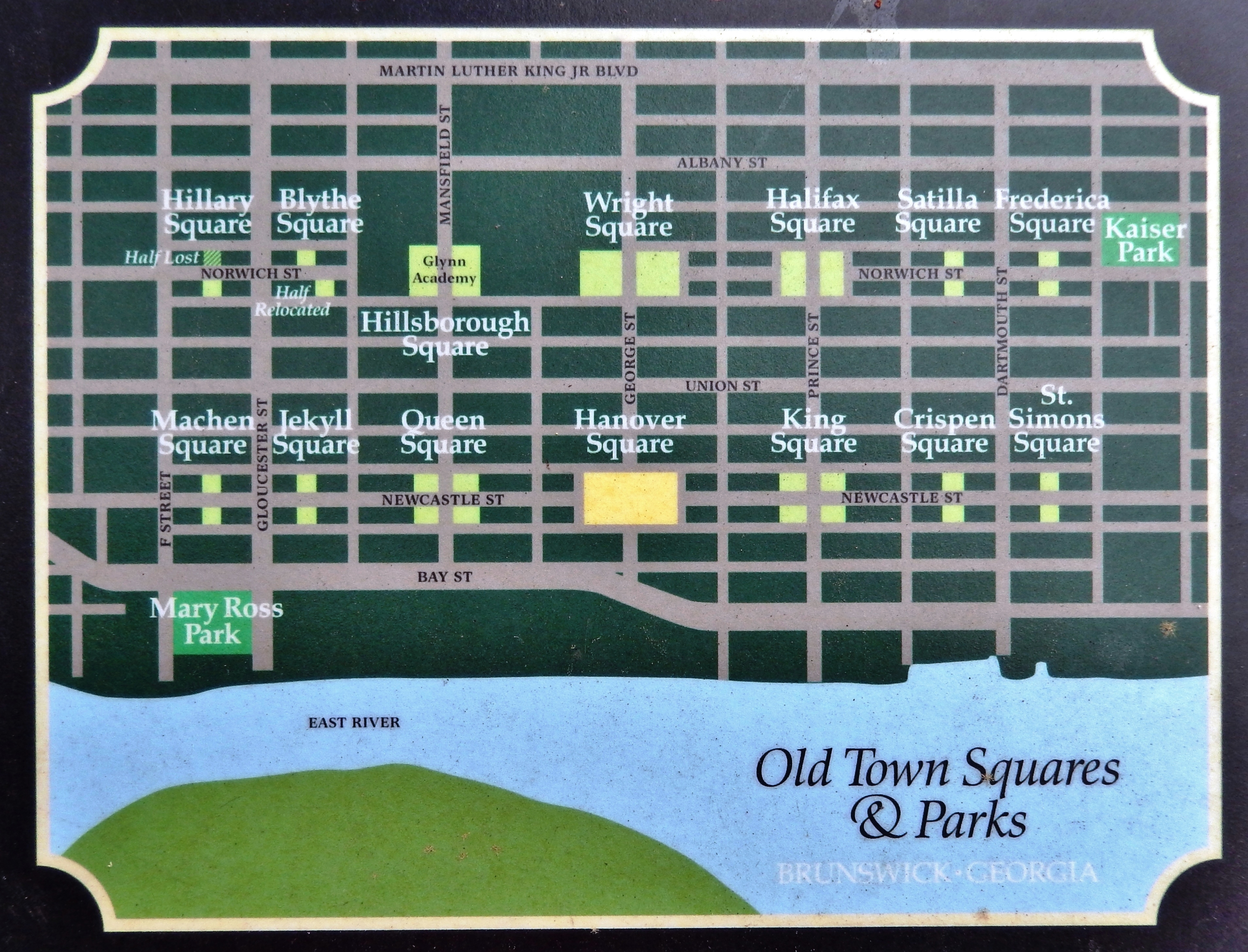
Marker detail: 1771 Town Plat • “the Oglethorpe Plan” | Additional Description: In 1771, the city of Brunswick, Georgia was laid out according to “the Oglethorpe plan,” named after the colony’s founder, General James Edward Oglethorpe. The design featured a grid of 14 large and 14 small squares. The intention of the plan was to create permanent, park-like common areas throughout the city. The squares still bear their original names, which reveal Brunswick’s strong historic ties to England.
Submitted: March 14, 2022, by Cosmos Mariner of Cape Canaveral, Florida.
Database Locator Identification Number: p643271
File Size: 4.121 Megabytes
To see the metadata that may be embedded in this photo, sign in and then return to this page.