Photograph as originally submitted to
this page in the Historical Marker Database
www.HMdb.org.
Click on photo to resize in browser. Scroll down to see metadata.
Photographer: Craig Baker
Taken: June 3, 2022
Caption:
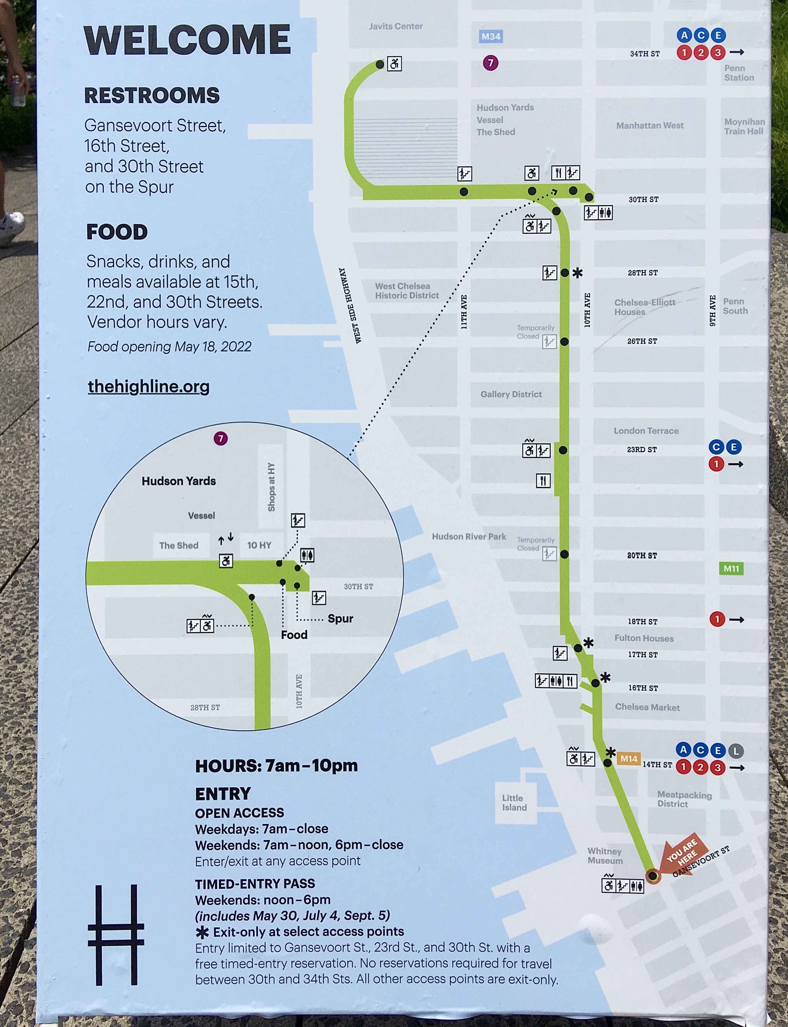
High Line map | Additional Description: This map is on display at the south end of the High Line. Inset shows The Spur. (click on photo to enlarge)
Submitted: June 3, 2022, by Craig Baker of Sylmar, California.
Database Locator Identification Number: p659273
File Size: 2.309 Megabytes
To see the metadata that may be embedded in this photo, sign in and then return to this page.