Photograph as originally submitted to
this page in the Historical Marker Database
www.HMdb.org.
Click on photo to resize in browser. Scroll down to see metadata.
Photographer: Craig Swain
Taken: September 28, 2022
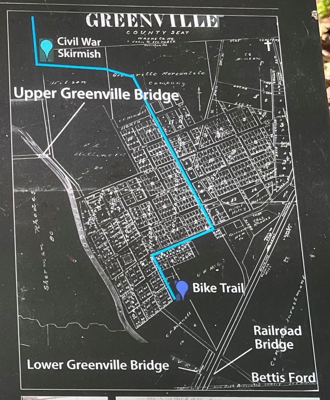
Caption:
Map on the Marker | Additional Description: The map has the route of the bike trail highlighted in blue. Callouts indicate the location of the Upper Greenville Bridge and the Lower (Railroad) Bridge.
Submitted: October 30, 2022, by Craig Swain of Leesburg, Virginia.
Database Locator Identification Number: p686320
File Size: 1.118 Megabytes
To see the metadata that may be embedded in this photo, sign in and then return to this page.