Photograph as originally submitted to
this page in the Historical Marker Database
www.HMdb.org.
Click on photo to resize in browser. Scroll down to see metadata.
Photographer: Craig Swain
Taken: September 28, 2022
Caption:
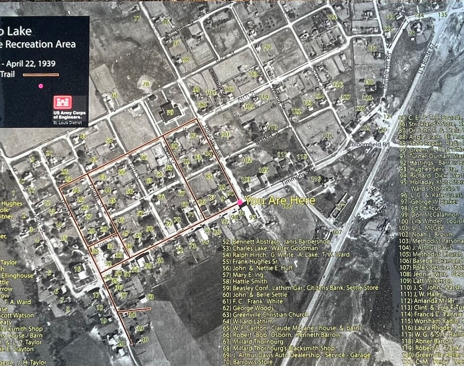
Close Up of the Aerial Photograph | Additional Description: The dark red line indicates the course of the Memory Lane walking tour of Old Greenville. A red dot indicates the reader's location relative to the photograph. One may wish to open this photo in a separate page in order to best match with the keys listed on the marker.
Submitted: November 6, 2022, by Craig Swain of Leesburg, Virginia.
Database Locator Identification Number: p688341
File Size: 1.502 Megabytes
To see the metadata that may be embedded in this photo, sign in and then return to this page.