Photograph as originally submitted to
this page in the Historical Marker Database
www.HMdb.org.
Click on photo to resize in browser. Scroll down to see metadata.
Photographer: The Hilton Head Island Historical Society
Taken: `
Caption:
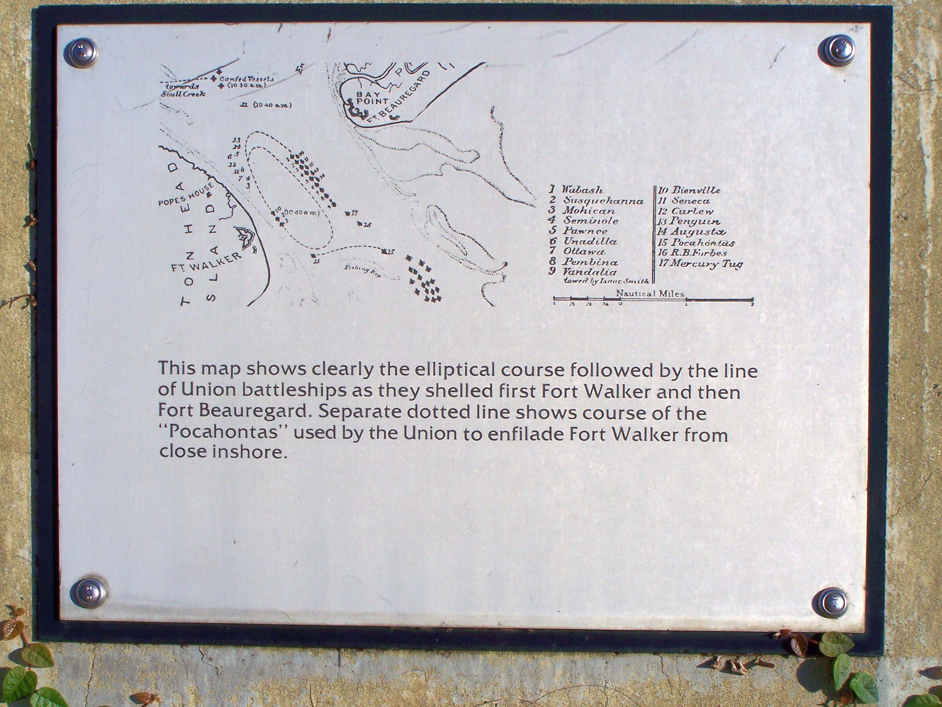
Fort Walker Line of Union ships Port Royal Interpretive Marker | Additional Description: This map shows clearly the elliptical course followed by the line of Union battleships as they shelled first Fort Walker and the Fort Beauregard. Separate dotted line shows course of the "Pocahontas" used by the Union to enfilade Fort Walker from close inshore.
Submitted: August 30, 2009, by Mike Stroud of Bluffton, South Carolina.
Database Locator Identification Number: p75663
File Size: 0.538 Megabytes
To see the metadata that may be embedded in this photo, sign in and then return to this page.