Photograph as originally submitted to
this page in the Historical Marker Database
www.HMdb.org.
Click on photo to resize in browser. Scroll down to see metadata.
Photographer: via Rare Maps
Taken: unknown
Caption:
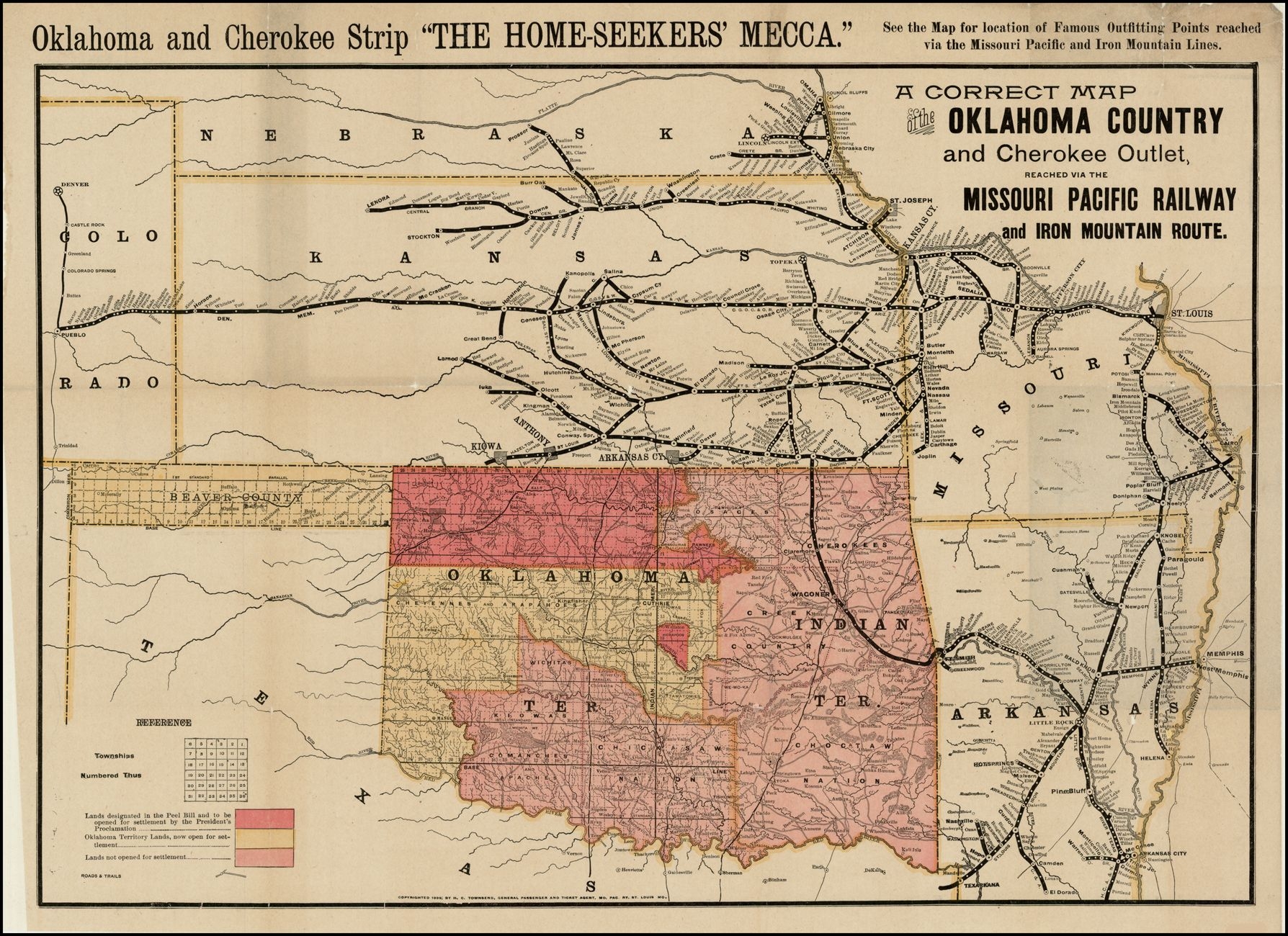
A Correct Map of the Oklahoma Country and Cherokee Outlet, Reached via the Missouri Pacific Railway | Submitted: October 29, 2023, by Larry Gertner of New York, New York.
Database Locator Identification Number: p757240
File Size: 2.773 Megabytes
To see the metadata that may be embedded in this photo, sign in and then return to this page.