Photograph as originally submitted to
this page in the Historical Marker Database
www.HMdb.org.
Click on photo to resize in browser. Scroll down to see metadata.
Photographer: U.S. National Park Service
Taken: 1936
Caption:
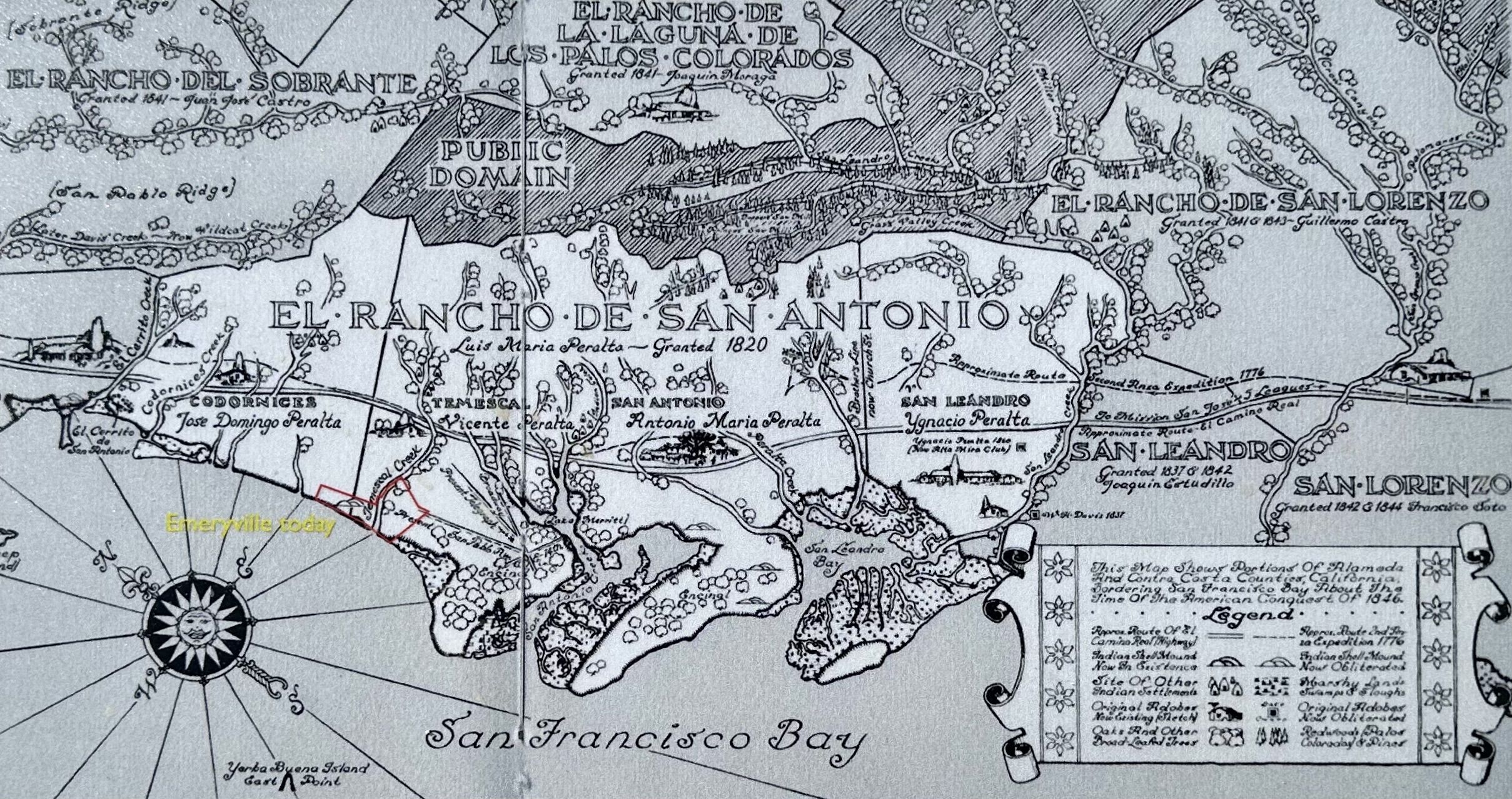
Marker detail: map and caption | Additional Description: Portion of “An Historical Map of the East Bay”, published by the U.S. National Park Service in 1936, showing how Rancho San Antonio was divided among the Peralta Brothers, with Emeryville’s present borders superimposed in red.
Submitted: January 6, 2024, by Andrew Ruppenstein of Lamorinda, California.
Database Locator Identification Number: p768259
File Size: 1.517 Megabytes
To see the metadata that may be embedded in this photo, sign in and then return to this page.