Photograph as originally submitted to
this page in the Historical Marker Database
www.HMdb.org.
Click on photo to resize in browser. Scroll down to see metadata.
Photographer: Library of Congress
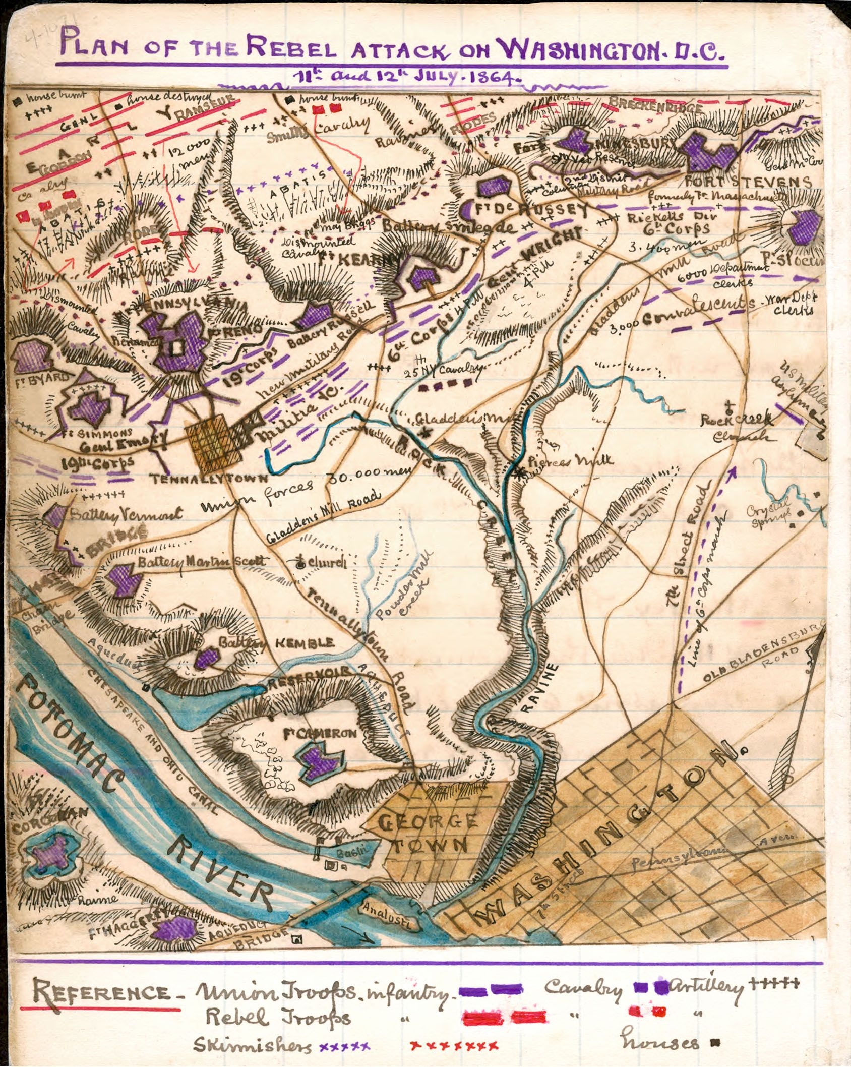
Caption:
Plan of the Rebel Attack
on Washington D.C.
11th and 12th July, 1864
by Robert Knox Sneden | Additional Description: Shortly after the Battle of Fort Stevens, U.S. Army Topographic Engineer Robert K. Sneden drew this somewhat inaccurate map of the field of action, which stretched from Fort DeRussey to Fort Slocum.
Library of Congress, Geography and Map Division.
Submitted: March 15, 2024, by Allen C. Browne of Silver Spring, Maryland.
Database Locator Identification Number: p779160
File Size: 0.886 Megabytes
To see the metadata that may be embedded in this photo, sign in and then return to this page.