Photograph as originally submitted to
this page in the Historical Marker Database
www.HMdb.org.
Click on photo to resize in browser. Scroll down to see metadata.
Photographer: Craig Swain
Taken: July 30, 2023
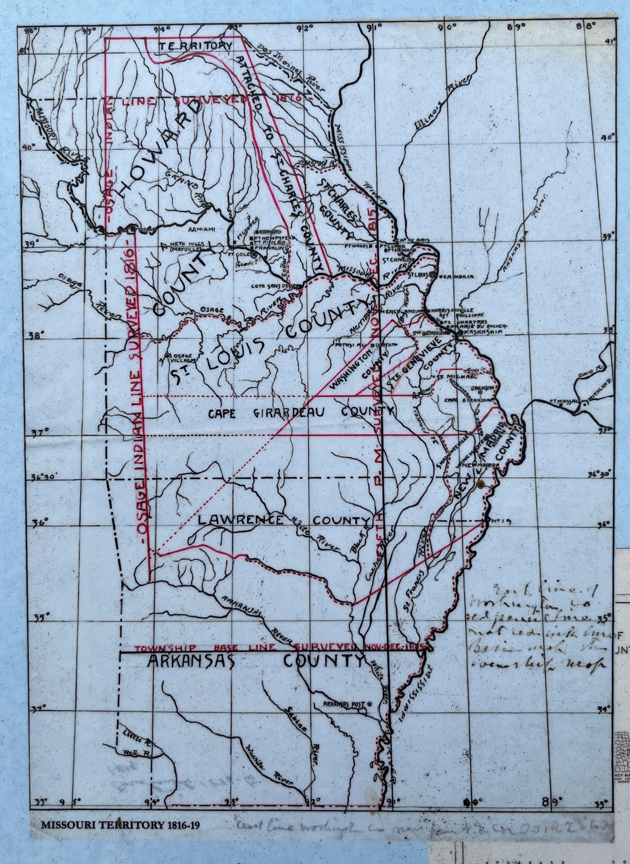
Caption:
Missouri Territory, 1816-19 | Additional Description: On the upper left of the marker. Note that New Madrid County included lands below of the confluence of the Mississippi and Ohio Rivers, including much of what is today's "Bootheel" of Missouri.
Submitted: March 20, 2024, by Craig Swain of Leesburg, Virginia.
Database Locator Identification Number: p779898
File Size: 4.946 Megabytes
To see the metadata that may be embedded in this photo, sign in and then return to this page.