Photograph as originally submitted to
this page in the Historical Marker Database
www.HMdb.org.
Click on photo to resize in browser. Scroll down to see metadata.
Photographer: F. Robby
Taken: September 23, 2007
Caption:
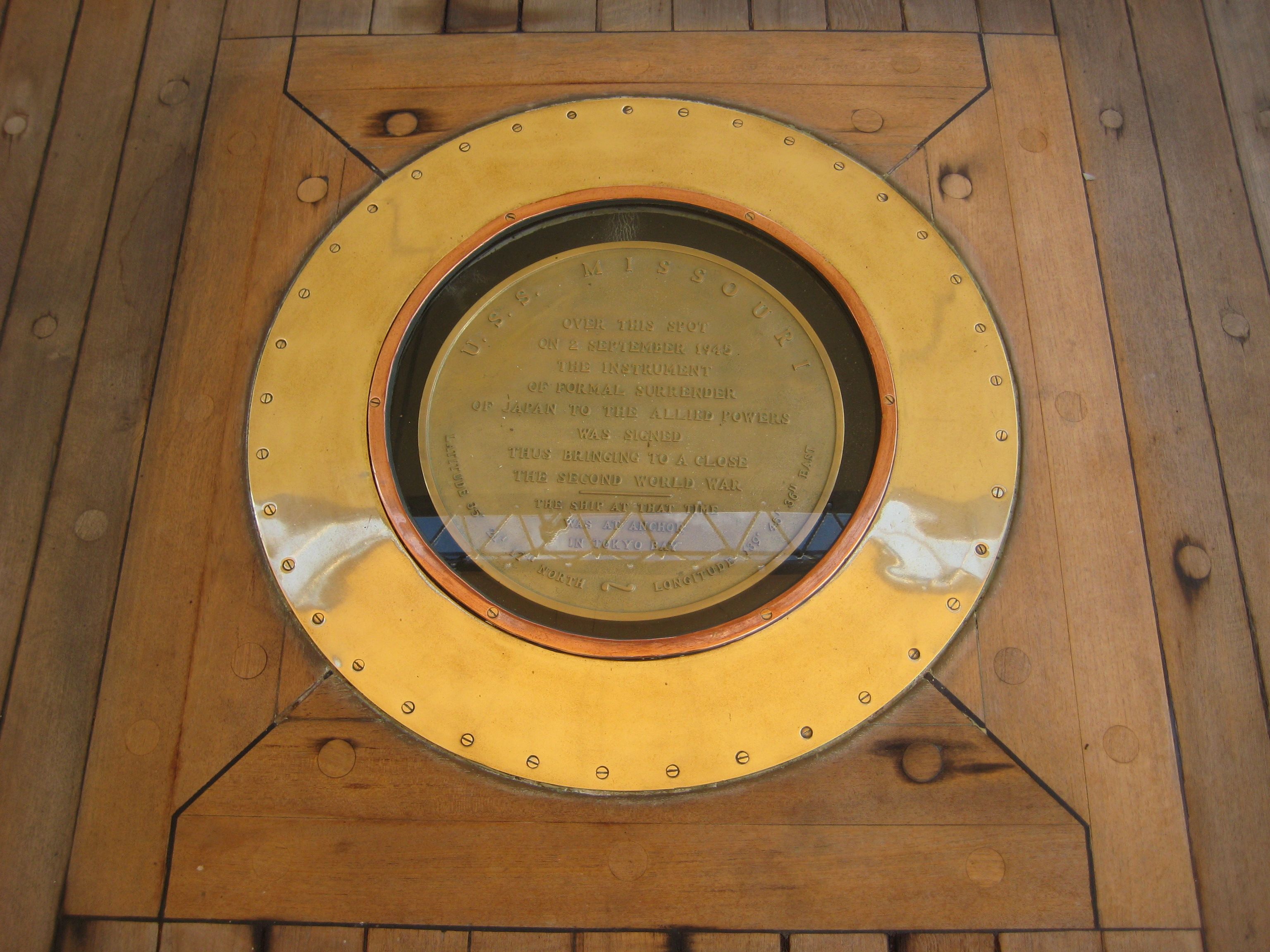
Spot of Surrender | Additional Description: This marker is on the floor of the surrender deck. It reads, “U.S.S. Missouri. Over this spot on 2 September 1945 the Instrument of Formal Surrender of Japan to the Allied Powers was signed thus bringingto a close the Second World War. The ship at that time was anchored in Tokyo Bay. Latitude 35° 21′ 17″ North ~ Longitude 139° 45′ 36″ East.”
Submitted: October 10, 2007, by F. Robby of Baltimore, Maryland.
Database Locator Identification Number: p8137
File Size: 1.778 Megabytes
To see the metadata that may be embedded in this photo, sign in and then return to this page.