Photograph as originally submitted to
this page in the Historical Marker Database
www.HMdb.org.
Click on photo to resize in browser. Scroll down to see metadata.
Photographer: J. J. Prats
Taken: April 8, 2006
Caption:
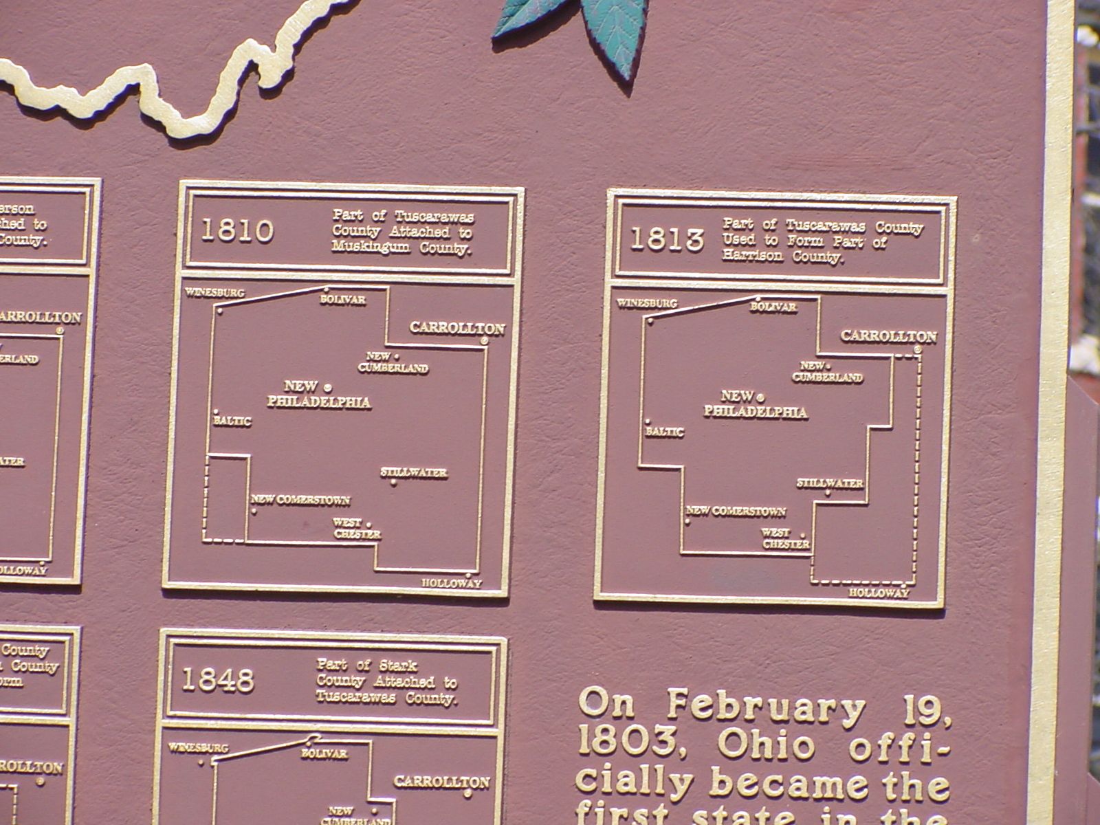
Marker Maps | Additional Description: 1810—Part of Tuscarawas County attached to Muskingum County. 1813—Part of Tuscarawas County used to form part of Harrison County.
Submitted: April 22, 2006, by J. J. Prats of Powell, Ohio.
Database Locator Identification Number: p839
File Size: 0.873 Megabytes
To see the metadata that may be embedded in this photo, sign in and then return to this page.