Photograph as originally submitted to
this page in the Historical Marker Database
www.HMdb.org.
Click on photo to resize in browser. Scroll down to see metadata.
Photographer: Craig Swain
Taken: August 26, 2007
Caption:
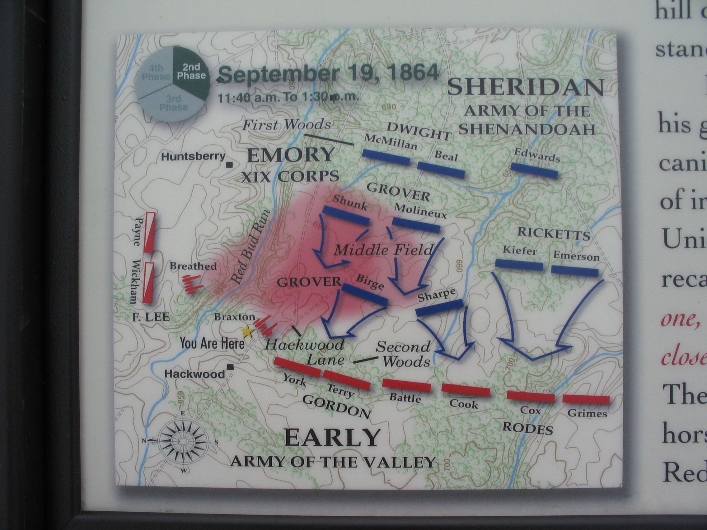
The Battle Map | Additional Description: Note how well integrated were the artillery of Braxton and Breathed. The rose shaded area in the middle of the map indicates the area covered by Confederate artillery fires. At the time of the battle, this section of the battlefield was open, and was called "Middle Field" by the Federal leaders in their after action reports.
Submitted: October 27, 2007, by Craig Swain of Leesburg, Virginia.
Database Locator Identification Number: p8999
File Size: 1.028 Megabytes
To see the metadata that may be embedded in this photo, sign in and then return to this page.