Photograph as originally submitted to
this page in the Historical Marker Database
www.HMdb.org.
Click on photo to resize in browser. Scroll down to see metadata.
Photographer: Jeremiah Knapp
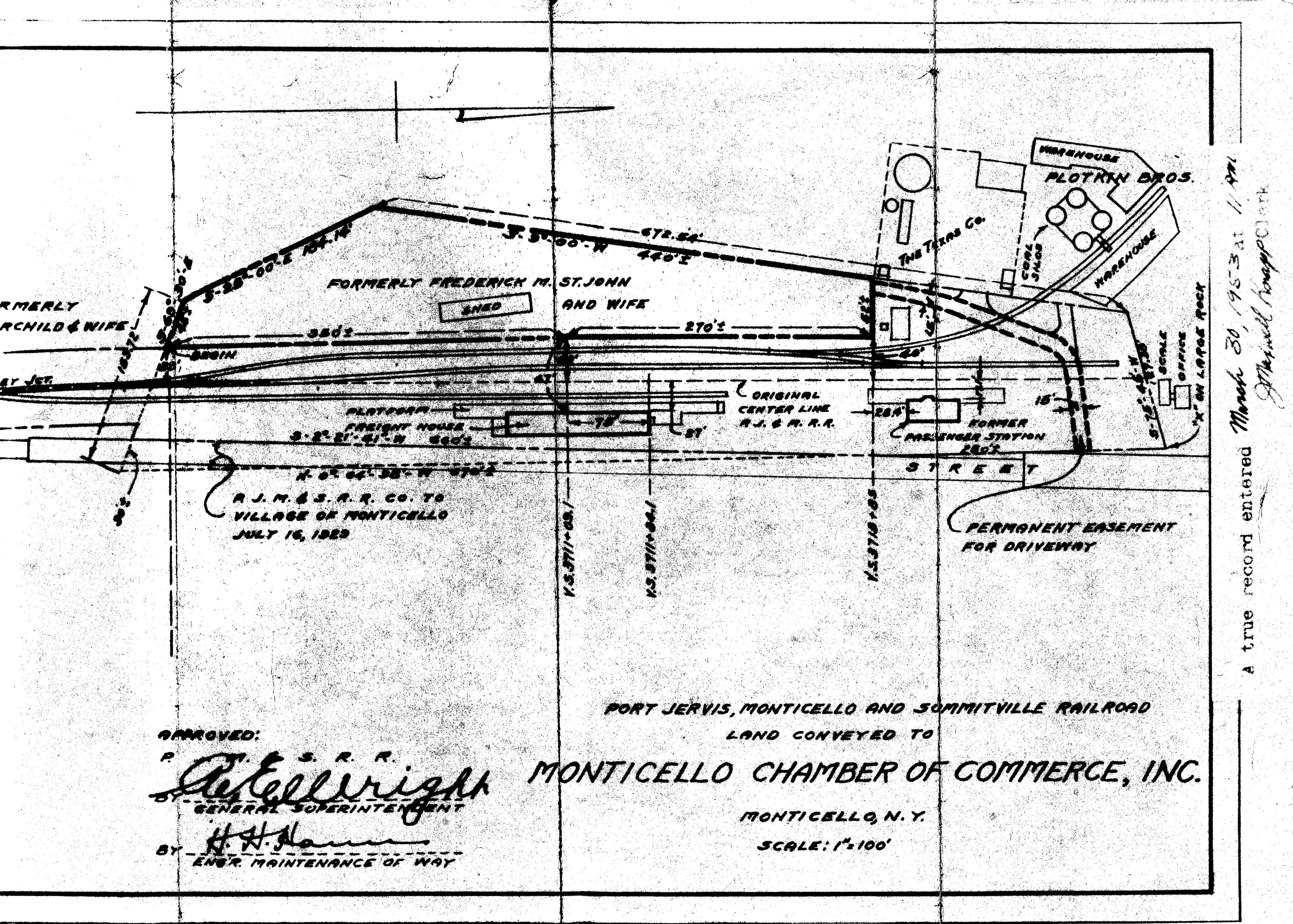
Taken: March 30, 1953
Caption:
Plat map of former O&W depot | Additional Description: Property map made when the premises were sold to VanEtten Oil Co. in 1953 (courtesy of Jan VanEtten).
Submitted: December 20, 2009, by Tom Rue of Monticello, New York.
Database Locator Identification Number: p90236
File Size: 5.423 Megabytes
To see the metadata that may be embedded in this photo, sign in and then return to this page.