Photograph as originally submitted to
this page in the Historical Marker Database
www.HMdb.org.
Click on photo to resize in browser. Scroll down to see metadata.
Photographer: Craig Swain
Taken: August 26, 2007
Caption:
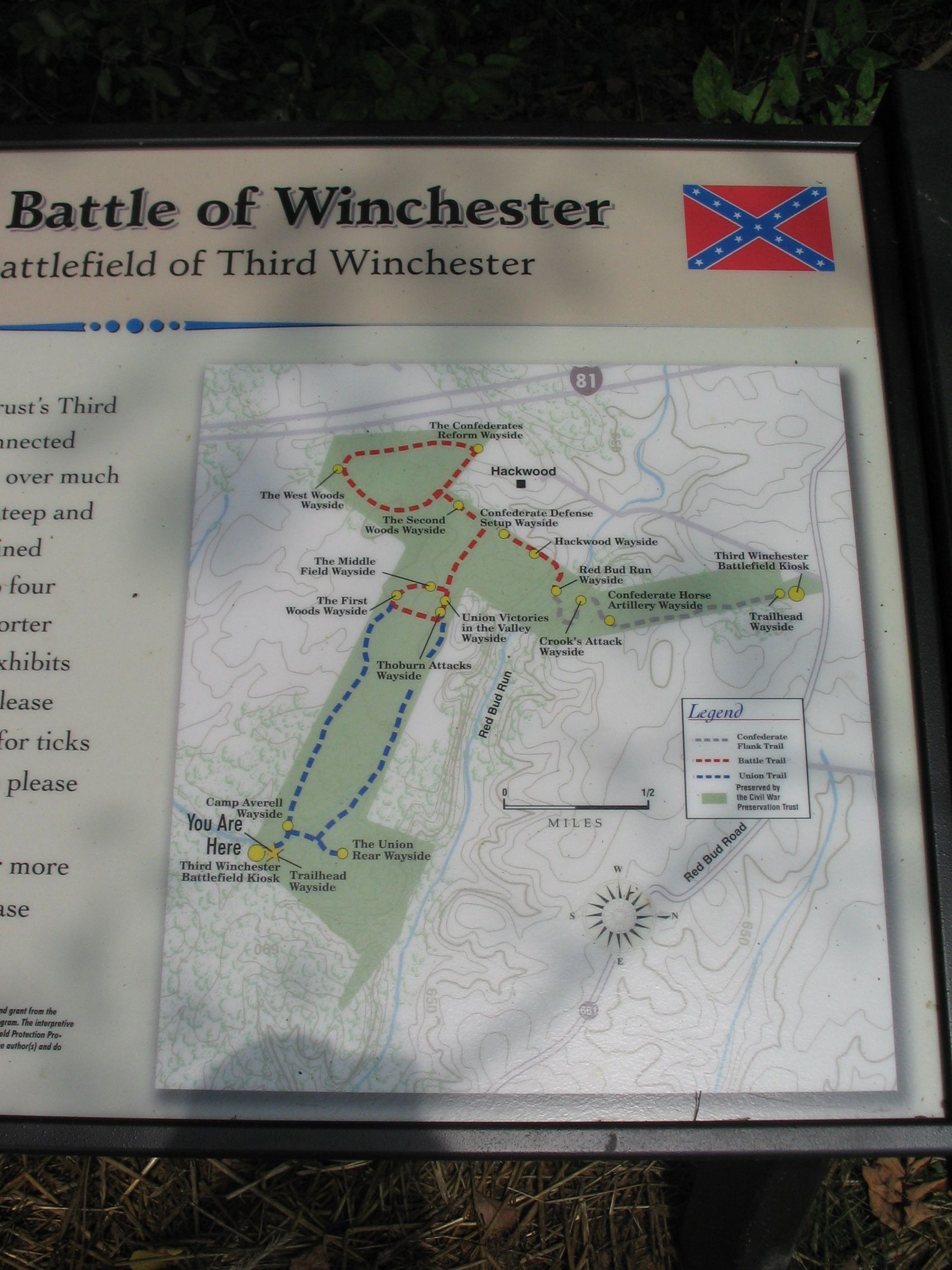
The Trail Map | Additional Description: Of the waysides, "Thoburn Attacks" is not in place at the time of writing. The other wayside markers are included on the related markers list.
Submitted: October 27, 2007, by Craig Swain of Leesburg, Virginia.
Database Locator Identification Number: p9058
File Size: 0.924 Megabytes
To see the metadata that may be embedded in this photo, sign in and then return to this page.