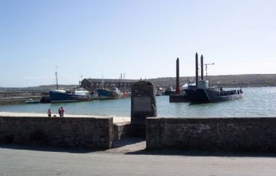
John Ridgeway & Chay Bylth
rowed the Atlantic in English Rose III
from Orleans to Kilronan, Aran,
Ireland 4th June 1966 - 3rd Sept. 1966
Na laga dia iad — — Map (db m22850) HM
This, one of the finest prehistoric fortresses in Western Europe, consists of three dry-stone ramparts, and the remains of a fourth, the outermost of which encloses an area of 11 acres.
Outside the second rampart there is a 30 foot band of . . . — — Map (db m109137) HM
On Main Street (National Road 67) at Courthouse Road, on the left when traveling east on Main Street.
Poet, Writer, Life-Long Worker
in the Irish Cause
was born in this house Sept. 29. 1854.
——•——
“For peace of mind I'll never find
until my own I call
that little Irish cailín
in her ould plaid . . . — — Map (db m28091) HM
Welcome to Port Corrúch Seal Colony
[First part of the marker is about the seal colony along the coastline and is not transcribed]
As you look across the North Sound you can see the Coast of Connemare and the Twelve pins of Connemara. Near . . . — — Map (db m22928) HM
Sraith Bhuí – The Yellow River Land
This is one of the finest megalithic tombs in Ireland. This particular example is a wedge tomb, so-called because of its shape, wider and higher at the entrance and gradually tapering towards . . . — — Map (db m28063) HM
Bún na hInes - Bottom of the River Meadow
This clapperbridge is a very unusual feature in the West of Ireland. The word clapper originally meant plank in the Sussex area of England, where there are many examples. Clapperbridges are a . . . — — Map (db m28058) HM
Monk's Fishing House
Fish was a staple in the diet of the mediaeval monastery, and this small building, probably built in the 15th or 16th century, is believed to have been used by the monks of Cong to make the task of catching fish a little . . . — — Map (db m28068) HM
This graveyard is now in the area known as Killeen. There is no trace of the early Christian church but there is a circular raised platform within the graveyard which could indicate where the original church stood. Tradition has it that if a . . . — — Map (db m28056) HM
On Church Road, 0.1 kilometers west of Long Street / Bridge Street (Road R335), on the left when traveling west.
Cluain Cearbhán - Meadow of the Buttercups
The Famine Museum in Louisburgh recounts local memories of the famine, presents coverage of the famine in the media, nationally and locally, and shows how links have been established . . . — — Map (db m28044) HM
Móinín - Small Bog
Lime Kilns date from the 18th century and were used until the 1940s in some areas. By lighting fires in these kilns and adding crushed limestone, lime was produced for use as fertiliser in the fields and also for . . . — — Map (db m27989) HM
Murrisk Abbey • site 6
Muraisc - Sea Marsh
Murrisk Abbey was founded circa 1456 by the Augustinian Friars because “the inhabitants of those parts have not hitherto been instructed in their faith.” It quickly . . . — — Map (db m27757) HM
Ag Críost an mhuir
Ag Críost an t-iasc
I líontaih Dé go gcastar sinn
This monument was erected to honour the
contributions of the traditional seafaring
fishing community in Murrisk.
We celebrate their memory and ask you to remember . . . — — Map (db m80404) HM
Murrisk - from Muraisc (Sea-marsh)
Murrisk Friary
This small house of Augustinian friars, located here on the south shore of Clew Bay in the shadow of Croagh Patrick, was founded in 1457 by Hugh O'Malley. It was dedicated . . . — — Map (db m27587) HM
On Local Road 335, on the right when traveling west.
To honour the memory of all who died, suffered and
emigrated due to the Great Famine of 1845 - 1850,
and the victims of all famines.
The Memorial was unveiled by the President of Ireland,
Mary Robinson, on 20 July 1997.
I gcuimhna . . . — — Map (db m27583) HM
In loving memory of
Squadron Leader
R.F.C. Garvey D.F.C. & Bar
Only son of J.C. & Gladys Garvey
Born at Murrisk Abbey 11th July 1918
Killed in a flying accident
at Shawbury, England,
on 14th January 1948 & buried there
Dearly . . . — — Map (db m28259) HM
On Local Road 335, on the left when traveling south.
To commemorate
the Hungry Poor
who walked here in 1849
and walk the Third World today
Freedom for South Africa 1994.
“How can men feel themselves
honoured by the humiliation
of their fellow beings.”
Mahatma Gandhi in . . . — — Map (db m27687) HM
On South Mall (National Road 59), on the left when traveling east.
IgCuimhne ar an maor
Seán Mac Giolla Bríde
Major John Mac Bride
Vice-Commandant
Irish Republican Army,
Major in the Army of the South
African Republic,
Organizer of the Transvaal
Irish Brigade,
who died for Ireland
5th . . . — — Map (db m27564) HM WM
On Wallace Court (National Road 60) at the Williamstown/Tuam Road, on the left when traveling west on Wallace Court.
This memorial was erected to
commemorate the memory of
Comdt. Patrick Glynn
Lieut. Michael Glavey
Vol. Michael Keane
who gave their lives for
the cause of freedom
during an attack on
Ballinlough R.I.C. Barracks
on Sept. . . . — — Map (db m27768) HM
On the Tulsk-Bellanagare Road (National Road 5), on the right when traveling west.
Cruachan is traditionally said to be the inauguration place of the Kings of Connacht. There are a number of monuments spread over an area of about two square miles. These include a large mound, a number of differently-shaped enclosures and some . . . — — Map (db m28192) HM
This memorial is erected on the site
of the birthplace of
William Percy French
Born 1st May 1854
and commemorates his life as
engineer, song-writer, entertainer,
artist and journalist.
“Remember me is all I ask,
and yet if . . . — — Map (db m28177) HM
Rathmoyle Cemetery is unique in that it is the property of the parish and is maintained solely by the local population.
The site appeas on the 1st edition of the 6 inch O.S. series of maps for Co. Roscommon as a Mortuary Chapel with surrounding . . . — — Map (db m28204) HM
Fine example
of town's Georgian
architecture.
Home of Dr. Dudley Forde
popular medical practitioner
in this area for many years
Died 1945 — — Map (db m27557) HM
Ireland's National Monument
to the Fighting 69th Regiment &
Brigadier General Michael Corcoran
Unveiled by
The Honourable Major Michael R. Bloomberg
New York City
22 August 2006
John Perry T.D
Chariman
Ballymore Community . . . — — Map (db m85947) WM
On R293 north of Camross, on the left when traveling north.
We sent you our starving and our evicted
you gave them freedom and opportunity
1861-1865
You sounded the call of arms
We answered with loyalty and courage
We gave service, limb and life
To the honour and lasting memory of Irish . . . — — Map (db m85946) WM
On Milford Street at Poe's Hill, on the right when traveling north on Milford Street.
To commemorate
the arrival of
the Carmelite Order
in Ireland
Leighlinbridge 1271
Jubilee 2000
————————
Comoradh ar theacht
na Mbrathar mban
go Heirinn . . . — — Map (db m136334) HM
On Milford Street at Poe's Hill, on the right when traveling north on Milford Street.
Planted 12 July 1991 by
the Right Honourable
Brian Mulroney
Prime Minister of Canada
to mark the occasion
of his visit to his
ancestral home. . . . — — Map (db m136332) HM
On Milford Street at Poe's Hill, on the right when traveling north on Milford Street.
Now part of our industrial heritage, culm crushers are remnants of the coal mining industry in the Coal Measures Hills of the 19th and early 20th centuries. Concentrated mostly in the areas around Old Leighlin and Castlecomer, they were a communal . . . — — Map (db m136345) HM
On Milford Street just north of Main Street, on the right when traveling north.
Déantar cuimhneachán ar go leor daoine áitiúla móra le rá anseo. Ach bealach ar leith atá sa Mheilteoir Colmais chun comóradh a dhéanamh ar shaol laethúil mhuintir eile an tsráidbhaile.
D'úsáid siad an chloch ollmhór ar chúis . . . — — Map (db m136446) HM
On Milford Street just north of Main Street, on the left when traveling north.
Déantar cuimhneamh i nGairdín na nDealbh ar thriúr de na mic ba mhó le rá i Leithghlinn an Droichid: John Tyndall, Comhalta den Chumann Ríoga, arbh é an chéad duine a chruthaigh gurb ann don larmhairt Cheaptha Teasa, an Cairdinéal Patrick . . . — — Map (db m136426) HM
On Milford Street at Main Street, on the right when traveling north on Milford Street.
The Kavanaghs
dominated this area.
To use the bridge
The Crown
paid
Black Rent
Safe shall sail
Through life's gale,
From the Quay of Leighlin, O.
Rowan McCombe. — — Map (db m136199) HM
On Milford Street, 0.03 kilometers south of Poe's Hill, on the right when traveling south.
The story of John Tyndall is one
of courage, passion and idealism.
A story of the highest personal
success achievable by any person
of humble beginnings in his time. — — Map (db m136381) HM
On Milford Street at Main Street, on the right when traveling north on Milford Street.
Supplied malt to
breweries & distilleries
of Ireland
via the navigable
River Barrow
As we're tied,
Side by side,
At the Quay of Leighlin, O. — — Map (db m136201) HM
On Milford Street at Poe's Hill, on the left when traveling north on Milford Street.
The Colonel from Leighlin who died in
one of the greatest battles to grip the
public imagination,
The Battle of the Little Big Horn
or what became known as
Custer's Last Stand. — — Map (db m136355) WM
On Milford Street at Poe's Hill, on the right when traveling north on Milford Street.
In Memory Of
Nurse Margaret Kehoe
Orchard, Leighlinbridge.
Born on 17th March 1867
who was shot dead
while carrying out her
duties at
The South Dublin Union
(St James Hospital)
on Easter Monday
April 24th . . . — — Map (db m136335) HM
On Milford Street just north of Main Street, on the right when traveling north.
From 1837-39 John Tyndall and his sister, Emma travelled the River Barrow towpath to Ballinabranna school, 4 miles distant. On the way they would occasionally join with their teacher, John Conwill who lived near the towpath at Rathornan and . . . — — Map (db m136347) HM
On Milford Street just north of Main Street, on the left when traveling north.
Leighlinbridge enjoys a range of gardens, built and designed by the local community to commemorate various aspects of village life over the years.
The Millenium Garden, located on Ballyknockan Hill, was built to celebrate the New Millenium . . . — — Map (db m136384) HM
On National Route N81, on the left when traveling south.
This shoeing stone
has been in the
Doyle Family of the Moate
for five generations
and has been
donated by them
to the
people of Rathvilly
————————
The shoeing stone was
relocated . . . — — Map (db m136195) HM
On National Route N81, on the left when traveling north.
H. Company
1st. Batt. Dublin Brigade
I.R.A.
of Tombeach in the Parish of
Rathvilly
Born in Dublin 20th. January
1902
Taken in Action against
British troops 20th September
1920
Hanged in Mountjoy Jail
1st. November 1920
Aged . . . — — Map (db m136190) HM WM
On National Route N81, on the left when traveling south.
Rathvilly nestles at the foothills of the Wicklow Mountains on the River Staney in the lush, green landscape of Ireland's Ancient East. The name Rathvilly derives from the Irish for 'Ring Fort of the Trees'. The village and its surrounds has a . . . — — Map (db m136197) HM
On National Route N81, on the right when traveling south.
To Mark The 50th Anniversary Of Rathvilly
All Ireland Tidy Town Win In 1961
This Plaque Was Unveiled On The 18th June 2011
By The Minister For The Environment
Mr Phil Hogan TD . . . — — Map (db m136193) HM
Near Castle Street just south of Lord Edward Street (National Road N81).
Castle Hall
The causeway entrance to the 13th century Dublin Castle lies under this building on the North/South axis. The Bedford Tower was built on the medieval entrance towers. This building, comprising of the former Genealogical Office and . . . — — Map (db m22435) HM
On Nicholas Street (National Route 81) at Ross Road, on the left when traveling south on Nicholas Street.
Chris Reid completed a public artwork consisting of 20 bronze plaques and a printed book. The texts are based on recordings the artist made from 2004 to 2008 with residents and people associated with Nicholas Street, Ross Road, Bride Street and . . . — — Map (db m22480) HM
On Kildare Street (Route R138) at Molesworth Street, on the right when traveling south on Kildare Street.
Construction of Georgian Leinster House began in 1745. It was commissioned by James FitzGerald (1722-1773), the twentieth Earl of Kildare, who became the Duke of Leinster in 1766, and is the original and oldest part of modern day . . . — — Map (db m241141) HM
A valiant woman who fought for Ireland in 1916
_________________________
In the 1916 Rising she was Second-in-Command to Michael Mallin in the College of Surgeons. She was sentenced to death for her activities but was released from prison in . . . — — Map (db m22504) HM
One of Dublin's major contributions to European civilisation has been in the area of literature. It is remarkable that so many writers of world renown were born here including three winners of the Nobel Prize for Literature. This Literary Parade . . . — — Map (db m22472) HM
On Fishamble Street, on the right when traveling north.
This bronze commemorates the first performance of George Frideric Handel's Oratorio Messiah, given in the Old Musick Hall in Fishamble Street at noon on Tuesday April 13th 1742 — — Map (db m22450) HM
On St. Stephen's Green at Grafton Street, on the left when traveling west on St. Stephen's Green.
In memory of the officers, non-commissioned officers and men of the Royal Dublin Fusiliers who fell in the South African War A.D.1899·1900
Fortissimis suis militibus hoc monumentum eblana dedicavit MCMVII
Hartshill•Ladysmith•Talana•Colenso• . . . — — Map (db m22470) HM
In 1925 a finely sculptured garden seat of Kilkenny limestone was placed in the park and inscribed on the back - “Anna Marie, 1829 - 1922 and Thomas Haslam, 1825 - 1917. This seat is erected in commemoration [sic - ‘honour’] of their long . . . — — Map (db m22485) HM
He has been described as the greatest poet of the nineteenth century. He died of cholera in 1849. The bronze bust by Oliver Sheppard was unveiled in 1909 on behalf of the National Literary Society.
In a niche in the pedestal is a marble head . . . — — Map (db m22488) HM
Acknowledged as a world figure in literature. He dismantled the English language and put it together again so that it became music. The sculpture in bronze was unveiled on June 16, (Bloomsday) 1982. — — Map (db m27047) HM
On Kildare Street (Route R138) at Molesworth Street, on the right when traveling south on Kildare Street.
This pub has been granted the
James Joyce Pub Award
for being an authentic Irish pub
'A good puzzle would be to cross Ireland
without passing a pub.' Ulysses
James Joyce identified and described the . . . — — Map (db m241142) HM
Ni dhéanfaidh gáeil bhearmao orc go brách
[Gaelic transcription is best effort]
———
Erected in 1954. An uncut rock of Wicklow granite symbolises the patriot's unbreakable spirit. Into the rock is set a plaque bearing an impression of . . . — — Map (db m25316) HM
On Kildare Street (National Route 11) just south of Molesworth Street, on the left when traveling south.
Since 1924, Leinster House has been the seat of the two houses of the Oireachtas, Dail and Seanad (Irish Parliament and Senate), who meet here a total of 90 days a year.
Designed in 1745 by the architect Richard Cassels, who also designed the . . . — — Map (db m22459) HM
On St. Stephen's Green at York Street, on the right when traveling north on St. Stephen's Green.
Prior to 1877 St. Stephen's Green was a private square for the use of the residents of the Green. In that year, through the generosity of Sir Arthur Edward Guinness (Lord Ardilaun) negotiations were concluded for converting it into a public park. . . . — — Map (db m25311) HM
On Lower Mercer Street at York Street, on the right when traveling north on Lower Mercer Street.
Margaret Anna Cusack was born on this site on May 6th 1829. At the time York Street was a centre of medicine. She was the daughter of Sara and Dr. Samuel Cusack. Her uncle was the interationally renowned surgeon James William Cusack, 3-times . . . — — Map (db m22454) HM
On Merrion Square West (National Route 11), on the right when traveling north.
The National Memorial to members of the Defence Forces is a place of contemplation and remembrance, providing a focal point where families, relatives and members of the public can reflect on the contribution and sacrifice made by members of the . . . — — Map (db m26868) HM
Presented to the People
of Ireland
by
The Robert Emmet
Statue Committee
of the
United States of America
April 13, 1966
Francis J. Kane, Chairman
Ambassador Scott McLeod
Devlin W. Dormer, Esq.
Hon. Michael J. Kirwan, M.C. . . . — — Map (db m25304) HM
On Patrick Street (National Route 81), on the left when traveling south.
Tradition has it that Saint Patrick baptised the first Irish Christians in a well, situated here in St. Patrick's Park, with water from the River Poddle, which still flows underground. A small wooden church was erected here to commemorate the . . . — — Map (db m22468) HM
On Lower Merrion Street (National Road 11) at Merrion Square (Road 118), on the right when traveling north on Lower Merrion Street.
aural and ophthalmic surgeon, archaeologist, ethnologist, antiquarian, biographer, statistician, naturalist, topographer, historian, folklorist, lived in this house from 1855 to 1876 — — Map (db m24755) HM
On Patrick Street (National Route 81) at St. Patrick's Close, on the left when traveling south on Patrick Street.
This majestic view of St. Patrick's Cathedral, Dublin is a colour reproduction from a series of original aquatints etched by James Malton, whose work, A Picturesque and Descriptive View of the City of Dublin, gives us a glimpse of Dublin at the . . . — — Map (db m22465) HM
Erected in 1887 from funds subscribed by the Dublin Metropolitan Police to commemorate Queen Victoria's Jubilee. [From the Monuments of St. Stephen's Green marker found in the park.] — — Map (db m22483) HM
This fountain, erected in 1956, is situated near the Leeson Street entrance to the park. It consists of a group of three bronze figures – Nornenbrunnen, representing the Three Fates, who weave and measure the thread of man's destiny.
The monument . . . — — Map (db m25306) HM
On St. Stephen's Green (National Road 11) at Hume Street, on the left when traveling north on St. Stephen's Green.
An Irish patriot convicted of treason. He died mysteriously in prison in November 1798.
The memorial consists of a ten-foot figure of Wolfe Tone backed by a wall of rough granite columns of varying width and rising to 16 feet in height. . . . — — Map (db m25303) HM
Born in County Dublin
9th February 1880
Killed at Guinchy
9th September 1916
Poet•Essayist•Patriot
____________________
Killed at Guinchy during the Great War, September 1916.
“Died not for Flag nor King nor Emperor
But for a . . . — — Map (db m22489) WM
Sunday Independent journalist,
was murdered on 26th June 1996.
Be Not Afraid
Greater justice was her ideal and it was her ultimate achievement
Her courage and sacrifice saved many from the scourge of drugs and other crime.
Her . . . — — Map (db m24078) HM
“He may be regarded as the pivot around which Irish literature turned from instinctive to conscious art.” (George W. Russell).
The memorial, erected in [October] 1967, is a tribute in bronze by Henry Moore, the sculptor. — — Map (db m27039) HM
On Abbey Street Lower at O'Connell Street Upper, on the left when traveling east on Abbey Street Lower.
2nd Battalion Dublin Brigade
Irish Volunteers
who was shot and burned in these premises
Easter 1916
[Balance of marker in Cló Gaelach script is not transcribed] — — Map (db m240758) WM
On O'Connell Street Upper at Prince's Street North, on the right when traveling north on O'Connell Street Upper.
And tyranny trampled them in Dublin's gutter until Jim Larkin came along and cried the call of freedom and the call of pride and slavery crept to its hands and knees and nineteen thirteen cheered from out the utter degradation of their . . . — — Map (db m241088) HM
On O'Connell Street Upper, on the left when traveling north.
[Top illustration caption reads]
The General Post Office and Nelson's Pillar in 1820
Nelson and the Spire
Long before the spectacular Spire of Dublin stood here this site belonged to a famous British admiral. Nelson's . . . — — Map (db m241105) HM
On O'Connell Street Upper, 0.1 kilometers south of Parnell Street, on the left when traveling south.
[Top photo caption reads]
Sackville Street, looking north, c.1750,
by Joseph Tudor
O'Connell Street
Long seen as the centre of Dublin, O'Connell Street is the city's favourite location for public commemorations and celebrations. . . . — — Map (db m241146) HM
On O'Connell Street Upper at Abbey Street Lower, on the right when traveling north on O'Connell Street Upper.
Erected by Public Subscription
to
Sir John Gray, Knt. MD. JP.
Proprietor of the
Freeman's Journal
M.P. Kilkenny City.
Chairman of the
Dublin Corporation Water Works
Committee 1860 to 1875,
during which period
preeminently . . . — — Map (db m240452) HM
On O'Connell Street Upper at Lower Abbey Street, on the right when traveling north on O'Connell Street Upper.
[Old Gaelic not transcribed]
Born 17th October 1803
Sentenced to death for
High Treason
on the
9th October 1846
Died
16th June 1864 — — Map (db m240453) HM
On Chesterfield Avenue, 0.3 kilometers west of Parkgate Street/Conyngham Road (Route R109), on the left when traveling west.
These enclosed gardens were laid out in 1864 by the Earl of Carlisle. They cover an area of 9 hectares, including the lake and provide an opportunity to see a fine example of Victorian horticulture.
————————————————— . . . — — Map (db m241166) HM
On Chesterfield Avenue, 0.4 kilometers west of Parkgate Street/Conyngham Road (Route R109), on the left when traveling west.
Asia and Europe saved by thee, proclaim
Invincible in war thy deathless name,
Now round thy brow the civic oak we twine
That every earthly glory may be thine.Conservata tuis Asia atoue Europa triumphis . . . — — Map (db m241169) HM WM
On Smithfield at New Church Street, on the right when traveling south on Smithfield.
Pre 1000 AD - The oldest Gaelic settlement Ath Cliath (hurdle-ford) takes its name from a man-made crossing point on the river close to the modern day Bow Street
1095 - St Michan's Church is founded. For 600 years it remains the only parish . . . — — Map (db m241010) HM
On Smithfield at Coke Lane/Stable Lane, on the left when traveling north on Smithfield.
This teapot is based on the 'Utah Teapot' form, a digital object made public by mathematician Martin Newell, in 1975. The shape was, and is, used for the development of software which enables myriad creative industries, including . . . — — Map (db m241009) HM
On Church Street (National Route 1) at the Luas tram line, on the right when traveling south on Church Street.
A synopsis of the archaeology
By Colm Moriarty
The archaeological excavations carried out at Hammond Lane and Church Street, Dublin 7 revealed a wealth of information about Dublin city's very first north-siders.
Excavated in three . . . — — Map (db m241027) HM
This plaque is to commemorate the
5th Infantry Battalion Pipe Band
which was stationed in this barracks
from 1973 to 1997 and whose
band room was above this archway — — Map (db m240667) HM
Arbour Hill Military Cemetery is a complex of monuments and buildings dating to the 19th and 20th centuries. These monuments and buildings commemorate diverse strands of Ireland's military past, from the graves of British military . . . — — Map (db m240998) HM WM
Arbour Hill Military Cemetery is the last resting place of British military personnel and their families who died while serving in Ireland from 1840 to 1876. Most of the military personnel served in one of the barracks located in . . . — — Map (db m240875) HM
Charles Manners, the Fourth Duke of Rutland (1754-1787) was a popular Viceroy of Ireland from 11th February 1784 until his death on 24th October 1787. He was well known for his ample
banquets in Dublin Castle and in particular for his love of . . . — — Map (db m240815) HM
On 12th December 1922 General Richard Mulcahy, Minister of Defence and Commander in Chief of the Irish Free State army took over this Barracks. He reviewed the first Free State troops here in Clarke Square.
Sculpture by John Coll, presented by . . . — — Map (db m240680) HM WM
372 entries matched your criteria. The first 100 are listed above. Next 100 ⊳