On Hastings Main Road (Route H7) just west of Garrison Road, on the right when traveling west.
Monument abstract This monument, a pathway of Independence, chronicles the foundation years of Barbados’ nationhood. Here, in this space renowned for recreation, learning and historical experience, we collectively celebrate 50 years of . . . — — Map (db m135176) HM
On Hastings Main Road (Route H7) at Bush Hill Road, on the left when traveling north on Hastings Main Road.
This building was constructed circa 1795 as Commissariat for the British Commission. Converted to the Garrison Theatre in 1893. Acquired by the Barbados Electric Supply Corporation in 1908. Renovated during 1986 75th year of operations. . . . — — Map (db m135153) HM
Near Unnamed road just east of Drill Hall Beach, on the left when traveling south.
The Commonwealth War Graves Commission was established by Royal Charter of 21 May 1917
The Commisioner’s work was guided by fundamental principals which were established in 1920. That each of the dead should be commemorated individually by . . . — — Map (db m135051) WM
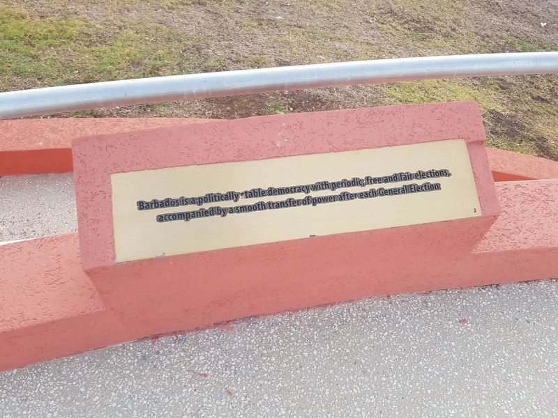
On Garrison Road just east of Bush Hill, on the left when traveling east.
Engineer’s Office & Quarters
Built circa 1720
The oldest ‘house’ within the Garrison. Known today as the ‘Bush Hill House’ or the George Washington House and Museum. George Washington stayed here in 1751. Acquired for the ‘New’ Garrison . . . — — Map (db m134545) HM
On Aquatic Gap just west of Hastings Main Road (Route H7), on the right when traveling west.
The Barbados Cruising Club Salutes the Right Excellent Errol Walton Barrow On this Errol Barrow Day, January 21, 2018, the Barbados Cruising Club dedicates this memorial at our Aquatic Gap, Pebbles Beach home, to our first Treasurer and . . . — — Map (db m135034) HM
On Hastings Main Road west of Harts Gap, on the left when traveling west.
Hastings Barbados You Are Entering A UNESCO World Heritage Property Historic Bridgetown and its Garrison exhibits an important interchange of human values in the diversity of African, European and other ethnicities, and the confluence of . . . — — Map (db m135028) HM
Near Unnamed road just east of Drill Hall Beach, on the left when traveling south.
1939-1945 To the enduring memory of those Barbadian Merchant Seamen who gave their lives in the Second World War Alle, E SS Inanda ∙ Anderson, FW SS Traveller ∙ Ashby, V SS Africa ∙ Atkins, G SS Traveller ∙ Bancroft, D SS . . . — — Map (db m135152) WM
On Garrison Road at Bush Hill Road, on the left when traveling north on Garrison Road.
Near This Spot Rest the Remains of Fourteen Soldiers And one Married Woman of the 36th Regiment who were killed by the destruction of the Barracks and Hospital during The awful visitation of the hurricane. August 11th, 1831. This Monument is . . . — — Map (db m135031) HM
On Garrison Road just north of Hastings Main Road (Route H7), on the left when traveling north.
Royal Artillery Barracks Built in 1812 Known today as Stafford House. The second storey arches were added after much of that floor was damaged during the 1831 hurricane. Originally used by the Artillery, this building was also later used to . . . — — Map (db m135030) HM
On Bay Street just north of Chelsea Road, on the right when traveling north.
Sir Grantley Herbert Adams Q.C., C.M.G. 1898-1971 Leader of the Government and Premier of Barbados 1946-1958 Primer Minister of the West Indies 1958-1962 “He was ready at the time when the people needed a leader who would be both the . . . — — Map (db m135032) HM
On Unnamed road just east of Drill Hall Beach Road, on the right when traveling east.
The Barbados Military Cemetery This site is dedicated to the men and families of the British Forces who died serving in Barbados 1780 to 1906 Thanks to Barbados good military defences no enemy has ever landed on its shores Today this . . . — — Map (db m135035) HM WM
On Garrison Road just north of Hastings Main Road (Route H7), on the left when traveling north.
The Main Guard Built in 1804 Still known today as The Main Guard At the central point of the Garrison, this building was also used for courts martial, with prisoners held in the guard house at rear. Sold into private hands in 1906, it became . . . — — Map (db m135029) HM