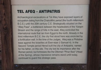
Archaeological excavations at Tel Afeq have exposed layers of occupation dating from the Chalcolithic period (the fourth millennium B.C.E.) until the 20th century C.E. Strategically situated on the "Afeq Pass", a bottleneck between the headwaters . . . — — Map (db m64309) HM
Commemoration of the UN Resolution of November 29, 1947.
A joint venture of the World Zionist Organization, and the City of Netanya
Initiative and funding: Jewish American Society for Historic Preservation
Right Marker
Design and . . . — — Map (db m212184) HM
John Henry Patterson was born in Ireland on November 10, 1876. He was an Irish Protestant who had a thorough knowledge of the Bible, and was sympathetic to the Jewish people in biblical times and to the Zionist idea.
He served in the British . . . — — Map (db m134674) HM
This is the most complete of the six Late Bronze Age (Canaanite), 1550-1200 B.C.E. palaces excavated at Afeq. The ground floor is preserved in its entirety, while the stairway testifies to the existence of the now-destroyed upper storeys. . . . — — Map (db m64406) HM
A remnant of the main street of the Roman city of Antipatris. "Cardo" is the name for the main north-south street of a Roman-era city. Shops lined the Cardo, and at its center it was connected to the Forum, the city's central square. Grooves can be . . . — — Map (db m64445) HM
On this site, in the 12th-13th century, towered the fortress of the Order of the Knights of the Hospital of Saint John (the "Hospitallers") who were based in Akko (Acre) until the Muslim conquest of the city in 1291. Over the ruins of the fortress, . . . — — Map (db m65456) HM
On their way to Jerusalem in 1099, the Crusaders killed the Jewish 'infidels' and destroyed many communities, among which were in the communities of Speyer, Worms and Magenza. In memory of those who perished the prayer "Merciful Father" was . . . — — Map (db m65446) HM
At the heart of this site is the Shrine of Bahá’u’lláh, the final resting place of the Founder of the Bahá’í Faith, regarded by Bahá’ís as the most holy spot on earth. Next to the Shrine stands the Mansion where Bahá’u’lláh resided from the summer . . . — — Map (db m79276) HM
This garden presents a collection of architectural artifacts discovered during the excavation of Caesarea, or found by chance.
The source of much of present day knowledge of the styles and building methods of the classical world of . . . — — Map (db m64466) HM
The gable, cornice, frieze and architrave are some of the architectural elements that were typical of the facades and other monumental structures. The ornamentation of these buildings changed according to the adopted style.
In the Roman . . . — — Map (db m65175) HM
In the Classical World, Planning and Aesthetics principles were clear and unambiguous. The Doric, Ionic, and Corinthian orders were elaborated by the Greeks and later, adopted by the Romans, with some variations. Each order bears its own rules and . . . — — Map (db m64499) HM
"(Po)ntius Pilatus, the prefect of Judaea, (erected) a (building dedicated) to (the emperor) Tiberius".
Replica. The original inscription, found in secondary use during the excavations of the theater, is on display at the . . . — — Map (db m65173) HM
"For if I be an offender, or have committed any thing worthy of death, I refuse not to die; but if there be none of these things whereof these accuse me, no man may deliver me unto them. I appeal unto Caesar. Then Festus, when he had . . . — — Map (db m64534) HM
"Herod built (…) on the south quarter, behind the port, an amphitheater also capable of holding a vast number of men and conveniently situated for a prospect to the sea" Josephus
This hippodrome (circus* in Latin), built in 10/9 B.C. by King Herod for the inauguration of the city, held horse - and chariot - races, athletics, gladiatorial combat and hunting games. Before falling into disuse at the end of the Roman period, . . . — — Map (db m136047) HM
Sarcophagi (coffins in Greek) made of stone (granite, marble, limestone) lead or wood were widely used among different people including Jews, throughout the Greco-Roman world. Sarcophagus means "flesh eater".
Stone coffins were made out of two . . . — — Map (db m64501) HM
This Sarcophagus lid is decorated at both ends by mythological Gorgon heads in relief.
Marble
The Late Roman period (2nd - 3rd centuries CE) — — Map (db m136545) HM
The nymphaeum was the public fountain that stood at the center of ancient Caesarea as one of the city's main monuments, and was situated at the intersection where the city's main street meets the Herodian port.
The nymphaeum had a decorative . . . — — Map (db m136550) HM
The chariot races thrilled the crowds. The counterclockwise seven-lap race commenced at the starting gates (carceres) (1) and ended at a finishing line situated in front of the dignitaries' tribune (2). At each end of the axial rib . . . — — Map (db m64537) HM
From the starting gates (carceres), chariots dashed counterclockwise on a seven-lap race whose finishing line was situated in front of the officials' tribune. The sharp curve at the turning posts (meta prima and meta secunda), . . . — — Map (db m136054) HM
This bathhouse is the only important remain of the private wing of the Byzantine governor's palace, almost entirely destroyed by the construction of the medieval fortifications. — — Map (db m136543) HM
The construction of the harbor was a far reaching enterprise, involving artificial islands built in the open sea and serving as bases for piers and breakwaters. Apparently, the raw materials and technology came with the Roman engineers sent by . . . — — Map (db m136547) HM
A refined palace with a swimming pool, once stood here. The sand only preserved its eastern wing, comprising a grand (dining?) complex: a central hall (Triclinium?) flanked by two small rooms on each side, all richly decorated, and provided with . . . — — Map (db m136035) HM
These four long, parallel vaults, opening onto the west through a portico, first served as substructures of the Roman financial procurator's palace. In a later stage, a large ornamented hall was added in front of the vaults converted into . . . — — Map (db m136542) HM
The edifice consists of two main units: the Lower Palace comprising the private wing, and the Upper Palace, housing the public wing. The latter, built around a large peristyle courtyard, was associated with the ruler's judicial and . . . — — Map (db m64517) HM
Some sixty lead scroll fragments dating to the 4th. c. A.D., probably execrations tablets and binding spells, were recovered from this well, where they had been intentionally thrown as a magical practice. In his address on the dedication of the . . . — — Map (db m64532) HM
The only remnants left from the Theater of Caesarea are rows of seats, the orchestra, the stage and the scene-frons which is an ornamental wall behind the stage. How did it look like? Comparisons show that it might resemble the facade of a two or . . . — — Map (db m64498) HM
The S.S. Exodus was an American Aliyah Bet ship crewed by American volunteers together with Haganah operatives from pre-state Israel. Her mission was to rescue Holocaust survivors trapped in Europe after the murder of 6 million Jews, bringing them . . . — — Map (db m134635) HM
The establishment of the German Colony in 1869 is a milestone in the history of Haifa's development. In the middle of a sparsely populated and largely barren land, laboring under deficient rule, hundreds of German settlers characterized by great . . . — — Map (db m79275) HM
On 21 March 1909 the mortal remains of the Báb, one of the Central Figures of the Bahá'í Faith, were interred in the Shrine that is the focal point of these gardens. Martyred in Iran in 1850, the Báb had devoted Himself to preparing the way for . . . — — Map (db m79010) HM
A public grain silo from the time of King Jeroboam II (8th century BCE). The silo had a capacity of 450 cubic meters. Straw found between the stones attests to the function of the installation. — — Map (db m65196) HM
[Text on the Left Side of the Marker]:
The deep section dug by the University of Chicago Expedition (1925-1939) provides a unique glimpse into the nearly thirty settlements built one on top of the other at the site. Due to the unique . . . — — Map (db m64908) HM
The city of Megiddo played a prominent role in the history of the ancient Near East. Strategically located at the mouth of the Nahal Iron Pass, Megiddo controlled access to the road that linked Egypt with Mesopotamia and Anatolia - the most . . . — — Map (db m64782) HM
The first excavations at Tel Megiddo were directed by Gottlieb Schumacher on behalf of the Deutscher Palastina-Verein, between 1903 and 1905. After excavating the Tempelburg ('temple-fortress') in the eastern section of the mound, . . . — — Map (db m65019) HM
The biblical tels of Megiddo, Hazor and Beer Sheba were inscribed in 2005 by the United Nations Educational, Scientific and Cultural Organization (UNESCO) as World Heritage Sites with outstanding universal value. They are fitting representatives of . . . — — Map (db m64811) HM
[Text on the Left Side of the Marker]:
The Late Bronze period (1550-1150 B.C.) is marked by Egyptian rule of Canaan. At that time, Megiddo was one of the country's major city-states and its king a loyal vassal of the Egyptian pharaoh. . . . — — Map (db m64821) HM
[Text on the Left Side of the Marker]:
Megiddo became an Israelite city sometime between the 10th and 9th centuries B.C., and functioned as an administrative center for he fertile Jezreel Valley. Some time later, a massive wall (1) and a . . . — — Map (db m64882) HM
[Text on the Left Side of the Marker]:
The foundations of this palace, first investigated by Y. Yadin in 1960, are presently being excavated by 'The Megiddo Expedition'. The edifice was apparently laid out as a bit hilani (North . . . — — Map (db m64898) HM
[Text on the Left Side of the Marker]:
Architectural complexes dating from the same period (9th or 8th c. B.C.) and of similar design were found near the northern and southern edges of the mound. Through the years they variously . . . — — Map (db m64889) HM
[Text on the Left Side of the Marker]:
This area served as a focus of worship for over two thousand years, from the Early Bronze through the Iron I periods. The University of Chicago excavation section a series of temples (1, 3-5) built . . . — — Map (db m64985) HM
[Text on the Left Side of the Marker]:
An elaborate ashlar-built palace (1) stood near the southern edge of the mound. A monumental entrance (2) - the only visible remains still standing - led to the courtyard (3). Like the northern . . . — — Map (db m65198) HM
[Text on the Left Side of the Marker]:
The southern stables' five units could accommodate 150 horses. As in the northern complex, each unit consists of a rectangular building divided into three sections by two rows of alternating pillars . . . — — Map (db m65204) HM
[Text on the Left Side of the Marker]:
The problem of supplying water to large cities, a serious issue even in times of peace, could become acute in times of siege. Megiddo's main water source was located at the foot of the mound, beyond . . . — — Map (db m65215) HM
On this site of what was once a Phoenician town, Stratos Tower, King Herod (37-4 BCE) built a resplendent city and named it Caesarea in honor of his patron, Augustus Caesar. Its inhabitants – Romans, Samaritan, and Jews – enjoyed the . . . — — Map (db m146243) HM
Welcome!
Caesarea was first founded in the Persian period (the fourth century BCE), but became famous thanks to the great harbor city built here by King Herod about 2,000 years ago. Alongside the harbor Herod built a palace, a theater, a . . . — — Map (db m235602) HM
Herod's theater, built between 22-10 B.C., was the first of its kind in Israel. Throughout the Roman and Byzantine periods the building underwent several alterations. Sometime during the 3rd or 4th c. A.D., the orchestra was converted into a large . . . — — Map (db m235600) HM
Most of Caesarea's statues were found headless. Roman statuary, which represented emperors(?), deities or local dignitaries, remained part of the urban ornament of the Byzantine city, and was sometimes displayed in Christian contexts alongside . . . — — Map (db m235598) HM
The building was renovated and modified several times in the 1st and 2nd c. A.D. In its final stage, the arena was shortened and the southern section of the building was converted into an oval amphitheater for gladiatorial combats and hunting games. . . . — — Map (db m222080) HM
Caesarea in the Middle Ages
In the course of the 7th century, Caesarea's population started to decrease. Large areas of the city were abandoned, and were used only as burial grounds and as a source of building stones. The perimeter . . . — — Map (db m164466) HM
Caesarea was founded by King Herod in the late 1st century BCE as a port city and the maritime gateway to his kingdom. Its name reflected its character: a typical Roman city, offering entertainment and pleasures, food and amusements. The . . . — — Map (db m164467) HM
During the Roman and Byzantine periods (the 1st to 7th centuries CE), the cities of Palestine were adorned with columned streets, plazas, temples, churches, entertainment buildings and bathhouses that were erected in the best classical . . . — — Map (db m164468) HM
This cornice was part of the roofing system (entablature) of a monumental building. It was adorned on both sides with geometric and floral motifs using the Corinthian order, the prevailing architectural-artistic style in Asia Minor in the . . . — — Map (db m164790) HM
The Palace was erected in several stages and underwent various alterations. At the end of the Roman period, the role of the whole area changed. The Upper Palace was partitioned into private swellings, before being abandoned at the end of . . . — — Map (db m221503) HM
A sarcophagus adored with garlands, whose carving was not complete. The broken part at its upper end indicates that the sarcophagus had been looted in antiquity. Inscribed on its lid is a funerary inscription, saying that Alypis, husband . . . — — Map (db m164793) HM
Inscribed Stones
In Caesarea, the streets, the public buildings and the burial tombs were all decorated with dedication inscriptions. During the first three-hundred years of the first millennium CE, Latin was the most used language . . . — — Map (db m164792) HM
In the early 2nd c. A.D., one vault was converted into a "Mithraeum". The contrast between the dark vault and the shaft of sunlight reaching directly the altar from the opening in the ceiling, played a role in the cult of Mithras, known . . . — — Map (db m164813) HM
The Praetorium was the symbol of power and control. Offices as well as police and guard rooms were located at the eastern side of the Upper Palace. Within sight of the hippodrome and the theater, the palace subtly reminded the crowds of . . . — — Map (db m166810) HM
These are the remains of a public bathhouse that stood close to the harbor pier. It was a service provided for seafarers, along with port facilities like trading posts, repairs, storage and maintenance.
Water was piped into the hot . . . — — Map (db m164808) HM
A very large sarcophagus simply decorated. It has a gabled lid, with two trapezoidal or triangular “handles” protruding at both ends, adorned with rosettes in relief. Marble – The Late Roman period (2nd – 3rd . . . — — Map (db m164805) HM
One of the vaults of this two-story twin building abutting the Byzantine governor's palace served in its last stage as a tavern. The vaults served either as warehouses, corridors or substructures for the upper story. . . . — — Map (db m166213) HM
In the Byzantine period - fourth to seventh centuries C.E. - Caesarea's population grew. The city expanded, and public buildings were erected on the remains of the hippodrome constructed by King Herod. Opposite, one can see remains of a . . . — — Map (db m166214) HM
For seafarers entering the harbor of Caesarea, their first encounter with the vibrant city was the splendid temple dedicated to Caesar Augustus and the goddess Roma, soaring above a massive platform supported by impressive vaults.
Over . . . — — Map (db m164810) HM
(Hebrew not transcribed)"Saul and Jonathan...they were swifter than eagles, they were stronger than lions"...(Samuel 2, 1:23)
The Jewish people have lived here for over 3,000 years.
Donated by the Jewish American . . . — — Map (db m240258) HM
Raoul Wallenberg, a "Righteous Among the Nations", lived in this building in 1936, while working in the Holland Bank office in Haifa's lower downtown area.
In 1944, he was sent by the Swedish government as a diplomat to Hungary and . . . — — Map (db m115458) HM
This Byzantine-period dwelling stood along the broad road that ascended to the Hulda Gates. It was built atop the remains of a structure from the Second Temple period, which included ritual purification baths and cisterns. In one of the rooms of the . . . — — Map (db m219888) HM
The ancient sages gleaned from this verse that four conditions were required for a mikveh to be ritually valid. The first two involve the structure itself, rendering that the mikveh must be rock-hewn or connected to the ground. The other two are . . . — — Map (db m219884) HM
Preserving physical purity has been a hallmark of Jewish religion since ancient times. The Bible mentions various states of ritual impurity and commands a life of purity. Beginning in Second Temple times, bathing for purposes of ritual purification . . . — — Map (db m219890) HM
This tower, which was destroyed and rebuilt several times in the Middle Ages, reflects the changes in government Jerusalem underwent at this time. In 1099 CE the Crusaders conquered the city from the Muslim rulers and renovated the city wall and its . . . — — Map (db m219054) HM
A large cistern, with a rock hewn column in its center, dates to the Second Temple period (first century CE). The cistern was probably originally used in the First Temple period.
(Hebrew and Arabic text not transcribed) — — Map (db m219645) HM
A medieval structure, approached from the Temple Mount, incorporating segments of masonry from different periods. The roof offers a panoramic view of the excavated area, as well as of the Jewish Quarter, Mount Zion, and the Mount of Olives. . . . — — Map (db m219244) HM
A rock-cut Jewish ritual bath (miqveh) from the Second Temple period (1st Century BCE-1st Century CE). The parapet down the middle of the steps separated bathers on their way down to be cleansed, from those ascending who had already been purified. . . . — — Map (db m219893) HM
A stepped ritual bath (miqveh), located in the ground floor of a build, dates to the late Second Temple period (first century CE). Numerous ritual baths and water reservoirs were found in the region. They were either built or hewn inside the remains . . . — — Map (db m219809) HM
A stepped ritual bath (miqveh), located in the ground floor of a building, dates to the late Second Temple period (first century CE). Numerous ritual baths and water reservoirs were found in the region. They were either built or hewn inside the . . . — — Map (db m219648) HM
An open public space was created on the Ophel ascent for the throngs of pilgrims before they entered the Temple Mount, featuring, among other things, many ritual purification baths. Because this area was on a slope, monumental staircases were built . . . — — Map (db m219313) HM
Buildings along the fortification line from the First Temple period (tenth-sixth centuries BCE): gate house (1), royal structure (2), section of the Small Tower (3), straight wall (4), below the road: the Large Tower (5).
Right Two vaulted rooms . . . — — Map (db m219819) HM
The gate was originally a small wicket gate built by Suleiman the Magnificent. It is named after the gate mentioned in the Book of Nehemiah. Arabic: Bab al-Maghariba.
(Hebrew and Arabic text not transcribed) — — Map (db m219898) HM
Rising above us, Jerusalem's impressive city wall was built by the Ottomans in the 16th century CE. In many places t was built above the remains of earlier city walls. Evidence of the wall's construction and destruction is visible in this section, . . . — — Map (db m219048) HM
In addition to laws governing bodily purity, Jewish law also mandates how to purify food utensils that were purchased from a gentile or had been rendered impure.
Many vessels from the Second Temple period were uncovered in excavations in the . . . — — Map (db m219887) HM
Jerusalem Walls National Park was officially declared in 1974 with the goal of protecting the landscape of open spaces and the heritage values surrounding the Old City. Most of the current line of the wall and its gates were built during the Ottoman . . . — — Map (db m219057) HM
The archaeological remains discovered in 1909 on this site have been transferred to the Notre-Dame de France guest house where father Germer-Durand created a museum. During the 1948 war, bombs hurt the southern wing of the building and destroyed . . . — — Map (db m222071) HM
The massive piers are the remains of one of the imposing public buildings erected around the Temple Mount area by the Umayyad rulers (7th-8th centuries CE).
(Hebrew and Arabic text not transcribed) — — Map (db m219818) HM
Ottoman Period - White
Ayyubid Period - Green
Early Islamic Period - Fatimid Wall - Yellow
Byzantine Period - Dark Blue
Roman Period - Herodian Wall - Gray
Hellenistic Period - Hasmonean Wall - Light Blue
Israelite Period - First . . . — — Map (db m219049) HM
Buildings, preserved to a considerable height along the fortification line of the First Temple period (tenth-sixth centuries BCE): a straight wall, a royal structure, destroyed by the Babylonians in 586 BCE, on the floors of which large store jars . . . — — Map (db m219340) HM
An entire tractate of the Mishnah is named "Miqva'ot" (ritual purification baths), and is devoted to laws related to these installations, such as the conditions needed to render them ritually valid and technical details concerning their . . . — — Map (db m219886) HM
Rock-cut channels covered in stone slabs served for drainage in the Second Temple period (1st century BCE - 1st century CE). One of the channels reaches nears the eastern Huldah gate.
(Hebrew and Arabic not transcribed) — — Map (db m219894) HM
The presence of tens of thousands of pilgrims in Jerusalem required suitable infrastructure, the most basic of which was the water supply. The water was used, among other purposes, for religious rituals and purification rites.
The water supply . . . — — Map (db m219876) HM
A hall built in the Middle Ages at the place where, according to tradition, Jesus partook of the Passover meal with his disciples, just before the crucifixion. — — Map (db m220113) HM
Miqva'ot are installations unique to the Jewish people. Their religious purpose is to cleanse the individual from ritual impurity, and they were built in keeping with the principles of Jewish religious regulations (Halakha). This rock-cut . . . — — Map (db m219824) HM
Gate house (1) and royal structure (2) from the First Temple period. The excavator, Eilat Mazar, suggests the buildings are part of the city wall that King Solomon constructed in Jerusalem: "...until he had made an end of building his own house, and . . . — — Map (db m219816) HM
The wall we see today was built at the initiative of the Turkish sultan Suleiman the Magnificent in 1535-1538 CE to enhance Jerusalem's importance as a holy city and to protect it from Christianity's patron, the king of Spain.
The Ottoman wall . . . — — Map (db m219046) HM
The Ottoman city wall is sealed, but the steps adjacent to it reveal a secret: they allude to the existence of a gate or postern in the city wall from the time of the Second Temple. Presumably this gate led to Herod's palace, which was located . . . — — Map (db m219053) HM
In the Second Temple Period, [illegible] the eastern ridge, which included the Temple Mount and the City of David, and the western ridge where the Upper City was built. The segment of wall in front of us encloses the northwestern part of the Upper . . . — — Map (db m219050) HM
The eastern Huldah Gate, built in the Second Temple period, was a triple gate. Of the original masonry, only the threshold and the lowest stone of the left doorpost have survived. A person cured of an illness carved a Hebrew inscription of . . . — — Map (db m219321) HM
The gate house comprises four rooms of identical size, flanking a central passage paved with tamped chalk. Its plan is characteristic of the First Temple period (tenth-sixth centuries BCE) and is similar to that of the gate houses exposed at . . . — — Map (db m219806) HM
"The two Hulda Gates on the south (of the Temple Mount), that served for coming in and going out" - (Mishnah, Middoth 1, 3)
The Hulda Gates, the eastern double gate and the western triple gate, in the southern wall of the Temple Mount . . . — — Map (db m219311) HM
"Nevertheless a fountain of a cistern wherein is a gathering of water shall be clean" - Leviticus 11:36
The Mikveh Trail passes through excavated remnants of various structures. Signs along the trail explain archaeological features, . . . — — Map (db m219829) HM
"Neverless a fountain or a cistern wherein is a gathering of water shall be clean" - Leviticus 11:36
The Mikveh Trail passes through excavated remnants of various structures. Signs along the trail explain archaeological features, . . . — — Map (db m219248) HM
382 entries matched your criteria. The first 100 are listed above. Next 100 ⊳