Washington wears the uniform of the army
he had led through six bitter years of
war. In the midst of battle his fearless example
inspired his men; when hunger stalked his weary
troops, he shared their lot; when his own officers
betrayed him . . . — — Map (db m212621) HM WM
In commemoration of the 400th anniversary of the discovery of Santa Monica by Juan Rodriguez Cabrillo on October 8, 1542, this tablet is erected and dedicated by the Historic Landmarks Committee, Native Sons of the Golden West, with the cooperation . . . — — Map (db m130424) HM
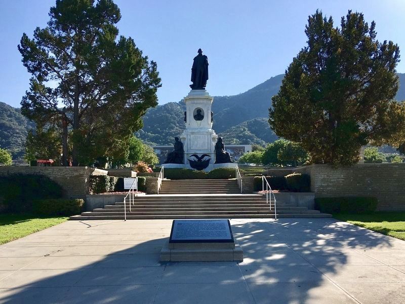
Founded by Father Junipero Serra July 14, 1774. Most picturesque setting. First mass was celebrated in presence of one Indian. Later congregation grew to a thousand neophytes. Famous for its fine horses and expert vaqueros. — — Map (db m154381) HM
Here June 3, 1770, landed Very Rev. Father Junipero Serra, O.S.F. and founded the following missions; San Diego, July 16, 1769, San Carlos Monterey, June 3, 1770, San Antonio de Padua, July 14, 1771, San Gabriel, Sept. 8, 1771, San Luis Obispo, . . . — — Map (db m63109) HM
When the Spanish army and missionaries came to California in 1769, they made a route, El Camino Real, for travel between missions they established, stretching from San Diego to Sonoma. In the early 1900s, a group of women's clubs, among others . . . — — Map (db m189668) HM
On September 22, 1779, Juan Bautista de Anza, with a party of over 200 emigrants and soldiers, set out from the presidio at Tubac, Mexico, to found San Francisco. His party reached the San Gabriel Mission on January 4, 1776, after many miles of . . . — — Map (db m224291) HM
On the mesa one-half mile south of here the original Mission of San Juan Capistrano was founded Nov. 1, 1776.
Commemorated El Viaje De Portola April 1968 — — Map (db m188901) HM
San Clemente Island is the southernmost of the eight California Channel islands. The 56 square miles island received its named in November 1602 when Spanish explorer Sebastian Vizcaino sailed passed it while mapping the region. It represents . . . — — Map (db m190450) HM
As Governor of Baja California Portola was the military leader of the Spanish expedition into Alta California, which camped near the future site of the Mission on July 23, 1769. — — Map (db m199165) HM
Yorba was one of the 66 Catalonian volunteer soldiers in the Spanish expedition, and later built the Miguel Yorba and Domingo Yorba Adobes. — — Map (db m199166) HM
A Spanish soldier station at San Juan Capistrano in the late 1700s. He was awarded a land grant in the San Juan Capistrano Area which remained in his family for 10 generations. — — Map (db m199168) HM
Ortega was the scout who blazed the trails for the 1769 Spanish expedition from San Diego to Sonoma, and discovered San Francisco Bay. — — Map (db m199145) HM
The two furnaces at this site, circa 1790's, are the oldest existing metalworking structures in California. They were used for the production of wrought iron, thereby introducing the natives living here to the Metal Age. Previously, only skills in . . . — — Map (db m195045) HM
Sergeant Jose Francisco Ortega was the chief Scout for the Gaspar de Portola exploratory expedition in 1769. While exploring a route for Portola on their way to Monterey Bay, he was the first non-Native American to discover Capistrano Valley. Nearby . . . — — Map (db m188649) HM
The San Gabriel River flows 43 miles (69 km) through Los Angeles and Orange Counties, California in the United States. Measured to its highest headwaters in the Angeles National Forest, along, the Prairie Fork in the San Gabriel Mountains, the river . . . — — Map (db m214795) HM
Dedicated - June 18, 1950 A Memorial to Richard O'Neill California pioneer (1850) Alice O'Neill, his wife Jerome O'Neill Richard O'Neill Jr.
El Trabuco - Mission Viejo 1769 - Captain Gaspar de Portola, Padre Crespi and soldiers . . . — — Map (db m185388) HM
Miguel Hidalgo y Costilla (1753-1811) Father of Mexico His battle cry for freedom on September 16, 1810 led Mexico to indenpendence from Spain and the end of colonialism. Statue donated by Alberto and Carmencita Heredia, and family, . . . — — Map (db m137649) WM
A prehistoric Indian village
called Atongai once existed
here. In 1776, famed Padre
Garces visited this settlement,
where in 1819 mission native
converts began building a
place for Christian worship. Their efforts
failed when they were killed . . . — — Map (db m166604) HM
San Diego bay is a natural harbor. First sighted in 1542 by the Spanish explorer Juan Rodriguez Cabrillo, the bay was originally named San Miguel. Next visited in 1602, Sebastian Viscaino renamed the bay after a canonized priest, San Diego, from . . . — — Map (db m191983) HM
Commemorating the visit of the officers and men
Buque Escuela Juan Sebastian de Elcano
in homage to their comrades-at-arms who at this place raised and defended the flag of Spain - 1797 to 1821
Dedicado en pax y amistad
San Diego, . . . — — Map (db m81237) HM
The first three sailing vessels to enter San Diego Bay came from the direction you are facing. They were the San Salvador, the Victoria and the San Miguel - Spanish vessels commanded by Juan Rodriquez Cabrillo. The San . . . — — Map (db m15439) HM
In this ancient Indian village of Cosoy Discovered and named San Miguel by Cabrillo in 1542 Visited and christened San Diego de Alcala by Viscaino in 1602 Here the first citizen Fray Junipero Serra Planted civilization in California Here he . . . — — Map (db m13055) HM
Traditionally the earliest planted tree in California. Directly in the rear, beneath the brow of the hill, lie the dead of the sacred expedition of 1769. Burial place of our first unknown soldiers. — — Map (db m11959) HM
To commemorate the discovery of California by Juan Rodriquez Cabrillo who landed on the shores of San Diego Bay September 28, 1542. — — Map (db m126875) HM
For the last 5,000 years this particular site served as a vantage point to the southeast, overlooking an ancient salt water bay fed by fresh water streams.
Standing on this bluff three to four hundred years ago, looking southeast, you would have . . . — — Map (db m93013) HM
The Native People of the Peninsula The Yelamu were one of 50 independent Ohlone tribes related through culture and language. Ohlone peoples have lived in the Bay Area for several thousand years. The Yelamu, whose territory . . . — — Map (db m131189) HM
The purpose of this monument is to forever stand as a tribute to our nation's Founding Fathers who created the two most important documents that laid the foundation of our country: the Declaration of Independence and the U.S. Constitution. This . . . — — Map (db m67581) HM
In 1769 a Spanish expedition led by Gaspar de Portolá discovered Chumash Indians building tomols, or plank canoes on the beach below their village. The Indians were caulking their tomols with asphaltum that came from natural oil seeps in the sand. . . . — — Map (db m165568) HM
Across this bridge lies California's eleventh mission and a glimpse of life during the 1820's. The Civilian Conservation Corps restored the buildings and grounds between 1934 - 1941. We hope you enjoy your visit to the past. — — Map (db m11116) HM
Mission La Concepcion Purisima de Maria Santisima (Mission of the Immaculate Conception of most Holy Mary) was founded by Father Presidente Fermn de Lasuen on Dec. 8, 1787 at what is now Locust Avenue and F Street. It was the eleventh of 21 . . . — — Map (db m70318) HM
First contact between the Spanish expeditions and the Ohlone tribes was usually friendly. These encounters, recorded in expedition diaries, indicated that throughout Ohlone territory, the Spanish were treated as "distinguished guests," suggesting . . . — — Map (db m197734) HM
Lt. Colonel Juan Bautista de Anza by decree of Carlos III of Spain led and expedition near this site – The mission being to colonize the San Francisco Bay Area.
In the center of the marker is a circular motif, designed by Doris Birkland . . . — — Map (db m24727) HM
Preserved herein is a portion of the Original cross first erected by Fray Tomas de la Peña, O.F.M. before the entrance to the first Mission Santa Clara de Asis January 12, 1777. — — Map (db m195449) HM
In front of you is the site of the fifth Santa Clara de Asis Mission.
Floods, earthquakes and fires forced the Santa Clara de Asis Mission to move five times.
Today each of the mission sites are commemorated on the Santa . . . — — Map (db m195448) HM
Lt. Colonel Juan Bautista de Anza by decree of Carlos III of Spain led an expedition to this site – The mission being to colonize the San Francisco Bay Area.
In the center of the marker is a circular motif, designed by Doris . . . — — Map (db m30323) HM
These school grounds were the center of Villa de Branciforte founded in 1797 by Governor Diego de Borica of California on orders from Spain through Viceroy Branciforte in Mexico. The settlement existed as political entity until American occupancy of . . . — — Map (db m2347) HM
Rancho Cañada Larga o Verde, as it was originally known, came out of lands of the San Buenaventura Mission. Following Mexican independence from Spain, Joaquina Alvarado de Moraga, whose late husband, Gabriel Moraga, was a distinguished soldier of . . . — — Map (db m124924) HM
A visible section of the mission aqueduct still exists just east of Highway 33 on Cañada Larga Road. It is one of the few remaining parts of a seven-mile-long system that delivered water from San Antonio Creek to El Caballo filtration plant on the . . . — — Map (db m143278) HM
You have entered the land of the Río Bravo del Norte, the northernmost outpost of sixteenth century Spain. To the Spanish people, the San Luis Valley was a wild and unexplored place known only to the Native people. Amidst the beauty and towering . . . — — Map (db m71878) HM
Isolated from the rest of Colorado, the San Luis Valley is often a forgotten place. For Native American tribes including the Utes, Apache, Navajos, and others, this Valley is a source of life - a place where humans and spirit enter and leave . . . — — Map (db m71875) HM
¡Bienvenidos! Caminantes!
Come! Take a walk with us. We know an old song, El Caminante, which tells of taking a long walk along the ancient roads. Like the first prehistoric inhabitants, you too are a ‘caminante’, or one who walks upon . . . — — Map (db m71877) HM
On August 10, 1776, there passed by here the expedition of Fathers Francisco Atanasio Dominguez and Silvestre Velez de Escalante with eight companions. They were seeking a route to link the long established missions of New Mexico with Monterey, the . . . — — Map (db m71613) HM
In 1776, Franciscan Fathers, Francisco Atanasio Dominguez and Silvestre Velez de Excalante and eight companions, explored what is now southern Colorado, Utah, and northern Arizona, as men of peace.
Between August and December, 1776, Dominguez . . . — — Map (db m153336) HM
From this spot in the fall of 1776, you might have seen a small expedition crossing the plains below, heading west into Utah. The group was led by Atanasio Dominquez and Silvestre Velez de Escalante, two Franciscan friars attempting to find a . . . — — Map (db m154613) HM
We have here a happy intermixture of nations and languages. French, Spanish, Indian and English salute your ears at one and the same time, and I am often at my wit's end to understand all the appeals made to me by such a Babel-tongued . . . — — Map (db m191922) HM
In the 1700s, this area of southern Colorado became a significant cultural crossroads for the Indian tribes of the high plains. Apaches and Kiowas, Utes and Comanches all pressed in to take advantage of the abundant buffalo and other game. This . . . — — Map (db m187029) HM
The Buffalo Symbol
The buffalo symbol, displayed in the walkways of this plaza, has been developed to symbolize the great importance that this animal had in Plains Indian cultures. For peoples such as the Arapahos and Cheyennes, who moved . . . — — Map (db m188267) HM
By 1700 Comanches moved south from the northern Rockies onto the plains of southern Colorado and northern New Mexico. They raided the Apaches and Spanish settlements from the late 1600s until 1779 when the Governor of New Mexico, Don Juan Bautista . . . — — Map (db m64775) HM
Discovered White River (which they called the San Clemente) and crossed it near here on Sept. 9, 1776. Seeking a route from Santa Fe to California, these Spanish explorers were the first white men to examine much of western Colorado. This . . . — — Map (db m163890) HM
Bethel
When this area was settled, soon after 1685, it was part of its present neighbor, Danbury. As population grew, residents petitioned the General Assembly of the Colony for parish status and a church closer than the center of Danbury. In 1759 . . . — — Map (db m114646) HM
Height at shoulder: 21 - 24 inches
Weight: 150 to 300 lbs
Habitat: Farms across Europe, Africa and the United States
Diet: Shrubs, weeds, bird eggs, mice grasshoppers, roots, tubers, even manure
Status: This . . . — — Map (db m230939) HM
Named for Narragansett Bay in Rhode Island, this is the oldest turkey variety developed in the United States. They originate from the breeding of native wild turkeys in New England to domesticated species brought here by European settlers. . . . — — Map (db m230944) HM
Wolves have been brought to near extinction, mainly due to conflicts with humans.
1630 - Present
Bounty Hunting for Wolves
In 1630, Massachusetts colonists passed the first wolf bounty law in America. They sought to eliminate wolves . . . — — Map (db m230845) HM
Size: about 3' tall at the shoulder, length of 6'-7'
Weight: 90 - 130 lbs for females, 130 - 220 lbs for males
Lifespan: up to 10 years in the wild, and up to 20 years in captivity
Diet: a wide variety of . . . — — Map (db m230895) HM
Bridgeport
"The Park City"
The area that is now Bridgeport was settled in the mid-17th century by farmers from the older towns of Stratford and Fairfield. Centers of settlement were Stratfield, present North Avenue; Pembroke, now Old Mill Green; . . . — — Map (db m91834) HM
Brookfield
Parish of Newbury
The land which comprises the geographical area of Brookfield belonged to the towns of Danbury, Newtown, and New Milford. In 1754 the Parish of Newbury was incorporated by decree of the General Assembly with boundaries . . . — — Map (db m35170) HM
Eight families came from Norwalk in 1685 to settle this area which the Indians called Pahquioque. They built their first homes a half mile south of here and made this green their common. The General Court in October 1687 decreed the . . . — — Map (db m22836) HM
In the spring of the year 1685, the first permanent settlement of Danbury was made. The eight determined families of Samuel Benedict, James Benedict, Thomas Barnum, Judah Gregory, Thomas Taylor, John Hoyt, Francis Bushnell and James Beebe settled . . . — — Map (db m71240) HM
Darien
Originally part of Stamford, this area became Middlesex Parish in 1737. It was incorporated as the Town of Darien in 1820. Settlement had begun about 1700 when the first roads were cut “in the woods.” In 1703 a school district . . . — — Map (db m80136) HM
On these grounds once stood
Middlesex Graveyard
1737 - 1923
Stones since removed to Spring Grove[.] Remains of our forebears here repose and still their love remains. — — Map (db m230982) HM
Telling the Story of Darien
Originally founded as the Darien Historical Society in 1953, the Museum of Darien is dedicated to telling the town's story.
Whether it's a 17th-century blanket chest, a hand-sewn Civil War-era flag, or an . . . — — Map (db m230984) HM
Ring’s End
Landing
Earlier Called Clock’s Landing
Trading Center
Of Middlesex Parish
Part of Stamford from 1641 until
Incorporated as Town of Darien
May 20, 1826
Presented by Kiwanis Club of Darien
As part of 150th . . . — — Map (db m80305) HM
Darien's Roots
The Creation of Middlesex Parish
The origins of Darien can be traced to the challenges of a very long walk. In the 1730s residents living in the rural outskirts of Stamford's east end joined forces with their neighbors . . . — — Map (db m230980) HM
[ front ]
Easton
North Fairfield, a part of the town of Fairfield, was purchased from the Aspetuck Indians in 1670 for thirty pounds and an amount of trucking cloth. In 1762 the Connecticut General Assembly established the parish of . . . — — Map (db m30939) HM
In memory of
Andrew Ward
Born in England 1597
One of the founders of
Wethersfield and Stamford
———
An honored citizen of
Fairfield Conn.
where he died in 1659
———
Member of a Commission . . . — — Map (db m27172) HM
Home Of
Thaddeus And Eunice Dennie Burr
Here
Dorothy Quincy and John Hancock
President
Of The Continental Congress
Were Married in 1775
Burned By British in 1779
Rebuilt in 1790 — — Map (db m27371) HM
This shallow depression in the middle of the Green was once a local landmark called Edward's Pond. The town filled in the pond around 1869, with the condition that no buildings be erected so the land would remain part of this public space in . . . — — Map (db m203397) HM
Marker front:
In 1639 Roger Ludlow and five companions, after serving in the Pequot War, purchased from the Indians a rich and abundant expanse of land which they called by the Indian name "Uncowaye." Shortly thereafter the name "Fairfield" . . . — — Map (db m27176) HM
This boulder commemorates
the settlement of Fairfield
by Roger Ludlow in 1639
and the burning of the Town
by the British July 8, 1779.
From the founding of the Town
the religious, military and civic life
of the people
has centered . . . — — Map (db m27227) HM
Welcome to Fairfield’s Historic Town Green
How Did This Green Come to Be? Most New England towns began with a central common "green." Where you are standing is Fairfield's historic center and is as old as the town itself. In 1639 Roger . . . — — Map (db m204367) HM
Connecticut's founding Puritans valued education. As early as 1650, towns with 50 or more families were required to teach children to read and write. The goal of education was to teach children how to read so they could gain a moral and spiritual . . . — — Map (db m203400) HM
In
memory of
Revd John Jones
AB MA
The Revd
John Jones
was born in
Southampton England
in 1595 and was a graduate of
Queens College Cambridge
A Puritan divine of the
Church of England he was
the first pastor of the . . . — — Map (db m27174) HM
Father of Connecticut, Author of the Fundamental Orders, Compiler of the Code of 1650, and Pioneer in the Development of American Constitutional Law.
Founded Fairfield and Made His Home Here from 1639 to 1654 — — Map (db m27141) HM
Site of "Verna"
Home of Timothy Dwight
Chaplain in Continental Army
Pastor of Greenfield
Founder of Academy
Poet of "Greenfield Hill"
President of Yale 1795 - 1815 — — Map (db m27421) HM
Site Of
Trinity Church
1790 – 1844
Rev. Philo Shelton
Rector For Forty Years
First To Be Ordained By
First American Bishop
Samuel Seabury — — Map (db m27376) HM
In memory
of
Thomas Sherwood
1586 – 1655
Puritan – Pioneer – Ancestor
A founder of New England
A first settler of Fairfield
Deputy to the General Court
Committeeman
Soldier of the Pequot War
and his wives . . . — — Map (db m27173) HM
In memory of the courageous men
who founded the first settlement of
the Town of Greenwich
in the Connecticut Colony
July 18-1640
Everardus Bogardus •
John Bowers •
Robert Feaks •
Jeffre Ferris •
Angell Husted •
Robert Husted • . . . — — Map (db m18669) HM
Under the jurisdiction of the New Haven Colony, the first settlers in 1640 purchased land from the Siwanoy Indians. Under New Amsterdam’s protection, this settlement was a dutch manor during 1642–56. In the years 1656–65, it was combined with the . . . — — Map (db m2484) HM
On July 18, 1640, Daniel Patrick and Robert Feaks landed on these shores in the name of the New Haven Colony to start a new settlement, later called Greenwich. This neck of land is called Elizabeth’s Neck after Mrs. Feaks.
The anchor above this . . . — — Map (db m2048) HM
[ front ]
Monroe
On May 23, 1823 the General Assembly granted the incorporation of this town and named it in honor of the then President, James Monroe. The town’s roots, however, are much deeper as it was an offspring of the mother-town . . . — — Map (db m26096) HM
This region was established in 1731 as Canaan Parish, a separate ecclesiastical society of the Congregational Churches of Norwalk and Stamford. Incorporated as a town in 1801. New Canaan encompassed the area of Canaan Parish with additional land . . . — — Map (db m46878) HM
Front
In the year 1724 twelve men from Fairfield, Connecticut , came to this area to purchase land from the Indians who then inhabited it. They negotiated with Chief Squantz of the Schaghticoke tribe, who lived near the pond in this . . . — — Map (db m23060) HM
This area, then known as Quanneapague, was purchased from the Pohtatuck Indians in 1705. Settled from Stratford and incorporated in 1711, Newtown was a stronghold of Tory settlement during the early Revolutionary War. French General Rochambeau and . . . — — Map (db m190109) HM
This historic graveyard is one of the oldest in Norwalk. It predates the Revolutionary War and is the resting place of several patriots of the American Revolution. It is situated on the original grant of land given to the professors of the Church . . . — — Map (db m53461) HM
Norwalk’s first European settlers grazed their cattle on this property – hence the name “Calf Pasture.” Among these earliest arrivals was Matthew Marvin, who moved to Norwalk in 1651 (the year the town was founded). His son, Matthew Jr., bought a . . . — — Map (db m53465) HM
11432 entries matched your criteria. Entries 101 through 200 are listed above. ⊲ Previous 100 — Next 100 ⊳