One of four historic cemeteries located on the campus of Bryce Hospital, Alabama's oldest mental health facility, this cemetery was established in 1953 and is still in use. It contains approximately 500 burials mostly marked with simple, . . . — — Map (db m235677) HM
Dr. Peter Bryce, first superintendent of the Alabama Insane (Bryce) Hospital was a leading proponent of humane treatment for people who experience mental illness. Born March 5, 1834, in Columbia SC, Bryce entered the South Carolina Military Academy . . . — — Map (db m235505) HM
Constructed in 1923 through gift of J. T. Horne, this building occupied by Druid City Hospital School of Nursing from 1923 to 1947. Used by University of Alabama from 1951 to 1954 to house first state supported collegiate school of nursing in . . . — — Map (db m29608) HM
Built 1829 as University dining hall.
Remodeled as a residence 1840.
Occupied by Gorgas family 1879-1953
(Reverse):
Preserved as a memorial to:
General Josiah Gorgas (1818-1883)
Chief of Ordnance, C. S. A. 1861-1865 . . . — — Map (db m29301) HM
Here, on the highest point of the original campus, stands the first celestial observatory at The University of Alabama and one of the oldest observatory buildings in the United States. Through the efforts of Professor F. A. P. Barnard, the first . . . — — Map (db m34842) HM
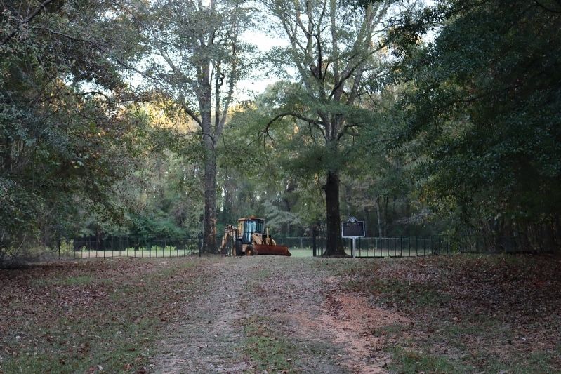
This is the oldest of four historic cemeteries located on the campus of Bryce Hospital, Alabama's oldest mental health facility. The first recorded burial dates to 1861. While only a few graves are currently marked, it is estimated that thousands of . . . — — Map (db m40450) HM
Erected: 1889
Reconstructed: 2000
Named for professor, scientist, and photographer F.A.P. Barnard who pioneered the study of astronomy at The University of Alabama and established its chapter of Phi Beta Kappa in 1851.
On August 26, 2000, . . . — — Map (db m29402) HM
These gates are replicas of the gates for Northington General Hospital, a U.S. Army Hospital that operated on this site during World War II. From 1947 to 1952, Northington General Hospital was the temporary home of DCH Regional Medical Center while . . . — — Map (db m35517) HM
Named for Eugene Allen Smith (1841-1927), University Professor and State Geologist, who served the State in this dual capacity for fifty-four years.
Smith rebuilt the collections of the Alabama Museum of Natural History, which had been . . . — — Map (db m29403) HM
Built by Robert Jemison Jr. Completed 1862, the 26 room Italian Villa style mansion is distinguished by its octagonal cupola and delicate carved fretwork. Jemison, a member of Alabama Legislature for 20 years (1840-63), 1861 Secession Convention (he . . . — — Map (db m35321) HM
Constructed as a guard house for the Alabama Corps of Cadets during the early 1860's, the Little Round House provided shelter from inclement weather for cadets on sentry duty. Until 1865, it also housed the University Drum Corps, which was composed . . . — — Map (db m25387) HM
Designed by Montgomery architect W. A. Crossland and named for noted professor and state geologist Michael Tuomey.
Tuomey's survey resulted in the landmark 1849 geological map of Alabama and his work began the Geological Survey of Alabama. . . . — — Map (db m29400) HM
Provided by local veterans and other dedicated citizens, this memorial pays tribute to all veterans of Tuscaloosa County who were engaged in the nine major American wars, 1776-1976. Rising centrally is the mainmast of World War II heavy cruiser USS . . . — — Map (db m35475) HM
The Tuscaloosa Veterans Administration (VA) Hospital was constructed in the early 1930's and was dedicated on July 6, 1932. The 272 bed General Medical and Surgical Hospital began admitting patients on July 15, 1932. In 1940, the hospital was . . . — — Map (db m203526) HM
This monument stands in front of the birthplace of Dr. Thomas Malcolm Blake (1917-1989), and near the site of his office where, for forty-seven years, he devoted his life to helping others, Dr. Blake’s birthplace was formerly the residence of the . . . — — Map (db m201733) HM
Mountains in Motion
Though the visible glaciers appear remote - gleaming between distant peaks - the valley below is strewn with signs of masses glaciation: stranded boulders, gouged-out ponds, and gravel outwash plains. The last big . . . — — Map (db m71362) HM
By August, 1904, when a Catholic priest arrived in Fairbanks, all choice lots in the center of town were taken. Father Francis Monroe, a Jesuit missionary, selected land at the edge of town, bordering the Chena River. The first Roman Catholic . . . — — Map (db m135350) HM
Dr. Maple was a structural engineer and principal designer of the trans-Alaska pipeline. He holds three patents for his development of innovative pipe supports that enabled the warm oil pipeline to safely traverse areas of permafrost. He pioneered . . . — — Map (db m58949) HM
This totem pole tells the story of the harnessing of the atom. The pole was carved in 1967 by Tlingit carver Amos Wallace of Juneau. His Tlingit name was Jeet Yaaw Dustaa of the T'akdeintaan Clan of the X'áakw Hít Tlingit (Freshwater-marked Coho . . . — — Map (db m181737) HM
Prospectors found gold in 1895 under the present Canyon Creek Highway Bridge and on Mills Creek. Those discoveries launched a rush to Turnagain Arm more than a year before the Klondike Gold Rush.
Prospectors Poke Around
After gold was . . . — — Map (db m49599) HM
The Christian cross was planted in Ketchikan's shoreline in 1897, when the settlement was only a creekside collection of Native homes and a trading site for the first white businessman in the area. The missionary priest who staked an ecclesiastical . . . — — Map (db m182004) HM
This two-story, wood clapboard and gambrel roofed cottage-style house was constructed during the summer of 1916 by the United States Department of Commerce, Coast and Geodetic Survey. Prior to the purchase of Alaska by the United States from the . . . — — Map (db m181580) HM
Built during the great depression using native stone & W.P.A. labor, this twenty-bed facility finally opened in 1939 when a doctor agreed to come to Round Valley to finish, lease & run the hospital for 10 years. — — Map (db m36649) HM
Dedicated to the
Engineering Achievements of
Percy Jones, Jr.
1888 –
Chief locating engineer who by sheer genius personally located more miles of Arizona highways than any other person. His college training in mining and geology . . . — — Map (db m37899) HM
This 11-ton telescope, built by the Alvan Clark & Sons Telescope Manufacturing Company of Cambridgeport, Massachusetts, was installed at Lowell Observatory in 1909. It came with four secondary mirror combinations so that it could be operated at four . . . — — Map (db m149451) HM
The rich diversity of plants and animals of the Flagstaff area was first recognized in the summer of 1889 when Dr. C. Hart Merriam led a biological survey to the San Francisco Peaks. Merriam's "Life Zone Theory" detailed that temperature and . . . — — Map (db m201772) HM
Understanding and predicting local weather patterns helps astronomers plan successful observing runs. Because of this, observatories such as Lowell typically maintain weather stations to monitor the conditions. One such station was set up at the . . . — — Map (db m149452) HM
Another life-long employee of Lowell Observatory, Henry is best remembered for his Proper Motion Study of 1971, which entailed repeating the Pluto search plates after 25 years to determine whatever changes had taken place in the background of . . . — — Map (db m149456) HM
Lowell Observatory has been designated a Registered National Historic Landmark Under the provisions of the Historic Sites Act of August 21, 1935 this site possesses exceptional value in commemorating or illustrating the History of The . . . — — Map (db m149455) HM
As the keystone shows, this building was constructed in 1911. Its owner was R.O. Raymond, M.D., one of Flagstaff’s first doctors. Raymond came west for his health. After a short stay in Williams, he moved to Flagstaff in 1906.
He was the doctor . . . — — Map (db m59511) HM
A gift to the Observatory from President A. Lawrence Lowell through this instrument the ninth planet Pluto was first found in 1930 ”It means a planet out there as yet unseen by Man, but certain sometime to be detected and added to the . . . — — Map (db m149454) HM
The first Chief Topographic Engineer of the U.S. Geological Survey • 1919-1929 and the first President of the American Society of Photogrammetry • 1934 He headed a Geological Survey expedition through the Grand Canyon in 1923 to acquire information . . . — — Map (db m157000) HM
”the Grand Canyon of the Colorado will give the best geological section on the continent.” —John Wesley Powell, 1868 The “geological section” described by John Wesley Powell is a vertical cross . . . — — Map (db m156995) HM
In 1898 the forested lands around
Williams were set aside as a forest
reserve that supplied timber for
the Saginaw-Manistee lumber mill
and box factory, which operated
from 1893 to 1942. Built by the
Rounseville brothers about 1915,
this . . . — — Map (db m236374) HM
An Ohio born dentist, Zane Grey spent many years under the Mogollon Rim, writing "To the Last Man" and a dozen other westerns with Arizona settings and characters. His prolific writings popularized the American cowboy as a taciturn, romantic . . . — — Map (db m67413) HM
Named for the rebellious medicine man who led the Chiricahua Apaches on their last raids, to surrender, and then into exile in Florida and Oklahoma. Their descendants lived in Eastern Arizona again. This was also the site of original Camp Thomas, . . . — — Map (db m28050) HM
He knew no yesterdays
His living was for tomorrow
Founder of the town of Chandler
Built the San Marcos Hotel
Arizona’s first veterinarian
Father of modern irrigation system
Pioneer rancher and developer of the southside area of . . . — — Map (db m70990) HM
Price Building, 1914
Chandler Historic Commercial District on the National Register of Historic Places
Chandler's first elected Mayor, David Jacobson, built this structure. It is named for Arthur E. Price, Chandler's first attorney and . . . — — Map (db m72051) HM
Greatest of the educated Apaches, this Mohave-Apache Indian was taken captive at the age of six by Pima Indians. He was sold to a white man who educated him as a physician. Dr. Montezuma had a splendid practice in Chicago and became a champion of . . . — — Map (db m27680) HM
Born of the selfless and compassionate services of those individuals
who gave medical, spiritual and other assistance to the sick and needy
in the Sunnyslope area. After the turn of the century, the Desert Mission
grew to be the center of these . . . — — Map (db m111478) HM
1921 - 1937 Sterling Drug Store
1937 - 1948 Scottsdale Pharmacy
1948 - Present Saba's Western Store
Built in 1921 by Dr. Walter S. Lawson to serve the needs of a growing farm village, this red brick building housed a drug store for . . . — — Map (db m141347) HM
Scottsdale City Councilman 1970-1978
Mayor of Scottsdale 1980-1996
"Serving the citizens of Scottsdale is the greatest job in the world."
Herb Drinkwater
"Mr. Scottsdale," Mayor Herb Drinkwater, served the citizens of Scottsdale . . . — — Map (db m141342) HM
Paiute people used the dark green leaves of datura, crushed as a poultice, to treat sores and swelling. This traditional medicinal plant was chewed to reduce toothache pain, as well as induce visions. Datura is highly poisonous. Please do not touch. — — Map (db m149368) HM
This building has been placed on
the National Register of
Historic Places
by the United States Department of the Interior
This adobe bungalow with low-pitched gable roofs and a partial front porch with tapered columns was the home of . . . — — Map (db m193553) HM
The Rainbow Forest area was the original park head-quarters from 1906 to 1962. In the 1920s, the museum was housed in a tar paper building and instead of a walking trail, a bumpy road wove through Giant Logs. Clearly, many things have changed. But . . . — — Map (db m187257) HM
It is not known if the prehistoric Indians of the canyons used this plant, but both Navajos and Hopis make medicine from it, to cure stomach-ache. The Navajos use it to cure colds and headache. — — Map (db m144404) HM
Hopis made arrows from the wood of this plant and shredded the soft bark to make a padding for babies' cradleboards. Like many of these plants, it provided medicine, and was used as an emetic and as a wash for wounds. — — Map (db m144393) HM
This plant, when made into a brew, was a multipurpose medicine, prescribed for stomach trouble, kidney afflictions, venereal disease, and coughs. — — Map (db m144407) HM
Hopi Indians burn rabbit brush kindling with three other wood fuels in their ceremonial kivas. Slender, flexible stems are woven into basketry. Green dye comes from the inner bark, while early autumn flowers yield a yellow dye. The Hopis once . . . — — Map (db m144448) HM
Serviceberry is one of the enduring "life medicines" of the Navajos, which insure their survival, health, and harmony. It is gathered to treat nausea, stomach problems, animal bites, and recovery from childbirth. It is also valued as a medicine in . . . — — Map (db m144449) HM
The Sanborn Fire Maps for the City of Tucson first recorded this building in 1883 as an adobe dwelling with an attached ramada. Between 1901 and 1930 additions were made to the main building and construction was completed on the outbuilding behind . . . — — Map (db m83244) HM
Kitt Peak
National Observatory
Founded 1958
The observatory’s objectives are to
strengthen basic research and education
in astronomy throughout the United States, its
territories and possessions. The observatory is
available to . . . — — Map (db m102813) HM
Steward Observatory
90 inch Reflector
University of Arizona
Erected 1967
Board of Regents
Jack Williams Governor · George W. Chambers President · Elwood W. Bradford · Sarah Folsom · Wesley P. Gross · Leon Levy · Norma Barr Rockfellow · . . . — — Map (db m102921) HM
This drawing shows the interior of the McMath solar telescope. You are looking at only part of telescope which is above ground. The tunnel for the light beam and the observing rooms where the scientific work is done are buried under the mountain. . . . — — Map (db m102919) HM
The accompanying picture shows a cross section of the solar vacuum telescope. This facility, built in 1973, is used to study the evolution of sunspots and other solar magnetic fields. It is operated daily by the National Solar Observatory (NSO) . . . — — Map (db m102918) HM
The octagon-shaped building that you see in the distance is the enclosure for the telescope of the WIYN Observatory. Completed in 1994, WIYN is owned and operated by the University of Wisconsin, Indiana University, Yale University, and the . . . — — Map (db m102920) HM
Dr. William Austin Cannon had this house built during 1904-1905. He was the first resident botanist with the Carnegie Desert Laboratory in 1902, and worked there until 1926. Dr. Cannon sold the house in 1913 to Dr. Andrew Ellicott Douglass, an . . . — — Map (db m83014) HM
This adobe building, which was designed by Levi Ruggles and built in 1878, combines Sonoran and Anglo-American architectural features typical of Territorial Arizona. It was the courthouse until 1891 and then served as a hospital, health center, home . . . — — Map (db m32956) HM
This Colonial Revival adobe was the home of George Brockway and his wife Esther. Brockway was the town medical doctor, Pinal County Hospital Superintendent and Territorial Prison physician. He owned a drugstore, and in 1908 became the first mayor of . . . — — Map (db m26712) HM
Dr. George Huffman built this large, two-story Bungalow-style adobe house to accommodate his family and his medical practice. Surgical rooms were located on the first floor with rooms for patients upstairs. Square pillars support full-width porches. . . . — — Map (db m32439) HM
Colonel William Boyce Thompson was a mining promoter, financial magnate, and Red Cross officer. He fell in love with the Picketpost Mountain area when he first visited his Magma Copper Mine near Superior and chose this spot for his winter home. . . . — — Map (db m117109) HM
The main cellblock was built to house up to 204 prisoners, but at times the Superintendent's report stated that up to 240 prisoners were kept here. Each cell was approximately 9 foot X 12 foot and could hold six prisoners. When space became limited, . . . — — Map (db m158292) HM
Sweet Spring Hotel
The Sweet Spring Hotel was established about 1887 at the corner of Pine Street and Spring, then known as Rice Street, with A.S. Capps as proprietor. The spacious three-story frame structure was painted white with dark . . . — — Map (db m80112) HM
"It is sometimes called The Basin Springs, and is invariably the first resort for visitors. If there is any one in the city you desire to find, if no other way, go to the Basin Springs, seat yourself comfortable, and await his coming."
Prof. . . . — — Map (db m63300) HM
This home was built about the year 1848 for John H. Saunders and his wife Martha A. Pettit Saunders. During the Civil War engagement at Ditch Bayou in 1864 the house was used as a hospital for soldiers of both armies. A number of military dead were . . . — — Map (db m107737) HM
Using advanced technology to understand the past.
Like the methods of Crime Scene Investigators, science provides a variety of ways to look beneath the surface of the Drennen House grounds for evidence of the past. Techniques like . . . — — Map (db m120491) HM
The Health Department, dedicated May 4, 1938, was built with funds by the Federal Works Progress Administration (WPA). When additional space was needed, the Crittenden County Negro Business Men's League, led by George Walker, Jr. and John Gammon, . . . — — Map (db m116780) HM
Following is a partial list of persons who died and were buried at Cadron. They perished from cholera while being relocated by the Army in 1834. Graves were marked with native stones with no inscriptions. Some of the Indians had adopted . . . — — Map (db m96643) HM
When illness threatened to end his Hall of Fame career prematurely in 1928, Al Simmons came to Hot Springs to take the baths and hike in the mountain trails. The visit worked wonders, and, encouraged by legendary Athletics' manager Connie Mack, . . . — — Map (db m167399) HM
Many baseball historians regard Ewing as the greatest all-around 19th century player. He came to the Army-Navy Hospital in Hot Springs in 1892, seeking medical advice for his sore throwing arm. On March 19th, after successful treatment, he hit a . . . — — Map (db m102685) HM
After crossing the lower slopes of Hot Springs Mountain, this "red" trail connects with Gulpha Gorge Trail on a ridge above Gulpha Gorge Campground. The Short Cut Trail leads to the summit.
Historic Exercise Trail
For the next 0.2 mile . . . — — Map (db m145671) HM
This spring remained open long after others were enclosed and diverted to bathhouses. It was common for the water of each hot spring to have a reputation for curing particular ailments, and the shallow water in this pool led naturally to foot . . . — — Map (db m145651) HM
The Tufa Terrace Trail passes historic Ral Spring and follows a fairly level path across the hillside before rejoining the Grand Promenade. From there you can stroll the Grand Promenade or descend past the Thermal Cascade to Arlington Lawn. . . . — — Map (db m145670) HM
In addition to the hot springs for which, the park is known, there are many cold springs within the park's boundaries. The springs come from underground aquifers, which are layers of porous or fractured rock filled with water. Water in aquifers is . . . — — Map (db m234364) HM
Officers Killed
Gen. J.G. Walker’s Texas Division made the final Confederate attack in the April 30, 1864, battle of Jenkins’ Ferry. Its three brigades, led by Gen. William Read Scurry, Gen. Thomas N. Waul and Col. Horace Randal, charged . . . — — Map (db m121207) HM
Disease, death, the practice of separating slave families—all left
children with no one to care for them. Scores of orphaned black
children in Civil War Helena suffered from neglect and exposure.
General Napoleon Buford asked for help. In . . . — — Map (db m107999) HM
Patrick Ronayne Cleburne, the son of Dr. Joseph and
Mary Anne Ronayne Cleburne, was born March 17,
1828. At the age of twenty-one he immigrated to the
United States. He settled in Helena in 1850.
The Son of . . . — — Map (db m109138) HM
Near this spot stood the substantial brick home of Alexander George (1812-1877), a wealthy German immigrant active in Little Rock's business, civic, social and political circles. Built during the 1858 to 1859 period, the George House with its . . . — — Map (db m121455) HM
Dr. Thornton lived at 1420 West 15th Street for more than fifty years. Using his income as a teacher, he put himself through Meharry Medical College in Nashville, Tennessee. He was known as one of the “deans of Black physicians” in Little Rock. He . . . — — Map (db m211469) HM
Front
The first human dissection in Arkansas was made on this spot in November 1874 by James H. Lenow M.D. Little Rock and Richard S. Vickery M.D. U.S. Army
Rear
Erected by the Arkansas Medical Society to perpetuate the . . . — — Map (db m116362) HM
William Blackwell Welch was born in 1828 in Scottsville, Kentucky and graduated from the University of Tennessee Medical School in 1849. In 1851, he married Alabama native, Laura F. McClellan, and the couple moved to Cane Hill in 1855. Here they . . . — — Map (db m240271) HM
Agricultural Chemistry Professors Barnett Sure (1920-51) and Marinus C. Kik (1927-67) made major advances in nutrition science during their long tenures at the University of Arkansas. Sure co-discovered vitamin E and extended knowledge of how . . . — — Map (db m224345) HM
From 1962-71, UA Agricultural Engineering Professor Xzin McNeal designed, built, tested and developed the nation's first successful pallet trailer system of stacking and storing cotton. His system solved the temporary storage problem created by the . . . — — Map (db m224263) HM
“Arksoy,” the first Arkansas soybean variety,
was developed by agronomy professor
Chalmers K. McClelland and released by the
Arkansas Agricultural Experiment Station in
1928. Agronomist Charles E. Caviness and
plant pathologists H.J. “Jack” . . . — — Map (db m224344) HM
University of Arkansas plant pathologists George Templeton, Roy Smith (USDA), David TeBeest and graduate student Jim Daniels conducted research in the early 1970s that led to Collego™, the first biological herbicide for weed control in a field crop. . . . — — Map (db m224721) HM
In the 1950s, Professor Paul Kuroda of the University of Arkansas' Department of Chemistry predicted that self-sustaining nuclear chain reactions could have occurred naturally in earth's geologic history. In 1972, his prediction was confirmed when . . . — — Map (db m224271) HM
In 1970-71, zoology graduate students Frances C. James and Herman Henry Shugart Jr., working in Professor Douglas A. James' laboratory, published papers that introduced a new way to determine aspects of the environment associated with habitat . . . — — Map (db m224259) HM
During the 1980s, Professors Allen Hermann
and Zhengzhi Sheng of the Department of
Physics were in the vanguard of research in
superconductivity – the phenomenon whereby
direct current (DC) electricity, once
started, can flow essentially . . . — — Map (db m224248) HM
The most widely implemented automated mail sorting equipment in the world – the Wide Area Bar Code Reader – was developed by the University of Arkansas' College of Engineering. A $50,000 grant from the U.S. Postal Service (USPS) to Professors Dwight . . . — — Map (db m224261) HM
On this site stood the former home of Dr. James W.
Webb (1878 1947) and Mrs. Joy Nelson Webb
(1891-1976). Dr. Webb also owned and operated a
dentist office on this property. Mrs. Webb published
and edited the weekly Prairie Grove . . . — — Map (db m225087) HM
Dedicated on March 25, 1928 as Humboldt
Hospital, the Albany Hospital served countless
patients until its closure in 1985. The hospital
provided a surgical department, as well as
emergency and obstetrical care and general
medical services. . . . — — Map (db m137078) HM
Site of the
Ernest V. Cowell
Memorial Hospital
1930-1993
Built for the
Student Health Service
Original location of the
Physically Disabled
Students Residence Program
1962-1975 — — Map (db m198024) HM
Gilman Hall was built in 1916-17 to accommodate an expanded College of Chemistry under the leadership of Gilbert Newton Lewis. This building provided research laboratories and teaching facilities for faculty and students specializing in physical, . . . — — Map (db m15870) HM
Former site of the Students' Observatory, completed in 1886 and named in 1951 for Armin Otto Leuschner (1868-1953), Director of the Observatory (1898-1938) and Chair of the Astronomy Department (1900-1938). — — Map (db m114355) HM
This is the electromagnet for the world's first major cyclotron. With it, professor Ernest O. Lawrence and others perfected the difficult cyclotron technology. Originally a 27-inch cyclotron, it was converted to a 37-inch instrument in 1937. . . . — — Map (db m91800) HM
5602 entries matched your criteria. Entries 101 through 200 are listed above. ⊲ Previous 100 — Next 100 ⊳