During the westward expansion of the United States in the early 1800’s, those whose destination was the new Mississippi Territory took a right fork off the Federal Road which led to the Alabama River ferry at Claiborne. After the land cessions of . . . — — Map (db m47638) HM
North of Salem Cemetery and the former church was the site of Price's Hotel, the first place to spend the night on the Federal Road after Greenville. Mr Price was also the stagecoach driver for this section between Greenville and his hotel. Mrs . . . — — Map (db m84986) HM
The second black Baptist Church in Montgomery. First pastor was Rev. C. O. Boothe. Present structure built 1885. Designed by Pelham J. Anderson; built by William Watkins, a member of the congregation.
Many prominent black citizens of Montgomery . . . — — Map (db m25128) HM
The Federal-Aid Highway Act of 1956, signed into law by President Dwight D. Eisenhower, authorized the construction of 41,000 miles of the Interstate Highway System over a ten year period - the largest public works project in American history to . . . — — Map (db m210249) HM
On multiple occasions in 1955, black women were arrested for challenging Montgomery's law requiring racial segregation on buses. The arrest of Rosa Parks sparked a mass protest that launched the modern civil rights movement and brought to prominence . . . — — Map (db m118040) HM
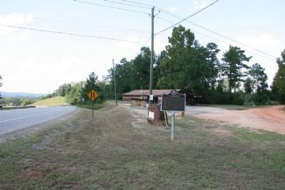
This 2.8-mile road connecting U.S. highways 331 and 31 first appeared on Montgomery County road maps in 1928. Land for the road was deeded to Montgomery County in September 1926 by local landowners from the Teague, Bellingrath and Matthews families. . . . — — Map (db m70932) HM
This 2.8-mile road connecting U.S. highways 331 and 31 first appeared on Montgomery County road maps in 1928. Land for the road was deeded to Montgomery County in September 1926 by local landowners from the Teague, Bellingrath and Matthews families. . . . — — Map (db m99235) HM
In this house, built in 1948, Frank and Alberta Smith raised their six children.
Through their activism and participation in two landmark suits, members of the Smith family played critical roles in the Civil Rights Movement. The family attended St. . . . — — Map (db m223847) HM
Side 1
The Federal Road
The 1803 Louisiana Purchase acquired 828,000 sq. mi. for the U.S., doubling its size. The Federal Road was built to provide a shorter route from Washington to New Orleans and the new territory. The Treaty . . . — — Map (db m71535) HM
In 1860, the Memphis and Charleston Railroad was the only east-west route through the United States south of the Mason-Dixon Line. Maintaining control of this rail line was essential to Confederate strategy. Union Brigadier General Ormsby Mitchell . . . — — Map (db m28262) HM
Old Bethel Road first came into use during the mid-nineteenth century. It ran adjacent to the property deeded to George Hartselle by President Polk in 1845 and President Buchanan in 1858. The road later connected with Fletcher Ferry Road and Georgia . . . — — Map (db m217103) HM
This area's first settlers arrived in the 1830s and established the Crossroads community at the intersection of the Columbus-Tuscaloosa and Vienna-Fayette stagecoach roads, one mile northeast of Gordo's present location on Highway 82. The name . . . — — Map (db m152577) HM
In the early 1800s, south Alabama was still inhabited by many groups of Native Americans: Creek, Chickasaw, and Choctaw among others. They traveled, hunted, traded, and made war on the many ancient trails here. European settlers improved these roads . . . — — Map (db m95359) HM
Built by U.S. Army, 1824,
from Ft. Barrancas, at Pensacola
to Ft. Bainbridge, S.E. of Tuskegee.
Here it joined Federal Road leading to
Ft. Mitchell in Russell County.
Road followed Indian trade trail
Became main road . . . — — Map (db m76745) HM
Oldest route from Atlantic to Southwest. In 1805 it became Federal Road, over which pioneers traveled from Milledgeville to St. Stephens. Oglethorpe, Lafayette, Burr and others used this trail. — — Map (db m165635) HM
The Old Federal Road that opened the southeastern United States to
settlers once crossed at this location. In 1805, the United States Congress
granted funds to build a post road from Georgia to New Orleans to
cross the sparsely settled wilderness . . . — — Map (db m237220) HM
Founder of Buffalo Rock Company (1901) in Birmingham and creator of Buffalo Rock Ginger Ale, a medicinal tonic first used in the Civil War. Lee's vision and influential support inspired the construction of this road across Double Oak Mountain . . . — — Map (db m52693) HM
In 1940, the U.S. Army put out a call to automobile manufacturers to produce a fast, lightweight, all terrain vehicle. The answer came in the form of the Willys MB. The Jeep was instrumental in World War II, the Korean War, and Vietnam.
This . . . — — Map (db m35515) HM
Two miles north of this point was the intersection of two important postal routes of early Alabama, the Saint Stephens-Cahawba Road and the Tuskaloosa-Prairie Bluff Road. — — Map (db m38495) HM
The Byler Road was Alabama's first state road. Governor W. W. Bibb signed into law a bill authorizing its construction December 16, 1819.
The turnpike was named for John Byler, its chief promoter. Byler and his associates were directed to build . . . — — Map (db m153313) HM
Byler Road
Byler Road, which passes through Natural Bridge, was
Alabama's first state road. Governor W.W. Bibb signed into law
a bill authorizing its construction on December 16, 1819. The
turnpike was named for John Byler, its chief . . . — — Map (db m153261) HM
“Instead of row after row of empty houses (Dawson), they are building new stores. The place is alive and busy-a little too crowded when we got there.” – a tourist in Fairbanks, 1928 — — Map (db m47406) HM
At the turn of the century, Ketchikan's pioneer townsite sprouted up from the base of a rugged, uncleared rocky mountainside where it meets deep tidewater. The downtown business district was literally built upon pilings and planked decking, with . . . — — Map (db m181910) HM
Shipments of iced halibut from Ketchikan to outside markets was pioneered by F.J. Hunt and H.C. Strong, following similar successful methods with salmon, and a thriving business was built through the construction of two large cold storage . . . — — Map (db m181914) HM
Dedicated to the indomitable spirit of the
sled dogs of the Iditarod Trail Sled Dog Race.
“The Last Great Race on Earth”
Endurance • Fidelity • Intelligence
Dedicated the first Saturday of March, 2012
Historic replica of . . . — — Map (db m80411) HM
Joe Redington, Sr.
Born in Oklahoma, February 1, 1917 • Died in Alaska, June 24, 1999
Joe was an accomplished man; homesteader, big-game guide, bush pilot,
commercial fisherman, boat builder, fish-plant manager, and mountain . . . — — Map (db m80410) HM
In loving memory of
Dean H. Christopherson
1916-1992
Made possible by a generous
contribution from
Mrs. Elaine G. Christopherson
in memory of her husband
The cabin is similar to the cabin at Rohn
the eighth checkpoint on the . . . — — Map (db m80413) HM
This highway was constructed during World War II as a military supply route for interior Alaska Military and Airfields in 1942. 7 Army regiments and 42 Contractors and Public Roads Administrators working from Delta Junction South and Dawson Creek . . . — — Map (db m59840) HM
The Taylor Highway leads through some of the earliest and richest gold mining country in Alaska to the City of Eagle on the Yukon River. Gold was discovered by Franklin in 1886 and the old town of Forty Mile was located on the Yukon River at the . . . — — Map (db m49596) HM
The U.S. Army arrived at Valdez during the Gold Rush to build a trail into the interior. They found the Valdez Glacier impassable much of the year. To bypass the glacier, they cut a narrow trail along the walls of rugged Keystone Canyon. The . . . — — Map (db m49611) HM
On the far side, just above the water are the remains of the old sled trail, used in the early days. It was cut out of the rock, just wide enough for 2 horses abreast. 200 ft. above can be seen the old goat trail. This road was used till 1945. — — Map (db m49610) HM
U.S. Route 66 (US 66 or Route 66), also known as the Will Rogers Highway, the Main Street of America or the Mother Road, was one of the original highways within the U.S. Highway System. US 66 was established on Nov. 11, 1926, with road signs erected . . . — — Map (db m184319) HM
Petrified Forest is the only National Park in the country with a portion of Historic Route 66 within its boundaries. You are currently standing where the Mother Road used to be, with the line of telephone poles paralleling its alignment through the . . . — — Map (db m163277) HM
You are standing near old Route 66. The line of the roadbed and the telephone poles in front of you mark the path of the famous "Main Street of America" as it passed through Petrified Forest National Park. From Chicago to Los Angeles, this heavily . . . — — Map (db m68904) HM
This 10 foot high, 5 ton statue cast by St. Louis sculptor August Leimbach is one of 12 identical monuments to the bold spirit of the pioneers erected in 1928-29 along the National Old Trails Road from Maryland to California. — — Map (db m36380) HM
Front of obelisk
Road Constructed by
Prison Labor 1913-14
Board of Control
Geo. W.P. Hunt Governor
C. Callaghan Auditor
U.R. Osburn Member
R.E. Sims Supt of Prison
Lamar Orb
State Engineer
Right side of obelisk . . . — — Map (db m48552) HM
The Road Below
We started through Apache Pass, over awful roads, up hill and down. We had to tie the wagon wheels with ropes and then in some places, the men had to stand on the wheels to keep them from turning over. Every man who could . . . — — Map (db m101004) HM
In 1857, the government awarded John Butterfield a contract to carry mail by stagecoach between St. Louis and San Francisco. The 2,800-mile route was to be traversed within 25 days. A year later, as the stagecoaches prepared to roll, Butterfiled . . . — — Map (db m100817) HM
The Apache Pass Stage Station was built of stone in July 1858. Within its 6-8 foot-high walls were a kitchen-dining room, sleeping rooms, a storage room for feed and weapons, and a mule corral with portholes in every stall. The stage stopped here . . . — — Map (db m100814) HM
Dedicated to the
Engineering Achievements of
Percy Jones, Jr.
1888 –
Chief locating engineer who by sheer genius personally located more miles of Arizona highways than any other person. His college training in mining and geology . . . — — Map (db m37899) HM
Dedicated to the
Engineering Achievements of
Percy Jones, Jr.
1888 –
Chief locating engineer who by sheer genius personally located more miles of Arizona highways than any other person. His college training in mining and geology . . . — — Map (db m37900) HM
At 1:00 p.m. on April 21st, 1907, the "Million Dollar Stope" was created when the Good Enough Stope caved in dropping a horse and wagon 75' into a gaping hole. The driver had climbed down to see why his horse had stumbled only to find himself . . . — — Map (db m131088) HM
Railroad Avenue became the Commercial center for the growth of Willcox and the Sulpher Springs Valley from the time of the construction of the Southern Pacific Railroad through the area in 1880. — — Map (db m28174) HM
In 1857 Congress authorized Navy Lieutenant Edward F. Beale to survey a wagon road along the 35th parallel from Fort Defiance, New Mexico Territory, to the Colorado River. A secondary mission was to test the feasibility of using camels in the . . . — — Map (db m33348) HM
From 1857-60, Lt. Edward F. Beale and a crew of 100 men completed the first federal highway in the southwest from Fort Smith, Ark. to Los Angeles, Calif. at a cost of $200,000. The wagon road was used extensively by immigrants en route to California . . . — — Map (db m33346) HM
Beneath the inverted, forked ponderosa entryway awaits an adventure in pioneer history, country-western legends and ghost stories - one of northern Arizona's liveliest landmarks since 1931.
Recognized by Hampton Hotels Save-A-Landmark . . . — — Map (db m192855) HM
This 1945 Model H International Farmall, purchased by the Zanzucchi Family after World War II, was used to plow the "Fields" at the Flagstaff Dairy. The Flagstaff Dairy operated from 1904 thru 1979 and was located 3 miles west of Flagstaff on Old . . . — — Map (db m178779) HM
Directly behind you, looking down into Hermit Canyon, you can see part of Hermit Trail and the remains of Hermit Camp. In 1911-12 the Santa Fe Railroad built both trail and camp to serve a blossoming tourist trade. Why did Santa Fe build here at . . . — — Map (db m156999) HM
Each year thousands of hikers enter Grand Canyon on the Bright Angel Trail. They follow a tradition - and a trail route - established by prehistoric people. For centuries humans have used this route for two key reasons: water and access. Water . . . — — Map (db m39563) HM
You are standing on a section of the original Hermit Road, constructed in 1911-1913. It was a road ahead of its time, offering sweeping vistas and gentle grades, at a cost of $250,000 — an unheard of sum for such a short road. It was built for . . . — — Map (db m157147) HM
"No language can fully describe, no artist paint the beauty, grandeur, immensity and sublimity of this most wonderful production of Nature's great architect. [Grand Canyon] must be seen to be appreciated."
C.O. Hall, Grand Canyon visitor, . . . — — Map (db m39659) HM
On the inner plateau, Hermit Camp has been built.... A skilled Chef is in charge of the dining room, where excellent meals are provided. It is camping out ‘deluxe.’ —1916 Hermit Camp postcard Deep in the canyon are faint signs of . . . — — Map (db m156994) HM
Today, most visitors will travel the Hermit Road by shuttle, but in 1912 when the road first opened, you would have traveled by horse or buggy. The Santa Fe Railway and U.S. Forest Service built the buggy road so early visitors had a choice in . . . — — Map (db m157166) HM
Constructed in 1928, the Kaibab Trail Suspension Bridge was the only crossing of the Colorado River in a distance of 754 miles from Moab, Utah to Needles, California. Built in a remove location with incredibly difficult access through rugged . . . — — Map (db m173929) HM
Behind you is the Bright Angel mule corral, where each morning mules greet riders and another adventure begins. Mules have carried people into Grand Canyon since sightseeers first visited here in the 1890s. For many people - including those who . . . — — Map (db m205170) HM
Allow about 30 minutes to tour Tusayan Ruin. The 0.1 mile loop trail through the main ruin is paved and wheelchair-accessible; the side loop to a prehistoric farming site is not. Signs along the way explain the site's features. An interpretive . . . — — Map (db m39633) HM
Under the direction of General George Crook this trail was built in the early 1870's. Starting at Fort Whipple, it winds down to Fort Verde then eastward across the Mogollon Rim to Fort Apache covering 200 miles. It was used as a supply route by . . . — — Map (db m67419) HM
Under the direction of General George Crook this trail was built in the early 1870's. Starting at Fort Whipple, it winds down to Fort Verde then eastward across the Mogollon Rim to Fort Apache covering 200 miles. It was used as a supply route by . . . — — Map (db m67420) HM
Segments of centuries-old Indian trails between St. George and Long Valley were used by Mormon pioneers in 1864 to settle Long Valley and its resettlement in 1871 following Indian conflicts. The trail
divided at the area of this marker; the . . . — — Map (db m131299) HM
John D. Lee settled here in Dec. 1872 and established ferry service thirteen months later. After her husband's death, Warren M. Johnson ran the oar-driven ferry for Emma Lee, 1875 to 1879, when the Church of Jesus Christ of Latter-Day Saints . . . — — Map (db m41997) HM
Navajo Bridge
has been placed on the
National Register
of Historic Places
By the United States
Department of the Interior
August 31, 1981 — — Map (db m94885) HM
There are three markers on this end of the Navajo Bridge.(Marker on left:)
National Historical Civil
Engineering Landmark
American
Society of
Engineers
1852
Designated by the American Society of Civil Engineers . . . — — Map (db m94887) HM
This Erection Toggle Screw was used in the construction of the historic Navajo Bridge to maintain bridge vertical elevations and as a means of lowering bridge sections in place. — — Map (db m38469) HM
Carl Richards constructed this building in 1947 as his blacksmith shop. At the time, auto garage work was just a sideline. Richards is known as Sedona's first 'Fire Chief' because he kept the town's first fire truck in his garage. If there was a . . . — — Map (db m78744) HM
1925 - Williams had two car camps to service travellers along Route 66 and those going to the Grand Canyon. A car camp consisted of cabins that served as both a garage and sleeping quarters.
1936 - An early gas station on Route 66 after a . . . — — Map (db m193234) HM
A Route 66 icon since the 1940's. Meteor City Trading Post is home to the "World's Longest Map of Route 66."
Recognized by Hampton Hotels Save-A-Landmark program as a site worth seeing — — Map (db m194738) HM
This pass was used by Kearny's Army of the West in a march to California in 1846. Guided by Kit Carson it was described in a journal of the trip as "Carson's Old Trail”. The pass led around the impassable canyon on the Gila River where . . . — — Map (db m28045) HM
This historic mail trail is dedicated to the memory of the mail riders named below and unknown mail carriers that braved weather, rough terrain and the Verde River to deliver mail 52 miles from Camp Verde to Payson, Arizona from 1884 to 1914.
. . . — — Map (db m67417) HM
Veteran of the Civil War and for twenty years a leader of Scouts for the U.S. Army in Arizona Indian troubles. Was killed on this spot February 19th, 1907 by a rolling rock during construction of the Tonto Road. His body is buried in the cemetery at . . . — — Map (db m34114) HM
"Riches from the Earth"
Imagine traveling this winding dirt road during the 1920s. The Byway takes you on a journey back through time when people relied on the land for their survival. As you enjoy the harsh beauty of the countryside, reflect . . . — — Map (db m172280) HM
This was a stage stop between Ehrenberg and Wickenburg and points east. Travelers in the 1870's and 80's made their first stop here on eastward journeys from the Colorado River. "No grass, but good water," an early desert guide indicated . . . — — Map (db m7004) HM
"The Apache Trail combines the grandeur of the Alps, the Glory of the Rockies, the magnificence of the Grand Canyon and then adds an indefinable something that none of the others have. To me, it is the most awe-inspiring and most sublimely . . . — — Map (db m34066) HM
The Powerhouse, Arizona's oldest known reinforced concrete industrial building, generated electricity from 1909 to 1938. After serving as a substation and later a recycling center, it was renovated to its current use and condition in 1997 by the . . . — — Map (db m193159) HM
Surveyed by Lt. Edward F. Beale 1857 - 1858. Followed by railroad survey, 1858 – 1859. Route of Atlantic and Pacific Railroad built across Arizona 1882 – 1883. Tracks reached Kingman, spring, 1883. U. S. Highway 66 closely follows . . . — — Map (db m29357) HM
The Old Spanish Trail, the main trade route between Santa Fe and Los Angeles, passed this way beginning in 1829. At the end of the Mexican-American War this portion of the route evolved into what was variously known as the Salt Lake Road, the . . . — — Map (db m78535) HM
This turn of the century gold mining camp was on the original road through the Black Mountains and eventually became Route 66. Burrows came with the miners and still roam the streets today.
Get you Kicks on Route 66 in Arizona. — — Map (db m188974) HM
This monument marks a segment of an early road across northern Arizona following the 35th parallel-transcontinental survey. The route evolved from several pathfinding expeditions: Lt. Amiel W. Whipple's 1853-54 railroad survey; Lt. Edward F. Beale's . . . — — Map (db m236476) HM
Across the Puerco River, the tracks of the Burlington Northern Santa Fe Railroad stretch for miles to the east and to the west. With no landforms or forests to block your view, you can see very long trains from beginning to end. More than 60 trains . . . — — Map (db m119934) HM
Opened in 1949, tourists were drawn to stop and see what "here it is" was all about. Their marketing campaign placed mileage signs along the highway counting down the distance to the oversized jackrabbit. — — Map (db m192859) HM
US Route 66: The Mother Road
In 1926, the section of the transcontinental National Old Trails Highway that passed through downtown Winslow on Second Street became part of US Route 66, which ran from Chicago to Los Angeles. The highway was . . . — — Map (db m239369) HM
The Little Colorado River and its tributaries supplied a vital water source to the area's earliest inhabitants and travelers. The watershed sustained the nearby Homol'ovi villages of the Ancestral Puebloans. A passable ford across the river allowed . . . — — Map (db m209669) HM
This monument marks a segment of an early road across northern Arizona following the 35th parallel-transcontinental survey. The route evolved from several pathfinding expeditions: Lt. Amiel W. Whipple's 1853-54 railroad survey; Lt. Edward F. Beale's . . . — — Map (db m236470) HM
Mary Colter's masterpiece, La Posada was one of the last great railroad hotels and known as one of the fanciest on Route 66.
Recognized by Hampton Hotels Save-A-Landmark program as a site worth seeing — — Map (db m192857) HM
This area was dedicated on September 11, 1999 as a tribute to the memorable song of the 1970's that made Winslow, Arizona a town to sing about on famous Route 66. — — Map (db m36329) HM
Dedicated to the Honorable Carl Hayden, United States Senator and to the Honorable Frank R. Goodman, former State Highway Engineer. Both being good roads advocates who by their close application and untiring efforts contributed much to the . . . — — Map (db m36275) HM
Tourist attractions are vital to Winslow's economic and cultural life. Residents and visitors alike enjoy local historic sites, artist galleries, and annual events, as well as outdoor recreation at Homolovi State Park and McHood Park at Clear . . . — — Map (db m239395) HM
For early travelers the road through this canyon was one of the most dangerous in Arizona. Indians attacked lone riders and wagon trains along this route from Tucson to Old Camp Grant on the San Pedro River. Despite the canyon's name, very little . . . — — Map (db m48999) HM
In 1862, Union soldiers took possession of a former Confederate camp located in what is now Armory Park neighborhood. The camp, originally named Military Plaza, was reactivated in 1866 as Camp Lowell. During its occupation, soldiers traveled between . . . — — Map (db m69704) HM
Named in the late 1860s for the location of the U.S. quartermaster’s corral where Camp Lowell’s military horses were held. The corral was located west of Camp Lowell near South Scott Avenue. — — Map (db m69623) HM
Named during Arizona’s Territorial period after businessman and Tucson pioneer, William F Scott (b.1831-d. ca.1914). In the 1870s, he operated a flour mill adjacent to his home at the corner of Main and McCormick (since demolished). — — Map (db m69622) HM
Named during Arizona’s Territorial period after businessman and Tucson pioneer, William F Scott (b.1831-d. ca.1914). In the 1870s, he operated a flour mill adjacent to his home at the corner of Main and McCormick (since demolished). — — Map (db m70214) HM
Named during Arizona’s Territorial period for Colonel John Finkle Stone (b. ca.1836-d.1869). He was a colonel in the Union Army and owner of the first house on Stone Avenue at McCormick Street. Stone also operated a mine near Apache Pass, where he . . . — — Map (db m69621) HM
Named in 1872 for First Lieutenant Howard B. Cushing (b.1838- d.1871). During his early military career, Cushing participated in many notable Civil War battles, including Shiloh, Fredericksburg, Gettysburg and Hatcher’s Run. In 1871, while in . . . — — Map (db m69562) HM
This beautiful highway was made possible by his sincere interest and unceasing efforts. It is dedicated to him and shall be known as"Hitchcock Highway" — — Map (db m30020) HM
9434 entries matched your criteria. Entries 101 through 200 are listed above. ⊲ Previous 100 — Next 100 ⊳