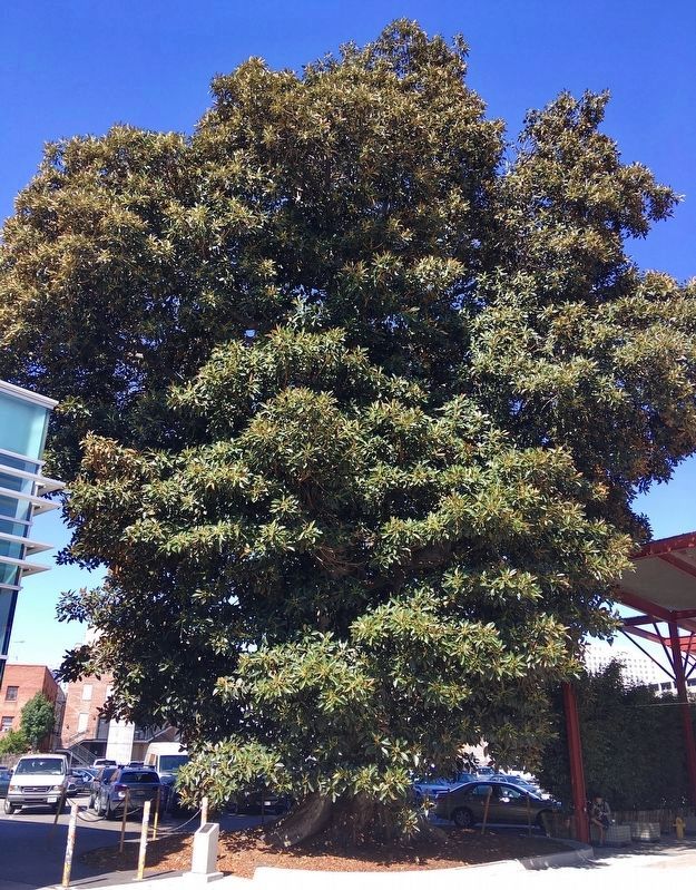
Ficus Macrophylla
(Moreton Bay Fig)
planted circa 1920.
Declared 2008,
Historic-Cultural
Monument No. 920,
Cultural Heritage Commission, City of Los Angeles. — — Map (db m183767) HM
Birth of the Atomic
Atomic Cafe is popularly known in the cultural history of Little Tokyo as ground
zero of the 1970s and 1980s punk rock and Downtown LA Arts movements.
But dig deeper and you'll unearth a shared history of the . . . — — Map (db m227986) HM
Colonel (USAF) Ellison Shoji Onizuka
Astronaut/National Aeronautics and Space Administration, June 24, 1946 — January 28, 1986.
Colonel Onizuka was the first Japanese American astronaut selected to
participate in America's Space . . . — — Map (db m183925) HM
America is a continuing story of a breaking from
the past the departure from old homes to build a
new life.
The late 19th century boats bringing Japanese
immigrants to the United States carried a cargo of
ambition, industry and . . . — — Map (db m228046) HM
Los Angeles Hompa Hongwanji Buddhist Temple,
built 1924-26.
Declared
October 24, 1986
Historic-Cultural Monument No. 318
by the
City of Los Angeles
Cultural Heritage Commission,
Cultural Affairs Department.
(second marker:) . . . — — Map (db m231223) HM
Dedicated in honor of the Americans of Japanese heritage who gave their lives in the defense of our
Country and the freedom of other nations. May their sacrifice be honored and remembered forever.
To Forget will be Dishonor.
To Remember . . . — — Map (db m230719) WM
"Enemy Ears are Listening!"
The posters, with caricatures of the eavesdropping enemy triumvirate of Hitler, Hirohito and Mussolini, hung in millions of public places throughout North America.
It was World War II, and the . . . — — Map (db m227993) HM
As early as 1869, a Japanese guidebook,
based on reports from countrymen
who had tried their luck in California,
described the state's climate as mild
and its produce rich and varied. It
promised, "the person having no pennies
will become . . . — — Map (db m231218) HM
Sei Fujii was born in Yamaguchi Prefecture, Japan and
arrived in Los Angeles in 1903. An early graduate of
USC Law, he and colleague J. Marion Wright won a US
Supreme Court ruling to build the Japanese Hospital in
1929. Sei Fujii also challenged . . . — — Map (db m230723) HM
The World Peace Bell is an internationally recognized symbol of world peace. The bell is cast
from coins and medals donated by 103 countries and represents a common bond among the
nations of the world.
The World Peace Bell Association, . . . — — Map (db m220125) HM
The initial wave of Chinese immigration to California began in the mid-1800's. As their
Caucasian counterparts, the Chinese first came to prospect for gold, but their formidable
enthusiasm and energies were soon to be relegated to quasi-slave . . . — — Map (db m226868) HM
During World War II, before the mass incarceration of West Coast Japanese Americans, thousands of Japanese, German, and Italian immigrant leaders were confined without due process in U.S. detention and internment camps as suspected threats to . . . — — Map (db m222305) HM
This monument is the oldest surviving structure of Chinese settlement in the Los Angeles area. It illustrates the use of traditional ceremonies brought from China and honors the lives of 19th century Chinese Americans.
The Chinese Historical . . . — — Map (db m149116) HM
Between June 2005 and May 2006, over 174 burial sites of unknown
persons were discovered during the construction of the Metro Gold
Line Eastside Extension. They were part of the indigent cemetery or
"potter's field,” located at the eastern end of . . . — — Map (db m191169) HM
Established in 1877, Evergreen Cemetery is the oldest secular cemetery still operating
in Los Angeles and is the final resting place of many prominent Los Angeles citizens.
At its inception, Evergreen Cemetery dedicated land for a public . . . — — Map (db m149115) HM
In Sacred Memory
This memorial is reverently placed here by the Japanese American Community, under the auspices of the Southern California Burial and Memorial Committee, in memory of American soldiers of Japanese ancestry who fought, . . . — — Map (db m74081) HM WM
Presented to the people of Los Angeles by the Thai Community Development Center and the Thai Town Formation Committee, June 15, 2007, with funding from the Department of Public Works and the Redevelopment Agency of the City of Los Angeles. . . . — — Map (db m226381) HM
Pacoima means “Rushing Waters”, named by the first occupants of the land: the Gabrielino Native Americans.
Pacoima’s First Elementary School, 1888.
Pacoima’s First Railroad Station, 1888.
Pacoima Flood, 1891. . . . — — Map (db m175733) HM
In 1892 Southern California Fish Corp. was the first cannery in Los Angeles Harbor. In 1903 a technique of preparing and canning was developed to can sardines, mackerel, bluefin tuna, yellowfin tuna and albacore. In 1912 the first fresh fish market . . . — — Map (db m85153) HM
Between the 1890s and World War II, several thousand Japanese settled in San Pedro. Their community centered on fishing,
shellfish and canning enterprises. It had its own doctors, dentists, shops, social and athletic clubs and a newspaper. . . . — — Map (db m155641) HM
Panel 1:
Terminal Island Memorial
From the early 1900s until World War II, the fishing village of "Fish Harbor" on Terminal Island was a thriving community of 3,000 people – primarily Japanese immigrants and their U.S.-born . . . — — Map (db m72145) HM
White Point fountain is a relic of the one-time
White Point Sulphur Springs spa complex which
was built on the shore below the cliff. Made of
concrete, it stood at the center of the hot
springs building complex near the sea wall and
outdoor . . . — — Map (db m147327) HM
The land before you has witnessed 5,000 years of human history,
some still etched on the landscape. Once the food gathering land of
the Tongva, the grazing land of Spanish and Mexican ranchers, the
center of an abalone industry, the farmlands . . . — — Map (db m173907) HM
The Japanese in Crenshaw
Though it is mostly known as an African American community, Crenshaw was
also home to the largest Japanese American population in the United States
for decades, a population that lived and worked alongside . . . — — Map (db m220021) HM
A Place For All
Opened in 1958 by a group of Japanese restaurateurs, the Holiday Bowl was for 40 years a culinary and recreational nexus for Crenshaw's African American and Japanese populations, and just about anyone else who came . . . — — Map (db m208108) HM
Craftsman style.
Significant as the first
permanent headquarters for
the Young Korean Academy.
Built 1910. Declared 2023,
Historic-Cultural
Monument No. 1274,
Cultural Heritage Commission,
City of Los Angeles. — — Map (db m231682) HM
This house was residence to the wife and five children of Ahn Chang Ho (1878-1938),
Korean patriot, educator, social reformer and statesman. Ahn and his wife Helen were
the first Koreans to legally immigrate to America as a married couple. . . . — — Map (db m229279) HM
In April 1942, during World War II, more than
a thousand American men, women, and
children of Japanese ancestry in Venice,
Santa Monica, and Malibu reported to this
corner at Venice and Lincoln Boulevards.
They were allowed to bring with . . . — — Map (db m213114) HM WM
The collapse of China seemed imminent when President Franklin D. Roosevelt authorized, by secret executive order, the formation of the American Volunteer Group in April of 1941. It allowed the recruitment of one hundred pilots and two hundred . . . — — Map (db m205452) HM WM
Grace Nicholson, a noted collector and authority on American Indian and Asian Art and artifacts, supervised the design of her combination gallery and museum which was completed in 1929. It has been called an outstanding example of 1920s revival . . . — — Map (db m59818) HM
Dedicated to the memory of Yuen Kee Laundry and the early Chinese settlers of Pasadena, who helped build the railroads, labored on the citrus and grape farms, and established successful businesses. On November 6, 1885 a mob threw stones into the . . . — — Map (db m243589) HM
The Los Angeles County Fairgrounds was one of 15 temporary assembly centers established during World War II pursuant to Executive Order 9066, signed by President Franklin D. Roosevelt on February 19, 1942.
The U S. Army confined at this site . . . — — Map (db m165492) HM
This site was designated a Point of Historical Interest at a meeting in regular session on May 1, 1992 in Sacramento. It particularly honors Kumekichi Ishibashi, who built the first Japanese-American farmhouse in 1906. He was born in Japan and came . . . — — Map (db m31245) HM
George Freeth was born in Honolulu November 8, 1883 of royal Hawaiian and Irish ancestry. As a youngster he revived the lost Polynesian art of surfing while standing on a board. Henry H. Huntington was amazed at Freeths surfing and swimming . . . — — Map (db m93273) HM
On this centennial we honor over three thousand Chinese who helped build the Southern Pacific Railroad and the San Fernando Tunnel. Their labor gave California the first north-south railway, changing the state’s history. — — Map (db m133729) HM
The courageous work done on the San Fernando Tunnel culminated
in the Southern Pacific Railroad's extension to Southern California
in 1876. Thousands of immigrants from China were recruited to
work on this connection between San Francisco and . . . — — Map (db m234711) HM
Signal Hill was home to fruit, flower and vegetable farms beginning in the early 1900s. In addition to the backyard gardens of hill residents, land was leased by Japanese “truck farmers” who grew produce and flowers to sell commercially . . . — — Map (db m100452) HM
The Central Pacific Railroad later Southern Pacific,
neared the village of Arcola in the Alabama Colony
in 1872 and as it was being built mainly with Chinese
labor established near here a Chinese camp of 2,500
men. Leland Stanford named the . . . — — Map (db m147956) HM
This one-acre cemetery was created in 1872 by and for the 2,500 Chinese laborers who were building the Central Pacific, later named Southern Pacific, railroad south from Sacramento. A tiny town, mostly tents was established beside the tracks . . . — — Map (db m197261) HM
This spot was once the center of a thriving Chinese fishing village. Starting in the 1860s emigrants from the Kwantung province in China lived with their families and fished here. China Camp is the only surviving fishing village among many in the . . . — — Map (db m102477) HM
The Grace Quan is a reconstruction of a San Francisco Bay Shrimp junk. Between 1860 and 1910, these were the workhorse of the Bay Area's Chinese-owned dried shrimp industry. The Shrimp Junks closely resembled vessels from the fishermen's home . . . — — Map (db m102478) HM
There are two markers on this monument
One of the earliest, largest and most productive Chinese fishing villages in California, China Camp was in operation by 1870. The Chinese immigrants and their descendants introduced the use of . . . — — Map (db m143403) HM
In 1910, the Immigration Station was moved from the San Francisco waterfront to Angel Island. Like Ellis Island in New York, Angel Island offered an isolated location that could be tightly controlled. Unlike Ellis Island, Angel Island came to . . . — — Map (db m203482) HM
Fenced Outdoor Area
Chinese and Japanese men were only allowed outside in the fenced recreation yard. It was opened after breakfast and could be used until dinner time. Women had slightly more freedom and could walk the grounds when . . . — — Map (db m203351) HM
Steam Heat for the Station
The steam heat produced by large oil fired boilers in this building kept employees and detainees warm on chilly days. Steam was also piped to the commercial kitchen for cooking. The building also housed an . . . — — Map (db m203442) HM
Waiting for Freedom
These detention barracks were built for Chinese and Japanese men and women. Shortly after opening, all women were moved to the Administration Building. Because of the restrictive exclusion laws, Chinese immigrants were . . . — — Map (db m203354) HM
In 1979, local restaurant owner "Trader" Vic Bergeron donated this monument in recognition of the contributions of Chinese immigrants to America. Originally located at the site of the former Asiatic Dining Hall, it was relocated to this overlook in . . . — — Map (db m91809) HM
Marker One:
Examination, Treatment, and Quarantine
Any detainee found to have a contagious but treatable disease was sent to this hospital run by the Marine Hospital Service, the precursor to the Public Health Service. The facilities . . . — — Map (db m203546) HM
Family Life on the Island
A number of employee families lived at the station. Island life offered challenges and benefits – older children took the ferry to San Francisco to attend school, wives shopped at nearby Fort McDowell and husbands . . . — — Map (db m203433) HM
Marker One:
The Chinese Exclusion Act
In 1882, Congress passed the Chinese Exclusion Act. The only law to target immigrants of a specific race, it barred Chinese laborers from entering the United States.
To get around this unjust . . . — — Map (db m203541) HM
For most immigrants, the stay on Angel Island typically lasted two to three days. The Chinese Exclusion Act, however, barred the immigration of Chinese laborers to this country. As a result, Chinese immigrants were subject to a long, intense . . . — — Map (db m203357) HM
At this site – 34 Main St.
James Yeh Jau Liu
(1910 - 2003)
World Renowned Chinese Watercolorist
and
Tiburon’s Artist Laureate
Operated Han Syl Studio from 1967 to 2003
Over the 35 years of offering his paintings to . . . — — Map (db m69203) HM
Women’s and Children’s Dormitories
Women and children were separated from the men in their families and housed on the second floor of the Administration Building. During part of this time, World War I enemy aliens – German crewmen from . . . — — Map (db m203356) HM
Immigrants were led from the ferry into the Examination Room, where they waited to be registered, processed and given a barracks assignment. Medical examinations were also conducted. Immigrants, particularly those unfamiliar with Western medicine, . . . — — Map (db m203430) HM
Reflecting the racism of the time, segregation existed throughout the Immigration Station. European and other non-Asian immigrants slept, dined, exercised, and were hospitalized separately from “Asiatics” (Chinese and Japanese). Men and women were . . . — — Map (db m203353) HM
Opened in 1910, the Angel Island immigration station hospital had separate doors and stairways during the first few years of its operation. Identified as “European” and “Non-European,” the two entrances were meant to divide immigrants based on race. . . . — — Map (db m203566) HM
After a long ocean voyage, an immigrant’s first steps on U.S. soil was on a wharf leading to this Immigration Station. They were soon immersed in unfamiliar surroundings, a foreign language, new customs and an uncertain fate.
”It was a . . . — — Map (db m203484) HM
Center Panel:
Fencing Out Freedom
Although it is often compared to Ellis Island, Angel Island was not a place of welcome. Instead, it was used to keep immigrants, specifically those from China, out.
The US Immigration Station . . . — — Map (db m203307) HM
One of the earlier Gold Rush buildings, and one of the last adobe structures left, this general store was established and operated by the Chinese from 1851 until 1926.
Named after it’s original owners Mow Da Sun and his son, Sun Kow, this store . . . — — Map (db m46366) HM
(This monument is made up of three plaques. The first plaque is on the front.)
This monument is dedicated to the fifteen young men from Yawatahama, Japan who sailed 11,000 kilometers across the Pacific in a 15 meter wooden boat to realize . . . — — Map (db m64325) HM
This sturdy iron-front building may have been a lesson learned from the April 1906 earthquake. The Dispatch Democrat newspaper reported on August 17, 1906 that a "deep cellar is being dug for a new brick building." Henry Meyer, who had come . . . — — Map (db m96482) HM
This was one of 15 temporary detention camps established during World War II to incarcerate persons of Japanese ancestry, a majority of whom were American citizens, without specific charges or trial. From May to September 1942, 4669 residents of . . . — — Map (db m128365) HM
World War II Valor in the Pacific National Monument was established in 2008, in part to serve as a reminder of the grave injustices endured by Japanese Americans incarcerated at the Tule Lake Segregation Center. The Tule Lake Unit also preserves a . . . — — Map (db m87890) HM
On this site, Bridgeport's most sensational court trial occurred June 9th, 1891. Ah Quong Tai, a local Chinese businessman accused of the cannibalistic murder of Poker Tom, a well known Paiute Indian, appeared in court defended by two attorneys, . . . — — Map (db m37596) HM
The Early Days: 1860s to 1930s
Castro founded the town in 1863
Juan Bautista Castro, from an important California family, subdivided his rancho to establish a town. He was the first in the county to offer lots to attract . . . — — Map (db m63772) HM
From its founding, Castroville has been home to immigrants. They came from many countries to make better lives for themselves and their children. Then, as now, the immigrants primarily worked in the fields nearby.
Japanese immigrants wanted their . . . — — Map (db m63714) HM
Quock Mui was born at Point Lobos in 1859 (lower left). Her parents were Cantonese fishermen who sailed to California by seagoing junk in 1851. Point Lobos was a thriving multicultural community in the later 19th century. Quock Mui had an aptitude . . . — — Map (db m55144) HM
Portuguese whalers
From the California Gold Rush to nearly the turn of the century, Portuguese whalers launched boats from this beach and rowed them out into the bay to intercept whales migrating along the Monterey coastline. Once harpooned, . . . — — Map (db m55191) HM
This Monument pays tribute to the many diverse characters vital to the evolution of Cannery Row. Perched atop the rocky outcropping sits Nobel Prize winning author John Steinbeck, who immortalized Cannery Row with his novel of the same name. He is . . . — — Map (db m81813) HM
Filipinos were attracted in large numbers to California after the 1924 Immigration Act excluded Japanese, who had been the major part of the state’s agricultural labor force. By 1930, as many as 35,000 Pinoys – young, single, male Filipino . . . — — Map (db m55100) HM
While the majority of Monterey’s commercial fishermen in the 1930s were Sicilian, about 10 percent of the fleet were Japanese nationals, some of whom has been fishing the bay since 1900. These Issei – first generation Japanese – came as . . . — — Map (db m55101) HM
Thomas Cole, an English sawyer, built this home for his family in 1856. Used over time as a dwelling house, it became the headquarters for the local Nationalist Chinese Political Party in the early 1940’s. — — Map (db m63224) HM
This monument is dedicated to the 3,586 Monterey Bay Area residents of Japanese ancestry, most of whom were American citizens, temporarily confined in the Salinas Rodeo Grounds during World War II from April to July 1942. They were detained without . . . — — Map (db m165487) HM
The first Filipino Infantry Regiment was activated July 13, 1942 at the Salinas California Rodeo Grounds. The Second Filipino Infantry Regiment was activated November 22, 1942 at Fort Ord. Personnel were Filipinos living in the United States then . . . — — Map (db m28040) HM
Of the many gold rush imigrants, the Chinese were noted for their honest, sober and industrious characteristics. Each mining camp had its Chinatown and Grass Valley was second only to San Francisco’s. Former residents Duck Egg, Georgie Bow, Ah Louie . . . — — Map (db m45126) HM
In the race to build the western portion of the transcontinental railroad the Central Pacific Railroad recruited over ten thousand young men from China, creating a skilled and dependable workforce. Upon completion many of these workers, who had . . . — — Map (db m234582) HM
Beneath this plaque the first transcontinental railroad traversed the mighty Sierra Nevada range. The 1659 foot long summit tunnel took over 15 months of Chinese muscle and sweat to build. The Chinese painstakingly hand drilled, then blasted the . . . — — Map (db m95506) HM
History 1866 - Right here
Bam, bam, quarter turn; Bam, bam, quarter turn; Bam, bam, quarter turn; all day long, three shifts a day, day after day, week after week. Chinese workers pounded away at the solid granite. One worker held a star . . . — — Map (db m81878) HM
In the 1850’s, Chinese laborers, who were an essential part of the community, built the wall you see before you. Large natural stones were hand stacked for its construction. The wall extends five miles in either direction, however much of it has . . . — — Map (db m39829) HM
History
Things to do right here
"They were a great army laying siege to Nature in her strongest citadel." -- Beyond the Mississippi, 1869.
They worked sunrise to sunset, six days a week, 52 weeks a year. Had it not been for the . . . — — Map (db m129733) HM
In August 1850 Washington was the highest point on the South Yuba River at which gold had been discovered with over 1,000 miners. In 1870 the Chinese out numbered the white population. The last try to strike it rich was in the 1890’s.
Washington . . . — — Map (db m43685) HM
This grove of dawn redwood trees was planted by the Orange County Cemetery District as a memorial to the People of Chinese Heritage interred in the Anaheim Cemetery. This species of tree was thought to be extinct until they were rediscovered growing . . . — — Map (db m197717)
Built in 1935 and dedicated in 1936. First Buddhist Church in Orange County. In 1954 the Church was moved to Stanton then moved to present location in Anaheim in 1965. — — Map (db m146156) HM
Kyutaro Ishii, Japanese settler, came here in 1905 and by 1910 was farming 40 acres. Returned to Japan in 1912 to marry Sada. They built a home here in 1913. — — Map (db m59742) HM
Duke Kahanamoku, three time Olympic gold medalist swimmer, public servant, goodwill ambassador of the State of Hawaii, and considered by many to be the father of modern surfing. In the early 1920's, the Duke surfed under Huntington's Pier. In his . . . — — Map (db m51964) HM
So named because of its location on the Bloomer Ranch, it remains virtually unchanged since its original construction in 1864. The overwhelming task of construction was undertaken by the diligent, hard working efforts of a small band of Chinese . . . — — Map (db m93971) HM
Built in 1855 by Gordon. Early tenants included Gellespy & Co. Clothing and J. Harwood & Co. Tin and Hardware. Hop Sing operated a Chinese laundry here circa 1894 until his death in 1944. Purchased in 1897 by Henry Bosse, left to his daughters . . . — — Map (db m43699) HM
Auburn’s original joss house (dedicated February 1909) was located directly across Sacramento Street. After the August 25, 1921 fire that destroyed most of Chinatown, a building was erected here that later became home to the Ling Ying Association. . . . — — Map (db m43696) HM
Dr. Kenneth H. Fox crafted this statue from 1 mile of reinforced steel rebar and 35 cubic yards of concrete. The “Chinese Coolie” stands 22 feet high, is 33 feet long and weighs 70 tons.
This giant statue relocated to this historic . . . — — Map (db m81597) HM
Katsuichi and Tomo Tsuda of Hiroshima, Japan established the K. Tsuda General Merchandise in 1918. That original store was located at 135 Sacramento Street, about one block east of this location. The business continued to operate at that site until . . . — — Map (db m55649) HM
View of Cape Horn Promontory
North Fork American River Canyon
Dedicated to the memory of thousands of Chinese who worked for Charles Crocker on the Central Pacific Railroad. They were lowered over the face of Cape Horn Promontory in wicker . . . — — Map (db m14437) HM
In 1857, the Whitney’s arrival in Rocklin signaled the start of the Spring Valley Ranch. In the early 1900’s another important chapter of Rocklin’s agricultural history began with the arrival of Japanese and Spanish immigrants.
Both the . . . — — Map (db m243176) HM
In 1870 the Chinese community of Goodwin Township consisted of 184 dwellings housing 248 people. They were accepted and more welcome here than in other mining areas due to the respect of their leader, Ah Tye in the white and Chinese communities — — Map (db m56301) HM
610 entries matched your criteria. Entries 101 through 200 are listed above. ⊲ Previous 100 — Next 100 ⊳