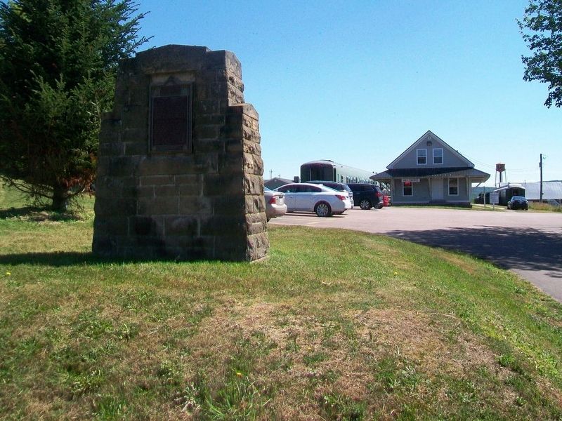
Near this town on 3rd September 1755, a detachment of Major Frye's troops, sent from Fort Cumberland to destroy Acadian settlements on the river and compel the people to surrender for deportation, was defeated by a French force under Charles . . . — — Map (db m106630) HM
Imagine 100 billion tons of water moving in and out of a bay twice every 25 hours. Powered by the gravitational pull of the moon and the sun, Fundy's tides are among the highest in the world and vary daily with the changing positions of these . . . — — Map (db m106860) HM
Although the flowerpot rocks come in a variety of different shapes and sizes, they have all been formed over millions of years by the dynamic movements of the earth and erosion from glaciers, tides, snow, ice and winds.
The story of the rocks . . . — — Map (db m106812) HM
This 18th century anchor
retrieved from the
Petitcodiac River
at Hopewell Cape in 1981
by Jack Weldon
Donated to the
Albert County Historical Society
by
his wife Grace
and sons James, Thomas and Dale
This plaque was given as a . . . — — Map (db m106638) HM
Designed by local architect Watson Reid, this magnificent Court House was built in 1904 partially on the same foundation as the original that was lost to fire earlier. The County Council reluctantly agreed to pay the whopping $4,495 price . . . — — Map (db m106750) HM
This small rectangle of land was part of a 738 acre tract originally granted to Robert Dickson Esq. and Jesse Converse on 8 May 1789. The original land grant encompassed all of present day Hopewell Cape. Later, after being acquired by the . . . — — Map (db m106770) HM
An original Shiretown building, the bottom floor of the Gaol was built with three cells and a gaol keeper's apartment. The second story was added around 1902 to provide better accommodations for the gaol keeper's family.
À l'origine un . . . — — Map (db m106769) HM
An original Shiretown building where all real estate and some other legal transactions were recorded. The records also include County births, marriages and livestock identifiers.
À l'origine un édifice du chef-lieu du comté, les . . . — — Map (db m106646) HM
An original Shiretown building where County citizens made their remittances. The pressed tin interior is a Victorian era addition that contributes to the building's pleasant ambiance.
À l'origine un édifice du . . . — — Map (db m106705) HM
As Hopewell Cape grew as the centre of County activity, the need for a Community Hall became apparent. This hall was built around 1870 to satisfy that need. Extensive refurbishment has returned it to a fully functioning centre of . . . — — Map (db m106749) HM
Viscount of Mickelham, Calgary and Hopewell
[Burgundy marker on monument]
Rt. Hon. Richard Bedford Bennett
1870-1947
Born at Hopewell Hill, New Brunswick, Bennett moved to Calgary in 1897. A member of the legislature of the North . . . — — Map (db m106707) HM
Built in the early 1900's, this building was converted into the Silver Jubilee Lodge and Library for the Hopewell Cape Boys Club. It later served as a branch of the local regional library system. It has been restored to its 1935 . . . — — Map (db m106641) HM
[English] In October 1869, the Saxby Gale was a powerful storm in which the combined force of wind and high tides destroyed homes and killed people and cattle all along the Bay of Fundy. In that storm the bridge over Sawmill Creek fell apart. . . . — — Map (db m198784) HM
A. R. McClelan was born in Riverside. At age twenty-three he entered politics and was elected to represent Albert County in the New Brunswick House of Assembly. He was a keen supporter of Confederation, and after Confederation in 1867 he became a . . . — — Map (db m106867) HM
[front]
In grateful remembrance of
all those who served
in past conflicts
In memory of
those who gave all
Boer War 1899-1902 • W.W.I 1914-1918
W.W.II 1939-1945 • Korean 1950-1953
At the going down of the sun
and in the morning, . . . — — Map (db m106865) WM
(English:) Historic salmon harvesting area of First Nations People and Loyalists. In the first half of the 20th century, the pool became internationally renowned as a sport fisherman's paradise.
(Français:) Zone . . . — — Map (db m138996) HM
Named on June 24, 1604 – the feast day of St. John the Baptist – during the expedition of Sieur de Monts and Samuel de Champlain the river originates in northern Maine and flows 673 kilometers emptying into the Bay of Fundy at Saint . . . — — Map (db m138997) HM
• Settled 1802 by William Orser United Empire Loyalist near where the Becaguimac Stream flows into the St. John River
• Originally known as Mouth of the Becaguimac
• Becaguimac — Abekaquimek — Maliseet for salmon bed
• . . . — — Map (db m138999) HM
English:This plaque commemorates the bicentenary of the 3rd Field Artillery Regiment (The Loyal Company), Royal Canadian Artillery, formed in Saint John, New Brunswick, on May 4, 1793 as “The Loyal Company of Artillery” . . . — — Map (db m139194) HM WM
(English:) Captured World War I German 77mm field gun manufactured by Krupp Armaments in Germany and introduced in 1896. Model: C96n/A Calibre: 77mm Maximum Range: 9186 yards (5 Miles) Weight: 1930 lbs. (8 75kg) Rate of Fire: 10 . . . — — Map (db m138994) HM WM
F. L. Atherton, Harness Maker, operated on the
town square for many years. “Fred,” the plaster
model horse, stood silently outside the shop
displaying the wares. In 1951 "Fred” was sold to
a museum in Maine. . . . — — Map (db m138908) HM
English:
Believed to have been built in the 1860’s for the Hon. Charles Connell, this Gothic Revival house was leased to Charles Bailey, a shoemaker and carpenter from the 1870’s through to his death in 1902. Bailey may have been . . . — — Map (db m140137) HM
(English:)
The Court House was built in two phases twenty years apart. The left half, completed in 1889, was designed by architect J. G. Fletcher, to house the Records Office. The upper half, with the cornerstone laid on July 31, . . . — — Map (db m137483) HM
(English:) The jail was built in 1901, with H. H. Mott as architect and R. Maxwell of Saint John as contractor. It was in use until 1993. Three hangings took place in the yard of this jail: George Gee in 1904, Thomas Cammack in . . . — — Map (db m138900) HM
(English:) Originally built as the Gibson House in 1873 by Alex Gibson and his son, John, it stood on Connell St. Following the 1881 fire that wiped out most of the buildings on Main St., the Gibsons built a new hotel at the . . . — — Map (db m138895) HM
Lumber merchant and politician, Charles Connell had this house
constructed circa 1840. Its pedimented front and freestanding columns
make it a fine example of the Greek Revival style. Such houses inspired
by classical temples are rare . . . — — Map (db m139149) HM
English:
This Classic Revival, 2 1/2 story house was built in 1896 for bank manager Mr. George White (1861-1922), and sold to Dr. J.F. Leigh Brown in 1920. Dr. Brown had just returned to Woodstock after being the Chief Medical . . . — — Map (db m139199) HM
(English:) The Prescott House was built circa 1840 by Robert Neilson. Dr. Alfred Prescott purchased the building in 1909 for use as a private hospital and it remained in use until closing in 1927. It served as apartments and . . . — — Map (db m138899) HM
English:
In 1905 Woodstock physician and surgeon Dr. William D. Rankin, who had been instrumental in establishing the first Carleton County Hospital three years previously, purchased this house from John Fisher, one of the owners . . . — — Map (db m139198) HM
English: Built c1905 for R. Norman Loane, this four square Edwardian house was designed by the same architect who built St. James United Church. Two provincial premiers have lived in this house: J. K. Flemming (premier from 1911 to . . . — — Map (db m139195) HM
Built circa 1868 this house is considered to be the best example of High Victorian architecture in Woodstock. The house was built on land that was originally part of the grounds of the Honourable Charles Connell House. It is possible that . . . — — Map (db m139106) HM
This Edwardian house, the home of Murray Hay,
was built in 1904. It has a decorative verandah
and a stained glass window in the dormer, facing
the scenic Meduxnekeag river. Mr. Hay was a well known businessman for many years. . . . — — Map (db m139183) HM
Built in 1839 for Hon. Charles Connell.
It represents the peak of classicism
in Woodstock architecture. It is Greek Revival,
its essence being the Greek Temple look.
Wood is used here to imitate stone.
Purchased by the Carleton County . . . — — Map (db m139176) HM
(English:) This house was built in 1856-1857 for Edwin Fisher, one of the owners of the Small and Fisher foundry. It is considered to belong to the "picturesque cottage style", a variation on gothic. The house is known as the "Judge . . . — — Map (db m138993) HM
L. P. Fisher (1821-1905) was the first mayor of
Woodstock, from 1856-1880. He was a lawyer and he
advocated free public education and technical training.
Due to his advocacy he left a free public hospital (his
private residence), a . . . — — Map (db m138868) HM
(English:) Constructed in 1913 in accordance with the wishes of the Lewis Peter Fisher estate, the L.P. Fisher Vocational School was erected to provide vocational training for the county's youth. It was deeded to the County and . . . — — Map (db m138990) HM
English:
This dwelling is a reminder of an era when small towns produced more of their own food. Built by local carpenter James McLean for his family in 1890, the lot included a barn where they kept the cows which supported a . . . — — Map (db m139577) HM
English: Built for the Hon. Charles Connell about 1855, this is probably the oldest surviving brick house in Woodstock. The mansard roof, which gives the house a Second Empire appearance, was added in 1880.
The house may have . . . — — Map (db m139193) HM
(English:) With "thirty new fish-barrels of my stock in trade", is how William T. Baird described his 1839 start in the drugstore business. Bought in Saint John, his stock traveled up the St. John River - from Fredericton to . . . — — Map (db m138898) HM
(English:) Built in 1908 to the Romanesque revival design of architect H.H. Mott and replacing an earlier wooden church on the same site, Saint James's red brick and sandstone exterior make it unique among Woodstock's churches. . . . — — Map (db m138992) HM
(English:) Completed in 1884, St. Luke's Anglican Church is the third Anglican Church to be erected on this site, its uncompleted predecessor having been destroyed by the Woodstock Fire of 1881. The first church erected on this site . . . — — Map (db m138897) HM
English:
Built in 1889-1890 in the Classic Revival style for Mr. James Wolverton (1856-1917) and his wife Eva (Hovey) this was originally operated as a boarding house. At the time it was said to have one of the finest bathrooms in . . . — — Map (db m139197) HM
English: The Women's Institute is a Canadian innovation, founded at the close of the 19th century as a discussion and action group for rural women. New Brunswick's WI was organized in 1911, at about the same time as Woodstock . . . — — Map (db m139196) HM
(English:) The early 1800s were a time of religious ferment in New Brunswick, and there are records of Baptist meeting houses in Woodstock as early as 1813. A Free Christian Baptist Church was organized here in 1834.
This Gothic . . . — — Map (db m138896) HM
In honour of
the men and women
of Canada who served
on land, sea, and air
overseas and at home
during World War II
1939-1945
Dedicated 8 May 2005
60th anniversary
V-E Day
Lest We Forget — — Map (db m138866) WM
English:
In 1984, the United States Congress designated Saint Croix Island an international historic site in recognition of the historical significance of the Island to the United States and Canada.
The majestic Saint Croix . . . — — Map (db m144503) HM
English:”Having found no place more suitable than this island... Sieur de Monts… allowed me to draw up the plan of our settlement."
Seventy-nine men, including noblemen, artisans, labourers, Catholic and . . . — — Map (db m144499) HM
English:
Sieur de Monts named the island Saint Croix Island, and Champlain recorded that: "The island is covered with fir, birch, maple, and oak. It is naturally well located... and is easy to fortify... We considered this the . . . — — Map (db m144498) HM
English:”It was difficult to know the country without having wintered there... Winter came upon us sooner than we had expected..."
Could you survive a winter on Saint Croix Island if...
• dangerous ice cut you . . . — — Map (db m144501) HM
English:
The precise mapping of Acadie in the 17th century was the work of one individual — Samuel de Champlain.
Between May 1604 and August 1605, travelling by barque, pinnace, canoe or on foot, Champlain surveyed and . . . — — Map (db m144500) HM
English:"In order to escape the cold and dreadful winter we experienced on Saint Croix Island, Sieur de Monts decided to move the settlement to another location. Having… found no port that was acceptable to us... we outfitted . . . — — Map (db m144502) HM
English:
Welcome On Saint Croix Island in 1604, French nobleman-courtier Pierre Dugua Sieur de Monts established a settlement. This outpost was the first attempt by the French at year-round colonization in the territory they . . . — — Map (db m144495) HM
English: Samuel de Champlain, explorer and geographer on Sieur de Monts' expedition, recorded in late June 1604 that:
”...we entered a river... wherein...we found two islands — one very small and near the western . . . — — Map (db m144496) HM
English:
The Micmac, Maliseet, and Passamaquoddy hunters and traders provided a commercial lifeline for Sieur de Monts' colony. Their first-hand knowledge of the territory allowed these entrepreneurs to control the supply of furs. . . . — — Map (db m144497) HM
In 1881, a group of American businessmen (called themselves the Campobello Company) purchased most of Campobello Island. In an era of summer-long vacations and great summer resorts, the company hoped, by promoting Campobello's charms, to attract, . . . — — Map (db m25467) HM
On this site, in 1885, James Roosevelt, businessman and country gentleman of Hyde Park, New york, built the cottage shown below. The Cottage was intended to be a summer retreat for his wife, Sara Delano, and their son Franklin Delano Roosevelt. . . . — — Map (db m25456) HM
The Campobello hotels welcomed socializing between their guests and the summer cottage owners. Summer colonists and hotel guests exchanged visits and participated in hotel activities such as excursions aboard the company's small steamboats, field . . . — — Map (db m25462) HM
Owners of the Campobello Company hoped to enhance their one million-dollar investment by subdividing their land and selling the smaller lots to hotel guests, island residents, and others. Only a few of the lots were actually sold and built upon. . . . — — Map (db m25471) HM
English on left
What kind of house?
A blockhouse is a modest fortified building with a distinctive overhanging upper level. In 18th- and 19th-century North America, both Britain and the United States built many blockhouses for . . . — — Map (db m77366) HM
English: This elegant church marks the growth of Presbyterianism and the Kirk of Scotland in New Brunswick. Built in 1821-1824, the structure successfully combines the American meeting house form with the British Palladian style. The . . . — — Map (db m137515) HM
W.W.I
Anning, William • Bartlett, George Leonard • Boone, George • Cork, Alfred • Crichton, Clarence M. • Greenlaw, Ernest • Grimmer, Harold Mackie • Jack, Edward • Key, William James • Markee, Percy • McMullin, Herbert • MacQuoid, Charles Loren . . . — — Map (db m77394) WM
This marker consists of two side-by-side plaques, one in English and the other in French. English:
The West Point Blockhouse and a battery were erected by the townspeople of St. Andrews at the outbreak of the War of 1812-14 in anticipation . . . — — Map (db m77240) HM
English
Founded by Loyalists in 1783, St. Andrews is a fine and rare surviving example of a Canadian town whose plan and character clearly reflect its 18th-century origins. The town retains the four key elements of a British colonial . . . — — Map (db m77398) HM
English
From the Chiputneticook Lakes, the waters of the St. Croix River tumble through rolling Appalachian scenery to one of the most historic estuaries in Canada, at Passamaquoddy Bay. Here, French colonization in North America began . . . — — Map (db m77395) HM
To commemorate the men and women serving in the Canadian Arms Forces and to honour those who made the ultimate sacrifice while serving Canada and the people of Afghanistan. — — Map (db m77433) WM
Kingsbrae Garden welcomes on of the world’s oldest and rarest trees, Wollemia nobilis; the only one in Canada. An epic journey for a historic little tree, across 90 million years and 10,000 miles. from Wollemi National Park’s Blue Mountains . . . — — Map (db m77397) HM
English on left
Against the odds
Many blockhouses were built in North America, but few have survived. Why is this one still here? Throughout the 19th century the St. Andrews Blockhouse was used for storage and occasionally as a . . . — — Map (db m77241) HM
English on left
No hard feelings
Have a look across the St. Croix River to the land on the other side of Navy Island; that’s the United States you can see! When the War of 1812 broke out, the citizen of St. Andrews had little to . . . — — Map (db m77363) HM
English on left
St. Andrews’ citizens step up
In 1812, St. Andrews was a young town, founded not long before by Loyalists from New England fleeing the American Revolution. A modest fortification - Fort Tipperary - had been built in . . . — — Map (db m77362) HM
English on left
Welcome to St. Andrews Blockhouse National Historic Site, part of Parks Canada’s diverse and ever-growing system of national park, national historic sites and national marine conservation area.
Wartime building . . . — — Map (db m77361) HM
In the waters off New Brunswick you'll find magnificent creatures of the deep - among them, North Atlantic right whales, humpback whales and finback whales
In New Brunswick, we're proud to live along the beautiful shores of the Bay of Fundy, . . . — — Map (db m106917) HM
English
Built in 1885-1887, this building was constructed to house the post office, customs and internal revenue. Designed under federal chief architect Thomas Fuller, the structure is one of a series of building erected to establish a . . . — — Map (db m77238) HM
English on left
They came from homes still standing in Milltown and St. Stephens. They were joined by experienced textile workers from England, Scotland, America and French Canada. They included young women, recruited from small towns and . . . — — Map (db m77234) HM
Although visitors had been coming to the island since 1855, Campobello's summer trade did not really prosper until the 1880s - years of long summer vacations and great resorts. A group of Boston and New York businessmen bought most of the . . . — — Map (db m63639) HM
Friar's Head takes its name from the stone pillar or stack (photo 1) that rises from the beach directly below the observation deck. While occupying Eastport, the British navy was said to have used the stone pillar for target practice, . . . — — Map (db m63629) HM
About 1840, a canal connecting Johnson and South Bays was dug in North Lubec and a dam constructed there to harness tidal energy to power plaster mills. Gypsum (the raw product used to make plaster) and grindstones from the Maritimes were important . . . — — Map (db m54995) HM
Lubec's known history began at a Passamaquoddy Indian encampment at Mill Creek in what came to be called Seward's Neck (now North Lubec). French settlers later came to those shores in the early 1700s, but shortly afterward were driven away by the . . . — — Map (db m55023) HM
[English version]
Built in 1885, the Mulholland Point Lighthouse guided many small coasters and freighters taking the shorter and foul weather-protected route through the narrow passage between Campobello and Lubec. Steamships, carrying freight . . . — — Map (db m54894) HM
Built in 1885, the Mulholland Point Lighthouse (photo 1) served as a guide for the many small coasters and freighters taking the shorter and more foul weather-protected route through the Lubec Narrows. Steamships, such as the . . . — — Map (db m63593) HM
Two of the Campobello Company's founders, Alex S. Porter and Samuel Wells, and several of the luxury hotel visitors, including James Roosevelt and families by the name of Sturgis, Cochrane, Prince, and Pell purchased land and refurbished or . . . — — Map (db m63641) HM
During the years FDR summered on Campobello, the daughter of one of Campobello's summer colonists married Dexter P. Cooper, an eminent American engineer. Cooper studied the tremendous rise and fall of Passamaquoddy Bay's tides and became . . . — — Map (db m63611) HM
Passamaquoddy Bay takes its name from the Native American Passamaquoddy Tribe. The word means People of the Pollock-Spearing Place. The Passamaquoddy have a rich heritage, once occupying much of what is now eastern Maine and western New . . . — — Map (db m63617) HM
The Great Depression 1929-1941
The depression was world-wide. In the U.S., the banking system collapsed and 12.8 million people were unemployed. Hardest hit were youth, minorities, the elderly, and workers in the consumer durables industries. . . . — — Map (db m54783) HM
The Roosevelt Campobello International Park is a unique example of international cooperation - jointly administered, staffed, and funded by the peoples of Canada and the United States. Established by international treaty in 1964, the . . . — — Map (db m63591) HM
Mrs. Lyndon B. Johnson and Mrs. Lester B. Pearson Together opened the Roosevelt Campobello Park on the twenthieth day of August 1964 Lyndon Baines Johnson President of the United States of America and Lester Bowles Pearson Prime Minister of Canada . . . — — Map (db m25394) HM
This house of God has welcomed worshippers for one hundred years or more. In commemoration of this fact this plaque has been presented in 1967
Canada's Centennial
of Confederation Year
1867 - 1967 — — Map (db m54939) HM
To the Glory of God
and the memory of our
Immortal Dead
Howard Mallock • Lawson Searles
Those who served our King and Country
Alison Alexander • Ronald Anthony • Wesley Anthony • George Babcock • Lydie Brown • Manning Brown • Raye . . . — — Map (db m54938) HM
Formal opening of the Nova Scotia portion of the Trans Canada Highway from the New Brunswick border to terminals at Caribou and North Sydney, a distance of 279 miles, took place November 22, 1968, at this point; having been constructed as a joint . . . — — Map (db m106956) HM
English:
The Grand Dérangement
L’Acadie, established by France in 1604, was a strategically located and highly coveted colony. In 1713, it was handed over to England and renamed Nova Scotia. The foundation of Halifax, in 1749, . . . — — Map (db m80580) HM
English:
Because of the vicissitudes of war, the Acadians, pioneers of this country, were dispersed in 1755. The arrival of Alexis Landry at Ste. Anne de Bocage, soon after 1755, symbolizes the return of the Acadians to their beloved . . . — — Map (db m80579) HM
This collection of historic buildings creates a community representing an evolution of rural New Brunswick society from the Loyalists to the late Victorians.
Cette collection de bâtiments
historiques forme une . . . — — Map (db m230388) HM
English: Here, within sight of the farm where he was born and the river where he swam as a boy, stands a monument in honor of the memory and accomplishments of Buctouche’s most famous son Kenneth Colin Irving. Born March 14, 1899, he was one . . . — — Map (db m80581) HM
English:
This stone marks the site where K.C. Irving built his first service station in 1924 and where he sold Irving Primrose gasoline and Ford cars.
Français:
Cette pierre marque l’endroit où K.C. Irving a . . . — — Map (db m139896) HM
Français:
À l'automne 1767, les familles Gueguen, Arseneau, Hébert et Bourg reçoivent les premières concessions de terres accordées à des Acadiens après le Grand Dérangement.
En novembre, Cocagne devient la première communauté . . . — — Map (db m139701) HM
This Monument is dedicated by the Village of Rexton in grateful commemoration of 74 years (1925-1999) of continuous medical service provided to the people of Kent County by two physicians and surgeons; Dr. William Francis Kenney and his son, Dr. . . . — — Map (db m150498) HM
English: Edward Hannay, regarded as one of the shrewdest horse traders who ever lived, would never pass by a pedestrian. He would say: "He knows something that we don't know, so pick him up." Ned, as he was widely and more . . . — — Map (db m150505) HM
Connue à l'origine comme « the Yard », la communauté fut fondée en 1825 alors que John Jardine, un constructeur de navire reconnu et respecté, y construisit la première demeure. L'imposante maison se tient encore fièrement debout, rendant hommage au . . . — — Map (db m150502) HM
294 entries matched your criteria. The first 100 are listed above. Next 100 ⊳