On Courthouse Avenue at Courthouse Ave., on the left when traveling north on Courthouse Avenue.
Accomac Historic District has been registered as a Virginia Historic Landmark pursuant to the authority vested in the Virginia Historic Landmarks Commission Act of 1966. — — Map (db m7827) HM
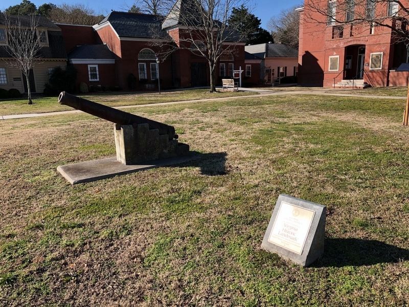
Near Alt. US 13 Front Street at Courthouse Ave., on the left when traveling north.
In honor of the men of Accomack County, Virginia who died in the service of our country in World War II, The Korean war and the Vietnam War. — — Map (db m7826) WM
On Alt. US 13 Front Street at Courthouse Ave., on the right when traveling north on Alt. US 13 Front Street.
Here stood the birthplace of Henry Alexander Wise (1806-1876), Governor of Virginia (1856-1860) and general in the Confederate States Army. A talented orator and debator in an age of great orators, Wise was elected to six terms in Congress. He . . . — — Map (db m7823) HM
On Courthouse Ave. (County Route 764) 0.1 miles north of Front Street (Alternate U.S. 13), on the right when traveling west.
Built in 1783 in one corner of the jailyard to serve as a residence for the jailer, the building served in this capacity for 41 years. Iron bars, oak batten doors and locks were added in 1842 when it was converted into a prison for debtors in . . . — — Map (db m162818) HM
On Front Street (Business U.S. 13) at Back Street (County Route T-1503), on the right when traveling north on Front Street.
who landed at Hunt's Point, Old Plantation Creek, on Easter Sunday 1776 and the same day preached the first Baptist sermon, “At the End of a Horsing Tree.” Opposition of the established church caused him to be deported; but kind . . . — — Map (db m71852) HM
On State Highway T-1502 at Back Street, on the right when traveling south on State Highway T-1502.
The Presbyterian Historical Society of Philadelphia, Pennsylvania erected this monument and dedicated it on May 11, 1908, at Makemie Park on Holder Creek where Francis Makemie is buried at his Pocomoke home. In 1984 the monument was moved here and . . . — — Map (db m7829) HM
On Alt. US 13 Front Street at T. C. Walker Drive, on the right when traveling north on Alt. US 13 Front Street.
The first high school for blacks in Accomack County was dedicated on this site in 1932. It was named in honor of Mary Nottingham Smith (1892-1951), a black educator who dedicated her life to educating all young people. In 1956, the school was . . . — — Map (db m7822) HM
On Atlantic Road (Virginia Route 679) 0.1 miles west of Arbuckle Neck Road, on the left when traveling north.
Fifty yards north on the hilltop stood Assawaman Church of the Anglican Accomack Parish, formed in 1663. The brick sanctuary was built after 1680 on land donated by Willam Taylor, a native of England who had settled on the Eastern Shore by 1637. . . . — — Map (db m205005) HM
On Lankford Highway (U.S. 13) at Savagetown Road (Virginia Route 603), on the right when traveling south on Lankford Highway.
The Occohannock Indians, one of the important Virginia Indian groups on the Eastern Shore, were composed of several tribes including the Onancock, Machipongo, Metomkin, Chincoteague, Kegotank, Pungoteague, Chesconessex, and Nandua. Capt. John Smith . . . — — Map (db m71855) HM
On Belle Haven Road (Virginia Route 178) at Merry Cat Lane (County Road T-601), on the right when traveling north on Belle Haven Road.
Site of Willis Store-House believed built circa 1835 by Dr. Robert Smith Trower, M.D. of "Melville" Plantation and used as medical office prior to Civil War. After the Civil War, was operated as "yellow-bodied store house" on main coach route by his . . . — — Map (db m165126) HM
On National Seashore Lane at Stephen Decatur Hwy (Virginia Route 617), on the right when traveling west on National Seashore Lane.
The historic Assateague Lighthouse is one of nearly 450 automated lighthouses maintained today by the U.S. Coast
Guard. First built by the U.S. Treasury Department in 1833 the
original 45-foot tower proved too low and dim to be effective. The . . . — — Map (db m205169) HM
On Main Street just west of Mumford Street, on the right when traveling west.
Boats and then bridges not only formed Chincoteague Island's lifelines to the mainland, they changed the island's way of life.
Beginning around 1881, after several years of irregular service by other boats, the steamboat Widgeon began . . . — — Map (db m165054) HM
Near Main Street at Post Office Street, on the right when traveling west.
First oysters, then bay and sea clams buoyed Chincoteague's economy.
During the second half of the 19th century, Chincoteague's seafood industry relied on the oyster. Each year, from September to April, island watermen gathered Chincoteague's . . . — — Map (db m165063) HM
Captain Timothy Hill House
Built circa 1800 is registered as a Virginia Historic Landmark and placed on the National Register of Historic Places by the United States Department of the Interior 2011 — — Map (db m59833) HM
On Main Street at Mumford Street, on the right when traveling west on Main Street.
Built in 1887, this Queen Anne style commercial building was originally the O.M. Jones Drug Store. In 1908, the building became Wallace "Tig" Jester's barber shop. For 75 years, Tig offered a shave, haircut, and gathering place for island men. In . . . — — Map (db m165065) HM
On Main Street just west of Post Office Street, on the right when traveling west.
1671
First land purchase from Gingo-Teague Indians recorded on April 1. Oral tradition says the Gingo-Teague called Chincoteague Island "the beautiful land across the water."
1680
Tenant farmer Robert Scott moves to Chincoteague . . . — — Map (db m165061) HM
On Main Street just west of Post Office Street, on the right when traveling west.
Historically, Chincoteague's western waterfront provided the town with its front door.
Many watermen sailed from docks along Chincoteague Channel, "goin' down da Bay" to return with cargoes of oysters, bay clams, mussels, and terrapins.
For . . . — — Map (db m165058) HM
Was established on this island on February 14, 1892 by Joseph B. Lynch, not far from this location. Doctrine is Justification and Sanctification. This building was erected in 1903. Since this beginning churches are established throughout the . . . — — Map (db m59834) HM
On National Seashore Lane at Stephen Decatur Hwy (Virginia Route 611), on the right when traveling west on National Seashore Lane.
Between 1922 and 1967. the white buildings visible in the distance marked the center of lifesaving activities on this end of Assateague Island. The twelve-man crew of the Assateague Beach Coast Guard Station stood ready to aid vessels in distress . . . — — Map (db m205179) HM
On Main Street just west of Post Office Street, on the right when traveling west.
Decoys carved by Chincoteague residents have evolved into a form of art that is highly respected and collected. But decoy carving itself originated in the long tradition of waterfowl hunting.
Ducks and geese have always been a part of life on . . . — — Map (db m165059) HM
On Main Street just west of Post Office Street, on the right when traveling west.
In 1890, fish made the Chincoteague news. Islanders caught so many fin fish that a reporter claimed the take was never so large, or the "fish so fine."
Fish became so plentiful in Chincoteague markets that a local islander wrote in 1922 that . . . — — Map (db m165060) HM
Keeping the Forest Full of Life
Wildlife have the same basic needs humans do—food, water, shelter, and space. To make sure those needs are met, refuge staff carefully manage forest areas. They remove some trees, plant others that are . . . — — Map (db m98827) HM
On Main Street just east of Mumford Street, on the right when traveling west.
Dedicated to the outstanding contribution to children's literature made by Marguerite Henry and Wesley Dennis in memory of Misty
Given to the Town of Chincoteague and the children of the world June 14, 2006 by the Misty of Chincoteague . . . — — Map (db m165040) HM
On Main Street at Mumford Street, on the right when traveling west on Main Street.
It started on a September Sunday in 1920. Fanned by a northwest wind, a fire in an ice cream parlor spread quickly to nearby wooden buildings. Volunteer fire fighters rushed to the scene, but their engine failed.
Before the flames died out, . . . — — Map (db m165057) HM
Near Beach Access Road north of Boat Ramp Access Road, on the right when traveling south.
Listed on the National Register of Historic Places, the Assateague Island Lighthouse is a striking landmark that attracts many visitors. At the same time, it is an active aid to navigation, operated by the U.S. Coast Guard, that gives ships a . . . — — Map (db m98824) HM
On Main Street just west of Mumford Street, on the right when traveling west.
The origin of this building is unknown, but was moved to this location to be used for a Western Union Telegraph office in 1896. Next door is the Boatman Bank and across the street stood the Atlantic Hotel.
Visitors, ferried from the mainland, . . . — — Map (db m165067) HM
On Main Street at Poplar Street, on the left when traveling west on Main Street.
In the early 20th century, without street lights or lighted homes to use as reference points, ferry boats from the Delmarva mainland would run aground as they approached Chincoteague Island.
Especially on dark nights, the Watson family would . . . — — Map (db m165071) HM
On Beach Access Road, 0.5 miles south of Wildlife Drive, on the right when traveling south.
Hardy, compact, and spirited—the horses on Assateague Island run freely over a range bounded by ocean and bay. Bands of mares and young led by protective stallions graze on marsh grasses, drink at freshwater ponds, and retreat into island . . . — — Map (db m98826) HM
On National Seashore Lane at Stephen Decatur Hwy (Virginia Route 611), on the right when traveling west on National Seashore Lane.
Since Colonial times, residents of Assateague and Chincoteague Islands have depended on fish and shellfish for food. By the time of the Civil War, islanders were exporting seafood to Northern cities. Toms Cove, or Chincoteaque, oysters . . . — — Map (db m205182) HM
On Main Street just west of Poplar Street, on the left when traveling west.
Built by Robert Watson and his son, David Robert Watson in the Chincoteague architectural style of the later 19th century. Annie Tatum married David Robert Watson and raised nine children in the house, all of whom lived and prospered on Chincoteague . . . — — Map (db m165073) HM
Near Beach Access Road north of Boat Ramp Access Road, on the right when traveling south.
In the 1800s, after the lighthouse was built, a small community grew up not far from here. By the early 1900s, about 225 lived in the village, which included a school, dry goods store, and a church. The residents harvested resources from the sea, . . . — — Map (db m98825) HM
On Main Street just east of Mumford Street, on the right when traveling west.
Storms continually reshape coastal islands and challenge resilience of residents. Chincoteague is no exception. A hurricane, the Great September Gust, "leaped upon the devoted island with a scream" in 1821. A blizzard in January 1922 rammed ice . . . — — Map (db m165049) HM
On U.S. 13 at County Line Road, on the right when traveling north on U.S. 13.
Five miles west is "Hedra Cottage", site of the home of Colonel Edmund Scarborough (Scarburgh), surveyor general of the colony. Beyond, at the end of Scarborough's Neck, was the village of the Occahannock Indians, the seat of Debedeavon, the . . . — — Map (db m7608) HM
On Ellis Street (County Road 3001) just west of School Street (State Route 3003), on the right when traveling east.
Building constructed in May 1956, on land donated by the late John A. Selby
Renovated into a community center — August 2004
This building is re-dedicated in memory of all persons whose hard work and devotion to their community helped . . . — — Map (db m165036) HM
On Junior Lane at Dockview Street, on the right when traveling west on Junior Lane.
Built in 1907 the buildings first floor was used for classrooms while the second floor was a meeting room for a fraternal lodge. Although the building served as a public school offering three years of high school classes, it was privately built and . . . — — Map (db m151385) HM
On Adams Crossing Road at US 13, on the right when traveling east on Adams Crossing Road.
This first play recorded in the United States was presented August 27, 1665. The Accomack County Court at Pungoteague heard charges against three men “for acting a play,” ordered inspection of costumes and script, but found the men . . . — — Map (db m7613) HM
On Adams Crossing Road at US 13, on the right when traveling east on Adams Crossing Road.
Two miles east, on Route 600, meets what is possibly the nation's oldest continuous Sunday School. Begun by William Elliott in his home in 1785, it was moved in 1816 to Burton's Chapel and in 1870 to the present church. — — Map (db m7615) HM
Near Market Street at College Avenue, on the right when traveling west.
As John Smith helped settle Jamestown, he admired the capabilities of the Native Americans' log canoes. Colonists adopted the log canoe and used iron tools to improve the design. Early canoes were made from a single log, but as the need arose for . . . — — Map (db m165105) HM
On Market Street just west of Ames Street, on the left when traveling west.
Ancient Free and Accepted Masons
Chartered November 1889
Met in this building
January 1, 1925 - January 13, 2010
Merged with Central Lodge #300
March 2010
— — Map (db m165099) HM
On South Street at Market Street, in the median on South Street.
Born June 2, 1840. Died June 13, 1876. His life was gentle and the elements So mixed in him that Nature might stand up And say in all the World. This was a man. — — Map (db m7678) HM
On Market Street near South Street, on the left when traveling west.
Known as the Scott Hall Cemetery, it dates from the late 18th century. Here will be found the grave of Commodore Whaley of the Maryland Navy who was killed in the Battle of the Barges in the Chesapeake Bay near the mouth of Onancock Creek in . . . — — Map (db m7681) HM
On West Street at Market Street, on the right when traveling south on West Street.
Built in 1854, Cokesbury Church is the oldest church building in Onancock. Today it serves the community as a venue for religious services, meetings, and concerts. Key events in its history include:
On Market Street near Mt. Prospect Ave., on the left.
Records of this mercantile business date back to 1842. This store also served the community as a bank and as a social and political meeting place. Deeded in 1970 to Association for the Preservation of Virginia Antiquities. — — Map (db m7675) HM
On Market Street near Crockett Ave., on the right when traveling west.
An eighteenth century mansion acquired in 1950 by the Eastern Shore of Virginia Historical Society as headquarters for the society. — — Map (db m7682) HM
Near Market Street at College Avenue, on the right when traveling west.
The Annie C, a five log canoe, is one of the largest canoes built on the Eastern Shore of Virginia. Designed as a work boat, she was built in 1904, by Horace Bundick in the Town of Sanford. After fastening five logs together with iron . . . — — Map (db m165115) HM
On US 13 at W. Main Street, on the left when traveling north on US 13.
Two miles west is Onancock, founded in 1680. A courthouse was then built and used for a few years. Militia barracks were there in the Revolution. From Onancock, Colonel John Cropper went to the aid of Commodore Whaley in the last naval action of the . . . — — Map (db m7673) HM
On Market Street, 0.1 miles west of West Street, on the right when traveling west.
Hard by this spot is the site of the home of Francis Makemie the founder of organized Presbyterianism in America who married Naomie Anderson of Accomack County Virginia and established one of his first licensed preaching places here in his Onancock . . . — — Map (db m165101) HM
Near Market Street at College Avenue, on the right when traveling west.
As originally build, the Annie C did not have an engine, although various engines were added in later years. As exhibited now, she was sail only and steered by a 7 foot tiller. This tiller was carved using traditional tools from a 10 inch by 4" . . . — — Map (db m165106) HM
Near Market Street at College Avenue, on the right when traveling west.
Only the largest log canoes had a cabin. This cabin had bunks and slept 3-4 persons. It had a small wood stove (installed later) for cooking and heat in the winter. A large portion of the cabin is taken up the centerboard truck and the mast . . . — — Map (db m165113) HM
Near Market Street at College Avenue, on the right when traveling west.
Looking at the port side of the Annie C you see "knees" every 16 to 18 inches. The original knees were made of cedar taken from the tree at limbs that formed the desired shape. The knees were fitted to the side of the boats and attached . . . — — Map (db m165111) HM
Near Market Street at College Avenue, on the right when traveling west.
Annie C has five logs. A center or Keel Log (24 inches wide and 4 inches thick), a port and starboard wind logs (about 20 inches wide), and a port and starboard garboard logs (about 19 inches wide) the thickness goes from about 4 inches at the . . . — — Map (db m165109) HM
On Market Street, 0.1 miles west of Mt. Prospect Avenue, on the left when traveling west.
Before railways and highways, the waterways of the Eastern Shore of Virginia were the primary mode of transportation of people and goods. Thus, the Town of Onancock, founded in 1680, grew and flourished. Despite the move to rail and then . . . — — Map (db m165102) HM
On County Line Road at County Line Road, on the right when traveling north on County Line Road.
Accomack County. Area 502 Square Miles. The Eastern Shore was first known as the Kingdom of Accomack, for an Indian tribe. Accomac was one of the original shires formed in 1634. The name was changed to Northampton in 1643. In . . . — — Map (db m7609) HM
On Cassatt Avenue (Virginia Route 316) just south of Mary Street, on the left when traveling south.
This curverd wooden bench is from the barber shop of Owen Crockett and Harry Miles. Located on Bennett Street, the barber shop operated from 1946 to 1983. For 1.00 you got a haircut and a piece of Bazooka Gum. On loan by Mr. Henry Nicholson. — — Map (db m165089) HM
On Bennett Street (Virginia Route 176) just west of Dunne Avenue, on the right when traveling west.
The Civil Air Patrol, a civilian organization established during World War II, operated Coastal Patrol Base Four about one mile west of here at the Parksley airport. Volunteers constructed runways and hangars, converted a farmhouse and chicken coop . . . — — Map (db m165077) HM
Near Dunne Avenue, 0.1 miles north of County Road T-1804, on the left when traveling north.
The Class X23 Box Car was adopted by the Pennsylvania R.R. as a standard box car in 1912. It was their first 40 footer standard box car and was also their first built with a steel underframed steel body with wood sheathing.
Most . . . — — Map (db m165094) HM
On Cassatt Avenue (Virginia Route 316) at Mary Street, on the right when traveling south on Cassatt Avenue.
Erected by Harmanson-West Camp Confederate Volunteers in memory of their dead comrades from Accomack and Northampton Counties
They died for the principles upon which all true republics are founded
They fought for conscience sake and . . . — — Map (db m165074) WM
On Dunne Avenue just north of County Road T-1804, on the left when traveling north.
Dining car #6061 was built for the Seaboard Airline Railroad in 1947 by Budd. It was used on the Seaboard Airline and Atlantic Coastline Railroads until Amtrack [sic] took over the passenger train service and renumbered it #8011. It stayed in . . . — — Map (db m165091) HM
On Dunne Avenue (Route 316) just north of Catherine Street, on the right when traveling north.
Jerry Clark Burkhead
Corporal
ACO, 1st BN, 9th, 3rd MARDIV
United States Marine Corps
19 Oct 1946 - 08 Feb 1968
Lee Mont, Virginia
Corporal Jerry . . . — — Map (db m165082) WM
Near Dunne Avenue, 0.1 miles north of County Road T-1804, on the left when traveling north.
The Fairfax River was built for the Richmond, Fredericksburg & Potomac Railroad in 1950 at the cost of $126,776.32 by the American Car and Foundry Company. It was leased to the Pullman Co. between March 1950 and October 1966. During this time it . . . — — Map (db m165095) HM
On Dunne Avenue just north of County Road T-1804, on the left when traveling north.
This maintenance-of-way tool shed was constructed soon after the N.Y.P.&N. Railroad was built from Pocomoke City, Maryland to Cape Charles, Virginia in 1884.
It was used by the section gang for the storage of tools and equipment . . . — — Map (db m165093) HM
On Dunne Avenue at County Road T-1804, on the right when traveling south on Dunne Avenue.
The Hopeton Passenger Station was donated to the Town of Parksley in 1988 by Nancy Shields for use as a museum. It has been relocated on the foundation of the 1906 Parksley Station and restored through the efforts of the Friends of the Eastern . . . — — Map (db m165088) HM
On Cassatt Avenue (Virginia Route 316) just north of Catherine Street, on the right when traveling north.
The railroad tracks that run through Parksley have operated continuously since 1884 when Alexander Cassatt, as president of the New York, Philadelphia and Norfolk Railroad, built the line connecting Pocomoke City, Maryland to Norfolk, Virginia, . . . — — Map (db m165090) HM
On Cassatt Avenue (Virginia Route 316) just north of Catherine Street, on the right when traveling north.
This corner portion of the brick foundation of Parksleys original 1884 station, a two story structure built by the NYP&N, was uncovered in 1988 when the museum's Hopeton Passenger Station was moved to this site.
The 1884 station . . . — — Map (db m165087) HM
Near Cassatt Avenue (Virginia Route 316) just north of Catherine Street, on the right when traveling north.
Since World War I, more than 90,000 American soldiers are unaccounted for.
This unoccupied seat is dedicated to the memory of those brave men and women and to the sacrifices each made in serving this country.
God Bless You. God Bless . . . — — Map (db m165085) WM
On St. George Circle just north of Bobtown Road (Virginia Route 178), on the right when traveling west.
St. George's Episcopal
Church
circa 1738
has been placed on the
National
Register of
Historic Places
by the United States
Department of the Interior — — Map (db m165125) HM
On Bannys Road at Factory Road, on the right when traveling south on Bannys Road.
At the south end of Main Ridge, the road becomes Banny's Road, which once led to Banty's Wharf. Banty's Wharf was named for Capt. John L. "Banty" who lived here with his wife, Mrs. Ellen Elizabeth Shores. For over 200 years the island's primary . . . — — Map (db m106987) HM
On Main Ridge Road north of Chambers Lane, on the left when traveling south.
At the end of Chambers Lane in an area once known as Chambers Wharf, site of the John Chambers Store. Lorraine's Sandwich Shop now occupies the site of the first Post Office, built in 1891.
The homes at 4411 and 4413 Chambers Lane were moved . . . — — Map (db m107002) HM
On Main Ridge Road just north of Hilda Crockett Lane.
The famous Chesapeake House occupies two old island homes. Hilda Crockett opened the business in 1944 in the Peter Crockett House with four guest rooms and a dining room on the porch. She expanded by purchasing the Nathan Rayfield House where the . . . — — Map (db m39952) HM
On Main Ridge Road at Chambers Road, on the left when traveling south on Main Ridge Road.
Peter Williams owned and operated the first store on this site. It was built by Charles Roland Parks and William Walters in the 1920's. It later operated as the Smith and Moore Market and was one of the first businesses to take credit cards when . . . — — Map (db m107006) HM
On West Ridge Road south of Wallace Road, on the left when traveling north.
The Doctor's Bungalow was built in 1961 by Grover Charmock. In 1964, Oscar Watson, Jr., MD moved in. It is thought to be the first house on Tangier to have two bathrooms. — — Map (db m106990) HM
On Main Ridge Road just south of Twin John Lane, on the right when traveling south.
Every week for more than thirty years Dr. David Buell Nichols made the voyage from Hummel Field in Middlesex County to Tangier Island in the Chesapeake Bay to administer health care to those in need. For an island with no resident doctor, the sound . . . — — Map (db m97803) HM
On Main Ridge Road at Wallace Road on Main Ridge Road.
The former Noble Dise Store was replaced with the island's first mobile home in 1959.
Manufactured homes remain popular today, but require a community-wide effort to move one into place after being delivered to the island by barge. — — Map (db m39950) HM
On Main Ridge Road at Long Bridge Road, on the right when traveling south on Main Ridge Road.
Fisherman's Corner Restaurant was featured in Southern Living Magazine (May, 2005) and is renowned for superb stuffed shrimp, irresistible crab bisque, and soft shell crab tidbits.
The owners, Irene Eskridge and Mary Stuart Parks rely . . . — — Map (db m107004) HM
On Main Ridge Road at Gabriel Lane, on the left when traveling south on Main Ridge Road.
In 1946, this building served as the first meeting place of the New Testament Congregation. It was vandalized several times during a rather contentious time in the island's religious history, a story reported in Newsweek, 1947.
Throughout the . . . — — Map (db m39682) HM
On Main Ridge Road near Thomas Road, on the left when traveling north.
In April 1814, during the war of 1812, British
forces commanded by Adm. Sir George Cockburn
established Fort Albion on the southern tip of
Tangier Island. The fort, which included barracks
a hospital, a church, parade grounds, and . . . — — Map (db m97720) HM
On Main Ridge Road just north of Janders Road, on the left when traveling south.
Dr. Charles Gladstone (1880 - 1968) was Tangier's longest serving doctor. He arrived in 1918 and was always on call. Monthly, he would go door-to-door to collect his flat fee of $1.50 but would accept whatever the family could afford. This monthly . . . — — Map (db m39684) HM
On Main Ridge Road south of Garman Road, on the right when traveling south.
Many people ask about the gravestones in front yards. While not unique to Tangier Island and seen throughout the Eastern Shore of Virginia, these are more obvious on such a small island. A number of reasons have been given for these burial sites: . . . — — Map (db m106973) HM
On Main Ridge Road at Thomas Road on Main Ridge Road.
This is the site of the island's only unsolved murder. Charles C. "Bud" Connorton, the Town Sergeant, was eating in an earlier building here when he was fatally shot through an open window. His assailant was never identified. — — Map (db m39555) HM
On West Ridge Road at Wallace Road, on the right when traveling north on West Ridge Road.
John Wallace (1855-1926) moved to Tangier in the 1870's. The J.E. Wallace & Co. Store was on the corner of Wallace Road and West Ridge, facing Wallace Road. It sold groceries, general merchandise, and coffins, as Wallace also worked as an . . . — — Map (db m106992) HM
On West Ridge Road at Joshua Thomas Lane, on the left when traveling north on West Ridge Road.
The Joshua Thomas House is long gone, replaced by the modern, chalet style house at the end of the lane. Joshua Thomas, the renowned "Parson of the Islands," lived here from 1799 until about 1825.
The Tangier Town Hall is a former US Navy . . . — — Map (db m106998) HM
On Canton Road just south of Canton Road, on the right when traveling south.
This cemetery is the possible site of Lee’s Bethel, the island’s first church. Next to the cemetery is the last of the island’s once plentiful garden farms.
Tangiermen were famous for growing melons, filling their boats until just the gunnels . . . — — Map (db m97873) HM
On Long Bridge Road at West Ridge Road, on the left when traveling east on Long Bridge Road.
Long Bridge, formerly called Mooney's Bridge, leads over the Main or Big Gut back to the section of Tangier known as "Meat Soup."
The house at the end of the bridge was the home of Norris Angle, who operated the Ambulance Boat. An airplane . . . — — Map (db m107001) HM
On Main Ridge Road at Parsonage Lane (Virginia Route T-1310) on Main Ridge Road.
The Methodist Parsonage, the home of the resident Reverend and his family, was erected in 1887. It is the only house on the island with a basement and the first to have an indoor bathroom.
It was the first house to have chain link fence, . . . — — Map (db m39949) HM
On Main Ridge Road at Dise Lane, on the left when traveling south on Main Ridge Road.
The New Testament Congregation was dedicated on Easter Sunday, 1957, and occupies the same site used for the Chautauqua tent in the 1920's.
The New Testament Mission House was once the home of teacher Alfred Benson (1893-1963) who taught at . . . — — Map (db m207732) HM
On Factory Road east of West Ridge Road, on the right when traveling east.
Factory Road was originally named New Road. It is said to have been built by Henry Frazier, a Black man, by hand, around the time of the Civil War. In 1919, George Lawson of Crisfield, MD in association with the Kegan, Grace & W. Shirt Makers Guild . . . — — Map (db m106988) HM
Near Parks Marina Lane west of Main Ridger Road, on the right when traveling west.
Owner Milton Parks has provided warm hospitality to boaters for decades. His marina serves local watermen, commercial and recreational boat traffic.
(captions)
Milton Parks on his scooter - Kaye, 2005
Oyster Buy Boats at Park's . . . — — Map (db m106963) HM
On Main Ridge Road at Garman Road, on the right when traveling south on Main Ridge Road.
The new house on the corner of Garman Road and Main Ridge is the site of the former Peter S. Crockett Store, later Daughtery & Ward, and then Haynie Grocery.
It had a two-story front porch and was featured in many old photographs. . . . — — Map (db m106972) HM
On Main Ridge Road at John Al Lane, on the right when traveling south on Main Ridge Road.
Spanky's Place, now an ice cream parlor with a 50's theme, is one of many businesses to occupy this site. These include Michael Thomas's store that sold stoves and propane, Jolly Jim's Restaurant, Nice's Place, and the Roadside Restaurant. It was . . . — — Map (db m106966) HM
The most prominent of the island's buildings, Swain Memorial United Methodist Church is easily recognized as the focal point of Tangier.
Built in 1899 on the site of the island's second church (1842), it is the center of the Tangier's religious . . . — — Map (db m39998) HM
Mailboat Harbor replaced Steamboat Harbor in the 1930’s as the age of steamboats came to a close. The harbor was first dredged in 1922, from the Eastern side. In 1967, the harbor was dredged through to the Western side of the island. This was a . . . — — Map (db m39554) HM
On Main Ridge Road at Twin John Lane, on the left when traveling south on Main Ridge Road.
This is the site of the former Lewis Crockett Store. It is also the site where in 1936, the Goodyear Blimp arrived with provisions to feed the islanders, who had been frozen in for over two months during a record freeze.
The Visitors Center . . . — — Map (db m106969) HM
The island was visited in 1608 by Captain John Smith, who gave it the name. A part was patented by Ambrose White in 1670. It was settled in 1686 by John Crockett and his sons’ families. In 1814, it was the headquarters of a British fleet ravaging . . . — — Map (db m46705) HM
12939 entries matched your criteria. The first 100 are listed above. Next 100 ⊳