By Keith L, April 19, 2008
East Arkdale Cemetery Marker
GEOGRAPHIC SORT Title Sort Marker Number Sort Marker Number Sort N Marker Number Sort T Publication Order Sort Publication Order Sort A Erected Year Sort Most Viewed Sort Most Recent-Interest Sort Most Recently Changed Sort SEE FAQ #33 FOR DESCRIPTIONS
On State Highway 21 east of 16th Avenue, on the left when traveling east.
On 18th Avenue, 0.3 miles north of Cumberland Avenue, on the right when traveling south.
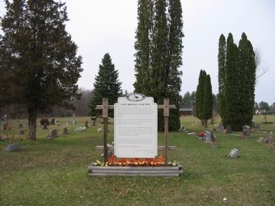
On Cypress Avenue west of 18th Avenue, on the left when traveling west.
On 18th Avenue at Cumberland Avenue, on the left when traveling south on 18th Avenue.
Near State Highway 13, 0.3 miles north of Czech Avenue, on the left when traveling north.
On Main Street (State Highway 13) at West Third Street, on the right when traveling north on Main Street.
On Bighorn Drive, 0.6 miles west of County Highway Z, on the left when traveling west.
Near County Road D near 10th Avenue, on the right when traveling east.
On Stuntz Avenue at 3rd Street East, on the right when traveling south on Stuntz Avenue.
On Lake Shore Drive East (U.S. 2) 0.1 miles west of 20th Avenue East, on the right when traveling west.
On Ellis Avenue (State Highway 13) north of 16th Street east, on the right when traveling north.
On Lake Shore Drive West (U.S. 2) at Turner Road, on the right when traveling west on Lake Shore Drive West.
Near Lake Shore Drive East (U.S. 2) 0.1 miles east of 15th Avenue East.
On Main Street West east of 3rd Avenue West, on the right when traveling east.
On East First Street (County Highway N) east of North Grant Street, on the left when traveling east.
Paid Advertisement
On State Highway 13, 2 miles north of State Highway 77, on the left when traveling north.
On East First Street (County Highway N) at North Grant Street on East First Street.
On Fort Road, 0.5 miles south of Ferry Dock, on the right when traveling south.
On Town Park Circle east of Big Bay Road, on the left when traveling east.
On Town Park Circle east of Big Bay Road.
On Chief Buffalo Lane west of Old Fort Road, on the left when traveling north.
On Bayfield - La Pointe Avenue at Colonel Woods Avenue (County Route H), on the left when traveling north on Bayfield - La Pointe Avenue. Reported permanently removed.
On Old Fort Road north of Capser Road, on the right when traveling south.
On State Highway 77 near Fayette Avenue.
Near POW/MIA Memorial Highway (State Highway 13) at Fayette Avenue, on the right when traveling north.
Near POW/MIA Memorial Highway (State Highway 13) at Fayette Avenue, on the right when traveling north.
On U.S. 2 at Old Odanah Road, on the left when traveling west on U.S. 2. Reported permanently removed.
On East La Salle Avenue just east of South 3rd Street, on the right when traveling east.
Near U.S. 53 at milepost 125,, 6.4 miles north of County Highway M, on the right when traveling north.
On 23rd Street, 0.1 miles north of 24th Avenue, on the right when traveling north.
Paid Advertisement
Near South Main Street (County Road SS) at Water Street, on the right when traveling north.
Near Stein Street east of South Main Street (County Road SS), on the right when traveling east.
Near Stein Street east of South Main Street (County Road SS), on the right when traveling east.
Near Stein Street east of South Main Street (County Highway SS), on the right when traveling east.
On 25 1/4 Avenue just east of 19 1/4 - 19 3/4 Street, on the left when traveling east.
Near U.S. 2, 1 mile west of Turner Road.
On South 1st Street at Wilson Street, on the left when traveling south on South 1st Street.
On Washington Avenue at North Front Street, on the left when traveling east on Washington Avenue.
On Front Street north of Rittenhouse Avenue, on the right when traveling north.
On South 1st Street at Wilson Street, on the right when traveling south on South 1st Street.
On Washington Avenue at Front Street, on the left when traveling east on Washington Avenue.
On State Highway 13 west of Siskiwit Falls Road, on the left when traveling east.
On Lenawee Road, 0.1 miles south of Wisconsin Highway 13, on the left when traveling south.
On Ino Road (Forest Road 236) at 407, on the left when traveling north on Ino Road.
Paid Advertisement
On State Highway 13, on the right when traveling west.
On State Highway 13 at Grand Avenue, on the right when traveling west on State Highway 13.
Near Little Sand Bay Road west of Allen Road, on the right when traveling west.
On Little Sand Bay Road, 0.5 miles west of Allen Road.
Near Little Sand Bay Road, 0.5 miles west of Allen Road.
On East Bayfield Street (State Highway 13) at Central Avenue, on the right when traveling south on East Bayfield Street.
On State Highway 13 north of Burlager/Bodin Road, on the right when traveling north.
Near 8th Avenue West at Lakeview Drive.
Near 6th Avenue West south of Lakeview Drive, on the left when traveling south.
Near 6th Avenue West south of Lakeview Drive, on the left when traveling south.
On East Bayfield Street (State Highway 13) at Central Avenue, on the right when traveling south on East Bayfield Street.
Near Riverside Drive north of West Allouez Avenue, on the left when traveling north.
On W. Mission Road west of South Webster Avenue, on the left when traveling west.
On Riverside drive (State Highway 57) north of Allouez Avenue, on the left when traveling south.
Near South Webster Avenue at Greene Avenue, on the right when traveling south. Reported permanently removed.
Near Riverside Drive (State Highway 57) at Lazarre Avenue.
Paid Advertisement
Near Riverside Drive (State Highway 57) south of Allouez Terrace. Reported missing.
On Webster Avenue at Greene Avenue, on the right when traveling south on Webster Avenue. Reported permanently removed.
Near Riverside Drive (State Highway 57) north of Allouez Avenue.
On South Webster Avenue north of Green Avenue, on the right when traveling south.
Near Riverside Drive south of Iroquois Avenue, on the right when traveling south.
Near Riverside Drive (State Highway 57) 0.3 miles north of West St Joseph Street.
On College Avenue, on the right when traveling east.
Near North Broadway Street (State Highway 57), on the left when traveling south.
On South Wisconsin Street at George Street (County Route G), on the right when traveling north on South Wisconsin Street.
On North Front Street south of James Street, on the right when traveling south.
Near William Street west of North Front Street.
On 505 3rd Street north of Marsh Street, on the right.
On Broadway (State Highway 57) at James Street, on the right when traveling north on Broadway.
On North Broadway (State Highway 57) north of Cass Street, on the left when traveling north.
Paid Advertisement
On Wisconsin Avenue (County Highway KB / T) north of Kellner Street, on the right when traveling north. Reported missing.
Near Benderville Road, 0.2 miles north of Nicolet Drive (County Highway A), on the left when traveling north.
On South Washington Street north of Crooks Street, on the right when traveling south.
On Chicago Street west of South Adams Street.
On Main Street (U.S. 141) south of Brook Street, on the right when traveling north.
On East Walnut Street (State Highway 29) at South Washington Street, on the right when traveling east on East Walnut Street.
On Cherry Street, on the right when traveling west.
On South Jefferson, on the right when traveling south.
On South Jefferson Street at Doty Street, on the right when traveling south on South Jefferson Street.
On Packer Drive, on the right when traveling west.
Near Dousman Street (U.S. 141) east of North Broadway Street (U.S. 141).
On North Baird Street at Cherry Street, on the right when traveling north on North Baird Street.
On Washington Street at Cherry Street, on the right when traveling north on Washington Street.
On Pine Street at North Jackson Street, on the right when traveling east on Pine Street.
On South Jefferson Street south of East Walnut Street (Wisconsin Highway 29), on the right when traveling north.
Paid Advertisement
On N. Baird St., on the right when traveling north.
On North Irwin Avenue south of University Avenue (Wisconsin Highway 54), on the right when traveling south.
On North Adams Street at East Walnut Street (Wisconsin Highway 29), on the left when traveling south on North Adams Street.
Near North Washington Street south of Mains Street (U.S. 141), on the right when traveling south.
3245 entries matched your criteria. The first 100 are listed above.
Next 100 ⊳