Sarasota in Sarasota County, Florida — The American South (South Atlantic)
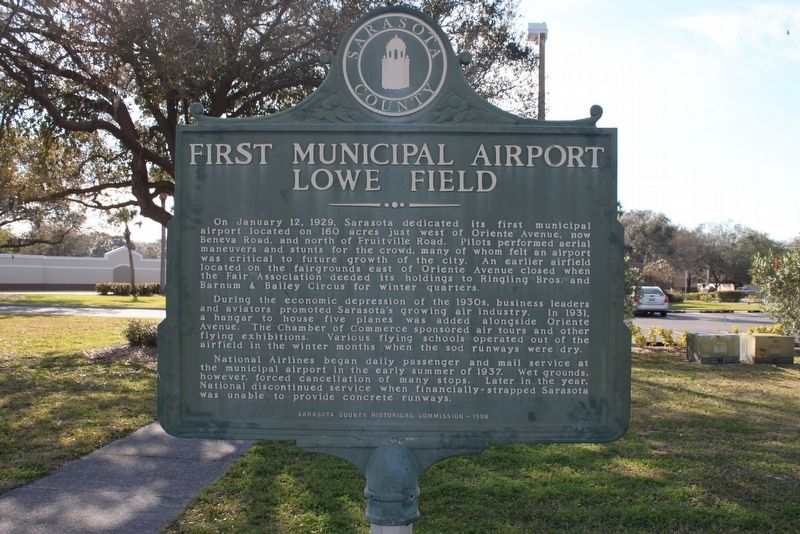
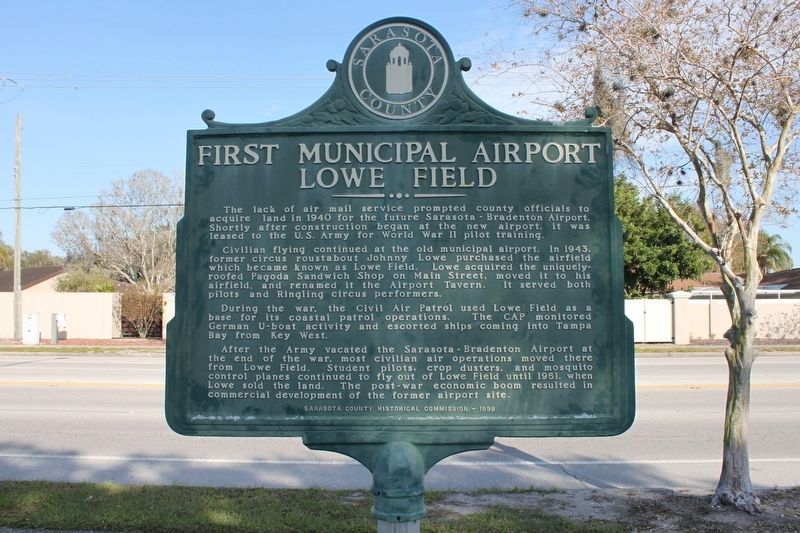
First Municipal Airport Lowe Field
On January 12, 1929, Sarasota dedicated its first municipal airport located on 160 acres just west of Oriente Avenue, now Beneva Road, and north of Fruitville Rd. Pilots performed aerial maneuvers and stunts for the crowd, many of whom felt an airport was critical to future growth of the city. An earlier airfield located on the fairgrounds east of Oriente Avenue closed when the Fair Association deeded its holdings to Ringling Bros. and Barnum & Bailey Circus for winter quarters.
During the economic depression of the 1930s, business leaders and aviators promoted Sarasota's growing air industry. in 1931, a hanger to house five planes was added alongside Oriente Avenue. The Chamber of Commerce sponsored air tours and other flying exhibitions. Various flying schools operated out of the airfield in the winter months when the sod runways were dry.
National Airlines began daily passenger and mail service at the municipal airport in the early summer of 1937. Wet grounds, however, forced cancellation of many stops. Later in the year, National discontinued service when financially-strapped Sarasota was unable to provide concrete runways.
Reverse:
The lack of air mail service prompted county officials to acquire land in 1940 for the future Sarasota-Bradenton Airport. Shortly after construction began at the new airport. It was leased to the U.S. Army for World War II pilot training.
Civilian flying continued at the old municipal airport. In 1943, former circus roustabout Johnny Lowe purchased the airfield which became known as Lowe Field. Lowe acquired the uniquely-roofed Pagoda Sandwich Shop on Main Street, moved it to his airfield, and renamed it the Airport Tavern. It served both pilots and Ringling circus performers.
During the war, the Civil Air Patrol used Lowe Field as a base for its coastal patrol operations. The CAP monitored German U-Boat activity and escorted ships coming into Tampa Bay from Key West.
After the Army vacated the Sarasota-Bradenton Airport at the end of the war, most civilian air operations moved there from Lowe Field. Student pilots, crop dusters and mosquito control planes continued to fly out of Lowe Field until 1961, when Lowe sold the land. The post-war economic boom resulted in commercial development of the former airport site.
Erected 1998 by Sarasota County Historical Commission.
Topics. This historical marker is listed in these topic lists: Air & Space • War, World II. A significant historical date for this entry is January 12, 1929.
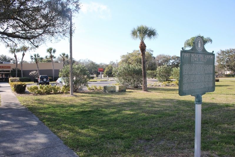
Location. Marker is missing. It was located near 27° 20.884′ N, 82° 29.846′ W. Marker was in Sarasota, Florida, in Sarasota County. Marker was at the intersection of North Beneva Road and 12th Street, on the left when traveling north on North Beneva Road. Touch for map. Marker was at or near this postal address: 1199 North Beneva Road, Sarasota FL 34232, United States of America. Touch for directions.
Other nearby markers. At least 8 other markers are within 3 miles of this location, measured as the crow flies. Winter Quarters (within shouting distance of this marker); Kensington Park (approx. 0.6 miles away); Atlantic Coast Line Railroad Station (approx. 1.9 miles away); World Trade Center Memorial (approx. 2.1 miles away); Payne Park (approx. 2.2 miles away); Oaklands/Woodlawn Cemetery (approx. 2.2 miles away); Sarasota County Courthouse (approx. 2.2 miles away); John Hamilton Gillespie (approx. 2.2 miles away). Touch for a list and map of all markers in Sarasota.
Credits. This page was last revised on March 20, 2023. It was originally submitted on January 27, 2017, by Tim Fillmon of Webster, Florida. This page has been viewed 336 times since then and 43 times this year. Last updated on March 19, 2023, by Dave W of Co, Colorado. Photos: 1, 2, 3. submitted on January 27, 2017, by Tim Fillmon of Webster, Florida. 4. submitted on March 19, 2023, by Dave W of Co, Colorado. • Bernard Fisher was the editor who published this page.


