Downtown in Louisville in Jefferson County, Kentucky — The American South (East South Central)
The Columbia Building
— Bourbon District Historic Site 401 west —
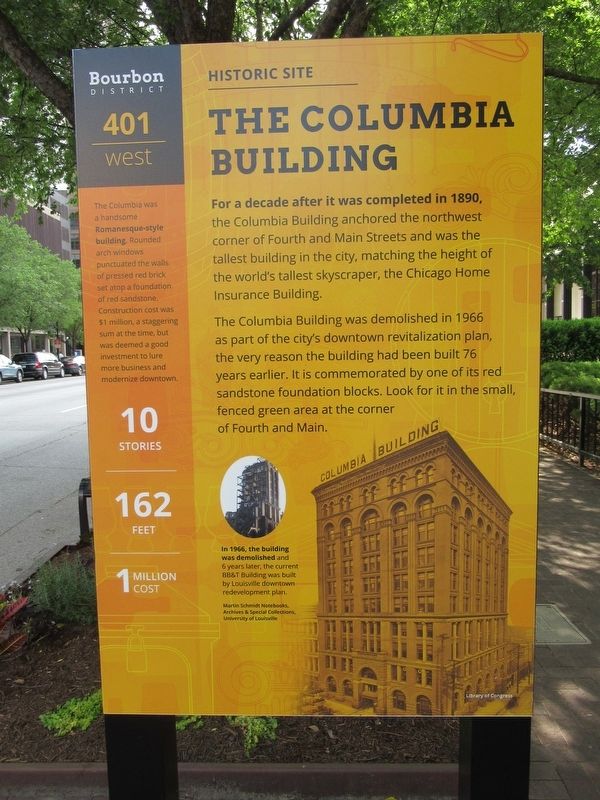
For a decade after it was completed in 1890, the Columbia Building anchored the northwest corner of Fourth and Main Streets and was the tallest building in the city, matching the height of the world's tallest skyscraper, the Chicago Home Insurance Building.
The Columbia Building was demolished in 1966 as part of the city s downtown revitalization plan, the very reason the building had been built 76 years earlier. It is commemorated by one of its red sandstone foundation blocks. Look for it in the small fenced green area at the corner of Fourth and Main.
The Columbia was a handsome Romanesque-style building. Rounded arch windows punctuated the walls of pressed red brick set atop a foundation of red sandstone. Construction cost was $1 million, a staggering sum at the time, but was deemed a good investment to lure more business and modernize downtown.
In 1966, the building was demolished and 6 years later, the current BB&T Building was built by Louisville downtown redevelopment plan.
Martin Schmidt Notebooks, Archives & Special Collections, University of Louisville
( back )
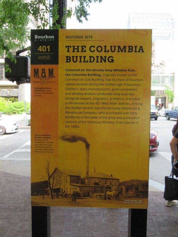
Centered on the already busy Whiskey Row, the Columbia Building, originally known as the Commercial Club Building, had its share of bourbon-related tenants during the Golden Age of bourbon. Distillers, stave manufacturers, grain companies, and whiskey brokers conducted daily business alongside lawyers, engineers, architects, and other professionals at the 401 West Main address. Among the distiller tenants was the Kentucky Distilleries & Warehouse Company, who purchased over forty distilleries in the wake of the price and production controls of the infamous Whiskey Trust scandal in the 1880s.
Mattingly & Moore Distillery Co. was a tenant in the Columbia Building.
The J.B. Wathen & Brothers Distillery, located at 26th & Broadway in Louisville, was one of the many distilleries bought by Kentucky Distilleries & Warehouse Company.
Topics. This historical marker is listed in this topic list: Notable Buildings.
Location. 38° 15.401′ N, 85° 45.409′ W. Marker is in Louisville, Kentucky, in Jefferson County. It is in Downtown. Marker is at the intersection of W Main Street and N. Fourth Street, on the right when traveling west on W Main Street. Touch for map. Marker is at or near this postal address: 401 W Main Street, Louisville KY 40201, United States of America. Touch for directions.
Other nearby markers. At least 8 other markers are within walking distance of this marker. Thelma French Schneider (a few steps from this marker); Evan Williams (a few steps from this marker); Bourbon District (within shouting distance of this marker); Kentucky Fugitives to Canada (within shouting distance of this marker); Kentucky Distillers' Association (within shouting distance of this marker); D.X. Murphy & Bro., Architects (within shouting distance of this marker); Bank of Louisville (about 300 feet away, measured in a direct line); Al J. Schneider (about 400 feet away). Touch for a list and map of all markers in Louisville.
Also see . . . Columbia Building (Louisville, Kentucky) on Wikipedia. (Submitted on June 14, 2017, by Michael Herrick of Southbury, Connecticut.)
Credits. This page was last revised on February 12, 2023. It was originally submitted on June 14, 2017, by Michael Herrick of Southbury, Connecticut. This page has been viewed 360 times since then and 44 times this year. Last updated on August 24, 2022, by Chris Gerstle of Louisville, Kentucky. Photos: 1, 2. submitted on June 14, 2017, by Michael Herrick of Southbury, Connecticut. • Devry Becker Jones was the editor who published this page.

