Derwood in Montgomery County, Maryland — The American Northeast (Mid-Atlantic)
Newmantown
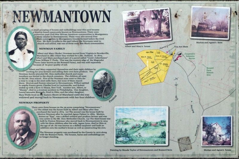
A small grouping of houses and outbuildings near this spot became a kinship-based community known as Newmantown. There were numerous post Civil-War African American communities in Montgomery County similar to Newmantown. There were also several Free Black communities in Montgomery County formed before the Civil, War. Mt Zion (3 miles to the east) where the Newmans went to church and school, was one of these early Free Black communities.
Newman Family
Albert and Mary (Burke) Newman moved from Virginia to Brookeville, Maryland in 1861 where they worked for a Mr. Holland. In 1879, Albert and Mary purchased part of a parcel called “Cook's Inheritance”, from William T. Poole. This was the western edge of the Magruder Farm Later known as the Bussard Farm), and was sold separately because of its poor quality of soil.
Albert and Mary supported themselves and their eight children by working for area farmers and selling their own farm produce. The Newman family attended Mt. Zion Methodist church and many members are buried in the church cemetery. The children all went to Mt. Zion school. Five of the Newman sons went to Ohio for a time to work in steel mills there, but none of them stayed there. Morton and Fenton returned to Newmantown, Wilbert settled in nearby Emory Grove, Charles lived in Laytonsville, and Robert ended up with a farm in Ithaca New York. Another son, Albert, or “Manny”, died in a streetcar accident in Philadelphia. One daughter, Laura Lancaster Kennedy, lived in Ohio, and the other daughter, Mary Webb lived on the Eastern Shore of Maryland until she was widowed and moved back to Newmantown with her four children.
Newman Property
There were three houses on the 39 acres comprising “Newmantown.” (1) The oldest was the house built by Albert and Mary after they purchased the land in 1879. (2) The second was the house built by Morton Newman after he married Agnes Palmer in 1885. Morton, known as “Epp”, was a skilled orchard and produce farmer and was very active in the Mt. Zion Methodist Church. (3) The third house was built by Fenton Newman who moved back to Newmantown in 1914 with his three children after his wife, Agnes Lynn, died in Ohio at the age of 28. He was known as a skilled carpenter and built an addition onto his mother's house as well as constructing his own.
The Newman property was purchased by the County in 1972 along with the Bussard Farm. The houses, barns, and outbuildings were no longer standing.
Topics. This historical marker is listed in these topic lists: African Americans • Agriculture • Notable Places. A significant historical year for this entry is 1861.
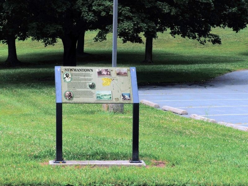
Location. This marker has been replaced by another marker nearby. It was located near 39° 9.891′ N, 77° 8.062′ W. Marker was in Derwood, Maryland, in Montgomery County. Marker could be reached from Rock Creek Park Road, 0.6 miles north of Muncaster Road, on the left when traveling north. The Marker is in the Agricultural History Farm Park near the MNCPPC Activity Center at 18410 Muncaster Road. Touch for map. Marker was in this post office area: Derwood MD 20855, United States of America. Touch for directions.
Other nearby markers. At least 8 other markers are within walking distance of this location. A different marker also named Newmantown (here, next to this marker); Sustaining a Family (here, next to this marker); Carriage Shed (approx. 0.2 miles away); Granary (approx. 0.2 miles away); Mike Roth (approx. 0.2 miles away); Corn Crib (approx. 0.2 miles away); Childhood and Slavery in Maryland (approx. 0.2 miles away); Bank Barn (approx. 0.2 miles away). Touch for a list and map of all markers in Derwood.
Related marker. Click here for another marker that is related to this marker. This marker has been replaced by the linked marker.
Credits. This page was last revised on May 14, 2022. It was originally submitted on July 7, 2017, by Allen C. Browne of Silver Spring, Maryland. This page has been viewed 2,749 times since then and 67 times this year. Photos: 1, 2. submitted on July 7, 2017, by Allen C. Browne of Silver Spring, Maryland. • Bill Pfingsten was the editor who published this page.

