Franconia in Grafton County, New Hampshire — The American Northeast (New England)
A Delicate Balance
(Captions)
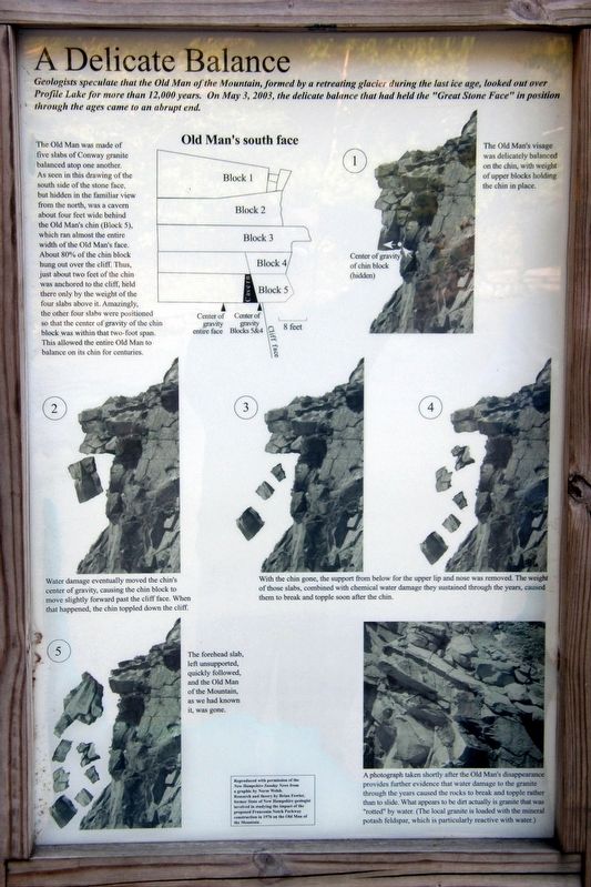
The Old Man was made of five slabs of Conway granite balanced one atop another. As shown in this drawing of the south side of the stone face, but hidden in the familiar view from the north, was a cavern about four feet wide behind the Old Man’s chin (Block 5). which ran almost the entire width of the Old man’s face. About 80% of the chin block hung out over the cliff. Thus, just about two feet of the chin was anchored to the cliff, held there only by the weight of the four slabs above it. Amazingly, the other four slabs were positioned so that the center of gravity of the chin block was within that two foot span. This allowed the Old Man to balance on its chin for centuries.
1 – The Old Man’s visage was delicately balanced on the chin, with weight of upper blocks holding the chin in place.
2 – Water damage eventually moved the chin’s center of gravity, causing the chin block to move slightly forward past the cliff face. When this happened, the chin toppled down the cliff.
3 & 4 – With the chin gone, the support from below for the upper lip and nose was removed. The weight of those slabs, combined with chemical water damage they sustained through the years, caused them to break and topple soon after the chin.
5 – The forehead slab, left unsupported, quickly followed and the Old Man of the Mountain, as we had known it, was gone.
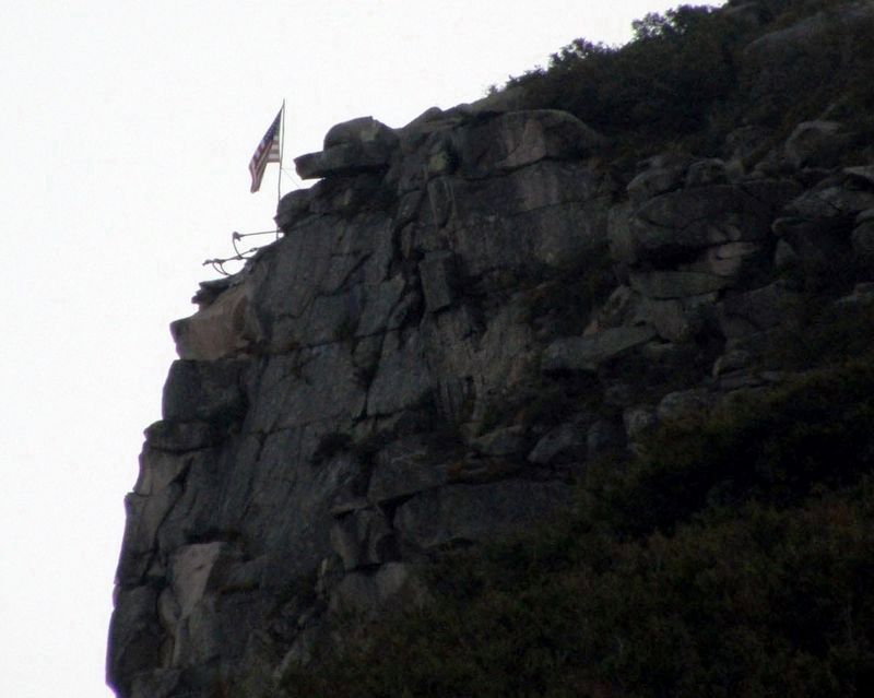
A photograph taken shortly after the Old Man’s disappearance provides further evidence that water damage to the granite through the years caused the rocks to break and tumble rather than to slide. What appears to be dirt actually is granite that was “rooted” by water. (The local granite is loaded with the mineral potash feldspar, which is particularly reactive with water.)
Topics. This historical marker is listed in this topic list: Landmarks. A significant historical date for this entry is May 3, 2003.
Location. 44° 9.949′ N, 71° 40.733′ W. Marker is in Franconia, New Hampshire, in Grafton County. Marker can be reached from Interstate 93. The marker is in the Old Man of the Mountain Historic Site in Franconia Notch State Park. Touch for map. Marker is in this post office area: Franconia NH 03580, United States of America. Touch for directions.
Other nearby markers. At least 8 other markers are within walking distance of this marker. Franconia Notch (here, next to this marker); Why is it called A NOTCH? (here, next to this marker); The Old Man of the Mountain (here, next to this marker); Viewing the Old Man (a few steps from this marker); Preserving a Fragile Formation (a few steps from this marker); Profile Lake (within shouting distance of this marker); Landslides (within shouting distance of this marker); Eagle Cliff (within shouting distance of this marker). Touch for a list and map of all markers in Franconia.
Credits. This page was last revised on January 16, 2022. It was originally submitted on July 24, 2017, by Larry Gertner of New York, New York. This page has been viewed 346 times since then and 23 times this year. Last updated on January 15, 2022, by Carl Gordon Moore Jr. of North East, Maryland. Photos: 1, 2, 3, 4. submitted on July 24, 2017, by Larry Gertner of New York, New York. • J. Makali Bruton was the editor who published this page.


