Cape Girardeau in Cape Girardeau County, Missouri — The American Midwest (Upper Plains)
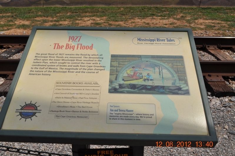
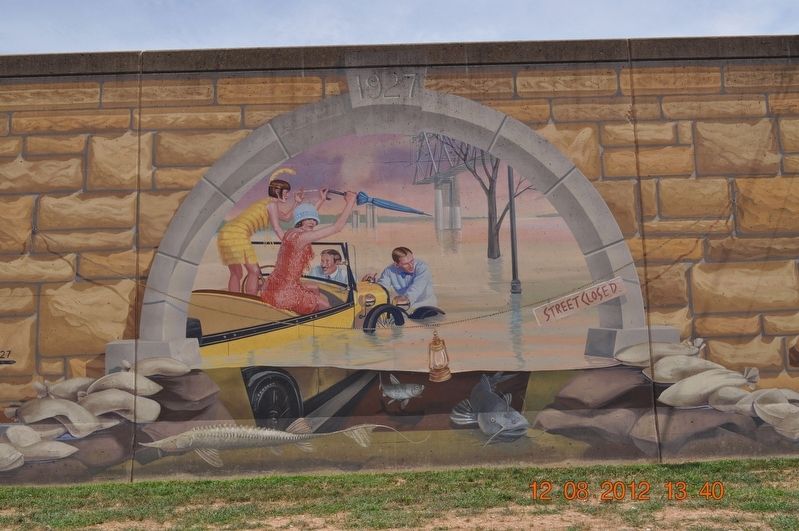
1927
The Big Flood
Erected by Mississippi River Tales / River Heritage Mural Association.
Topics. This historical marker is listed in these topic lists: Disasters • Environment • Waterways & Vessels. A significant historical year for this entry is 1927.
Location. 37° 18.155′ N, 89° 31.081′ W. Marker is in Cape Girardeau, Missouri, in Cape Girardeau County. Marker is on Water Street. Located on Missouri Wall of Fame along the Missouri River Front. Touch for map. Marker is in this post office area: Cape Girardeau MO 63703, United States of America. Touch for directions.
Other nearby markers. At least 8 other markers are within walking distance of this marker. Visionary Women / Entrepreneurs (here, next to this marker); Mark Twain / Missouri Generals / George Caleb Bingham (here, next to this marker); Literary Giants / Missouri Mule (a few steps from this marker); 1958 (a few steps from this marker); 1918-1919 (within shouting distance of this marker); The Civil War / The Boys of Summer / Sports Dazzlers (within shouting distance of this marker); George Washington Carver (within shouting distance of this marker); Captains of Industry (within shouting distance of this marker). Touch for a list and map of all markers in Cape Girardeau.
Also see . . .
1. Mississippi River Tales Mural. The Mississippi River Tales is a mural containing 24 panels covering nearly 18,000 square feet (1,700 m2) of the 15-foot (4.6 m)-high downtown floodwall in Cape Girardeau, Missouri. (Submitted on September 2, 2017, by Sandra Hughes Tidwell of Killen, Alabama, USA.)
2. Great Mississippi Flood of 1927. The Great Mississippi Flood of 1927 was the most destructive river flood in the history of the United States,[1] with 27,000 square miles (70,000 km2) inundated up to a depth of 30 feet (9 m). To try to prevent future floods, the federal government built the world's longest system of levees and floodways. (Submitted on September 2, 2017, by Sandra Hughes Tidwell of Killen, Alabama, USA.)
3. The 1927 Great Mississippi Flood 80-Years Retrospective. In the spring of 1927, the most catastrophic river flood to impact the United States occurred along the Mississippi River. The flooding, which inundated parts of Arkansas, Illinois, Kentucky, Louisiana, Mississippi, Missouri, and Tennessee, was notable both for its extent as well as its profound impact on future flood risk management. In all, approximately 27,000 square miles (70,000 square kilometers) were left underwater, ruining crops, damaging or destroying 137,000 buildings, causing 700,000 people to be displaced from their homes, and killing 250 individuals across the seven impacted states. (Submitted on September 2, 2017, by Sandra Hughes Tidwell of Killen, Alabama, USA.)
Credits. This page was last revised on February 17, 2022. It was originally submitted on September 2, 2017, by Sandra Hughes Tidwell of Killen, Alabama, USA. This page has been viewed 248 times since then and 14 times this year. Last updated on February 17, 2022, by Carl Gordon Moore Jr. of North East, Maryland. Photos: 1, 2. submitted on September 2, 2017, by Sandra Hughes Tidwell of Killen, Alabama, USA. • Devry Becker Jones was the editor who published this page.

