Near Buckland in Prince William County, Virginia — The American South (Mid-Atlantic)
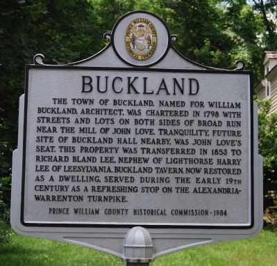
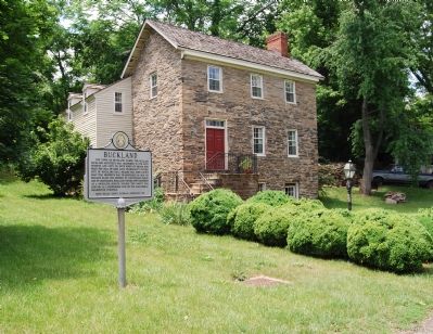
Buckland
Erected 1984 by Prince William County Historical Commission. (Marker Number 66.)
Topics and series. This historical marker is listed in these topic lists: Roads & Vehicles • Settlements & Settlers. In addition, it is included in the Virginia, Prince William County Historical Commission series list. A significant historical year for this entry is 1798.
Location. 38° 46.846′ N, 77° 40.458′ W. Marker is near Buckland, Virginia, in Prince William County. Marker is at the intersection of Lee Highway (U.S. 29) and Buckland Mill Road (County Route 684), on the right when traveling south on Lee Highway. Touch for map. Marker is in this post office area: Gainesville VA 20155, United States of America. Touch for directions.
Other nearby markers. At least 8 other markers are within 3 miles of this marker, measured as the crow flies. The Buckland Mill (about 400 feet away, measured in a direct line); Buckland Mills Battle (approx. half a mile away); Battle of Buckland Mills (approx. half a mile away); Aldo Leopold (approx. 2 miles away); On Hallowed Ground (approx. 2.1 miles away); Second Battle of Manassas (approx. 2.3 miles away); Campaign of Second Manassas (approx. 2.3 miles away); Bull Run Battlefields (approx. 2.3 miles away). Touch for a list and map of all markers in Buckland.
More about this marker. The Alexandria-Warrenton Turnpike in this area is now known as U.S. Route 29. When route numbers were assigned in the 20th century, it was numbered U.S. Route 211 and north-south U.S. Route 29 borrowed its road surface from Warrenton to Washington D.C. Now Route 211’s eastern terminus is Warrenton.
Credits. This page was last revised on December 7, 2023. It was originally submitted on June 5, 2007, by Dawn Bowen of Fredericksburg, Virginia. This page has been viewed 2,481 times since then and 25 times this year. Last updated on December 6, 2023, by N. Jozsa of Woodbridge, Virginia. Photos: 1, 2, 3. submitted on June 5, 2007, by Dawn Bowen of Fredericksburg, Virginia. 4. submitted on June 6, 2021, by Bradley Owen of Morgantown, West Virginia. • Bernard Fisher was the editor who published this page.


