New Madrid in New Madrid County, Missouri — The American Midwest (Upper Plains)
New Madrid
Inscription.
(Front)
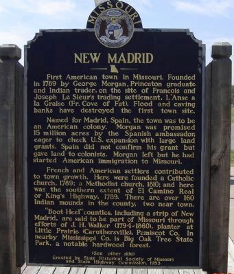
First American town in Missouri. Founded in 1789 by George Morgan, Princeton graduate and Indian trader, on the site of Francois and Joseph Le Sieur's trading settlement, L'Anse a laGraise (Fr. Cove of Fat). Flood and caving banks have destroyed the first town site.
Named for Madrid, Spain, the town was to be an American colony. Morgan was promised 15 million acres by the Spanish ambassador, eager to check U.S. expansion with large land grants. Spain did not confirm his grant but gave land to colonists. Morgan left but he had started American immigration to Missouri.
French and American settlers contributed to the town growth. Here were founded a Catholic church, 1789; a Methodist church, 1810; and here was the southern extent of El Camino Real or King's Highway, 1789. There are over 160 Indian mounds in the county, two are near town.
"Boot Heel" counties, including a strip of New Madrid, are said to be part of Missouri through efforts of J.H. Walker (1794-1860), planter at Little Prairie (Caruthersville), Pemiscot Co. In nearby Mississippi Co. is Big Oak Tree State Park, a notable hardwood forest.
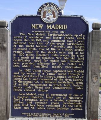
(Reverse):The New Madrid Earthquake, made up of a series of monstrous and lesser shocks, which began Dec. 16, 1811, and continued over a year, centered here. One of the great earthquakes of the world because of severity and length it caused little loss of life in a thinly settled region. Some of the shocks were felt as far as 1100 miles. Reelfoot Lake across the river is a result of the disaster. New Madrid land certificates, good for public land elsewhere, were provided sufferers by U.S. relief act, 1815, which benefited mostly speculators.
In 1862 Union forces captured New Madrid and by means of a "canal" sawed through a submerged forest to a bayou, gained control of Island No. 10 and command of the river. Nearby in Mississippi Co. is Belmont battlefield, scene of an 1861 engagement in which both Federal forces under Grant and Confederates under Pillow claimed victory.
New Madrid, seat of government of one of 5 Spanish districts, later one of Missouri's first 5 counties, serves a farming community. Cotton and soybean crops predominate. Rich land has been reclaimed by the Little River and St. Johns Levee drainage systems.
Erected 1953 by State Historical Society of Missouri and State Highway Commission.
Topics and series. This historical marker is listed in these topic lists: Colonial Era • Disasters • Settlements & Settlers • War, US Civil. In addition, it is included in the Missouri, The State Historical Society of series list. A significant historical date for this entry is December 16, 1868.
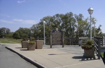
Location. 36° 35.015′ N, 89° 31.611′ W. Marker is in New Madrid, Missouri, in New Madrid County. Marker is at the intersection of Levee Road and Main Street, on the left when traveling west on Levee Road. The marker is located on a boardwalk along a levee overlooking the Mississippi River. Touch for map. Marker is in this post office area: New Madrid MO 63869, United States of America. Touch for directions.
Other nearby markers. At least 8 other markers are within walking distance of this marker. Fort Bankhead (a few steps from this marker); Bissell's Submergible Saw (a few steps from this marker); Battle of Island No. 10 (a few steps from this marker); New Madrid & Island No. Ten (within shouting distance of this marker); Water Route to Indian Territory (about 600 feet away, measured in a direct line); They Passed This Way (about 600 feet away); Higgerson School (about 700 feet away); A Growing State...A Shrinking County (approx. 0.3 miles away). Touch for a list and map of all markers in New Madrid.
Also see . . .
1. New Madrid. City homepage:
The locality features several historic homes and sites. (Submitted on October 10, 2008, by Craig Swain of Leesburg, Virginia.)
2. Marker Dedication. New Madrid website entry:
An account of the marker's dedication ceremony from 1954. (Submitted on October 11, 2008, by Craig Swain of Leesburg, Virginia.)
3. The Great New Madrid Earthquake. University of Memphis Center for Earthquake Research and Information - New Madrid Compendium Eyewitness Accounts:
In a first hand account of the Earthquake, offered here, from Eliza Bryan, the effects of the first shock are described:
On the 16th of December, 1811, about two o'clock, A.M., we were visited by a violent shock of an earthquake, accompanied by a very awful noise resembling loud but distant thunder, but more hoarse and vibrating, which was followed in a few minutes by the complete saturation of the atmosphere, with sulphurious vapor, causing total darkness. The screams of the affrighted inhabitants running to and fro, not knowing where to go, or what to do - the cries of the fowls and beasts of every species - the cracking of trees falling, and the roaring of the Mississippi - the current of which was retrogade for a few minutes, owing as is supposed, to an irruption in its bed -- formed a scene truly horrible. (Submitted on October 10, 2008, by Craig Swain of Leesburg, Virginia.)
4. Earthquakes on the Mississippi: The New Madrid Seismic Zone. How Stuff Works entry (Submitted on January 24, 2021, by Larry Gertner of New York, New York.)
5. Battle of Island Number 10. Wikipedia entry (Submitted on April 7, 2022, by Larry Gertner of New York, New York.)
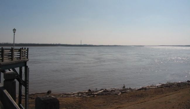
Photographed By Craig Swain, March 17, 2009
6. New Madrid Bend Today
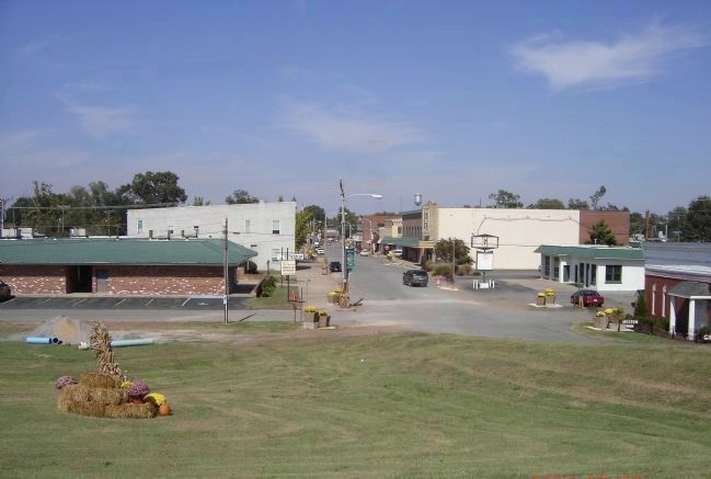
The river course has changed over time. Here at New Madrid, the original town stood in what is today the river channel. The river turns south again on the right side of this photo. In the far distance are the smoke stacks of an aluminum plant, further south on the Missouri shore. That smokestack is very close to the epicenter of the largest tremor in the New Madrid earthquakes.
Credits. This page was last revised on January 8, 2024. It was originally submitted on October 10, 2008, by Craig Swain of Leesburg, Virginia. This page has been viewed 3,701 times since then and 168 times this year. Last updated on January 4, 2024, by Mark St. Martin of Kalamazoo, Michigan. Photos: 1, 2, 3, 4. submitted on October 10, 2008, by Craig Swain of Leesburg, Virginia. 5, 6. submitted on May 31, 2009, by Craig Swain of Leesburg, Virginia. 7. submitted on October 11, 2008, by Mike Stroud of Bluffton, South Carolina. • J. Makali Bruton was the editor who published this page.
