Idaho Falls in Bonneville County, Idaho — The American West (Mountains)
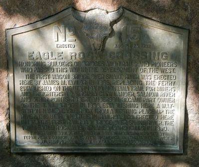
Eagle Rock Crossing
The first wagon bridge over Snake River was erected here by James M. Taylor in 1865 replacing the ferry established on the Utah-Idaho-Montana trail for miners and freighters to Virginia City, Lander, Salmon River and other points. Robert Anderson became part owner of the toll bridge in 1866, establishing here a way station named Eagle Rock from a nesting place up the river. The Utah & Northern Railroad Co. erected here in 1879 the first railroad bridge over Snake River. The town Eagle Rock was renamed Idaho Falls in 1890.
This granite boulder from Grand Teton mountain was set by Teton Peaks Council, Boy Scouts of America and the tablet provided by Utah Pioneer Trails and Landmarks Association
Erected 1932 by Boy Scouts of America, Teton Peaks Council and Utah Pioneer Trails and Landmarks Association. (Marker Number 15.)
Topics and series. This historical marker is listed in these topic lists: Bridges & Viaducts • Roads & Vehicles. In addition, it is included in the Utah Pioneer Trails and Landmarks Association series list.
Location. 43° 29.541′ N, 112° 2.683′ W. Marker is in Idaho Falls, Idaho, in Bonneville County. Marker can be reached from West Broadway Street near River Parkway, on the left when traveling west. Touch for map. Marker is at or near this postal address: 635 West Broadway Street, Idaho Falls ID 83402, United States of America. Touch for directions.
Other nearby markers. At least 8 other markers are within walking distance of this marker. Taylor's Bridge (about 300 feet away, measured in a direct line); Eagle Rock Ferry (about 300 feet away); Farmers' and Merchants' Bank (approx. 0.2 miles away); Prisoners of War in Idaho Falls (approx. ¼ mile away); The Odd Fellows (approx. 0.3 miles away); Snake River Bridge (approx. 0.3 miles away); Upper Snake River Valley Irrigation (approx. 0.4 miles away); Eagle Rock Meeting House (approx. 0.4 miles away). Touch for a list and map of all markers in Idaho Falls.
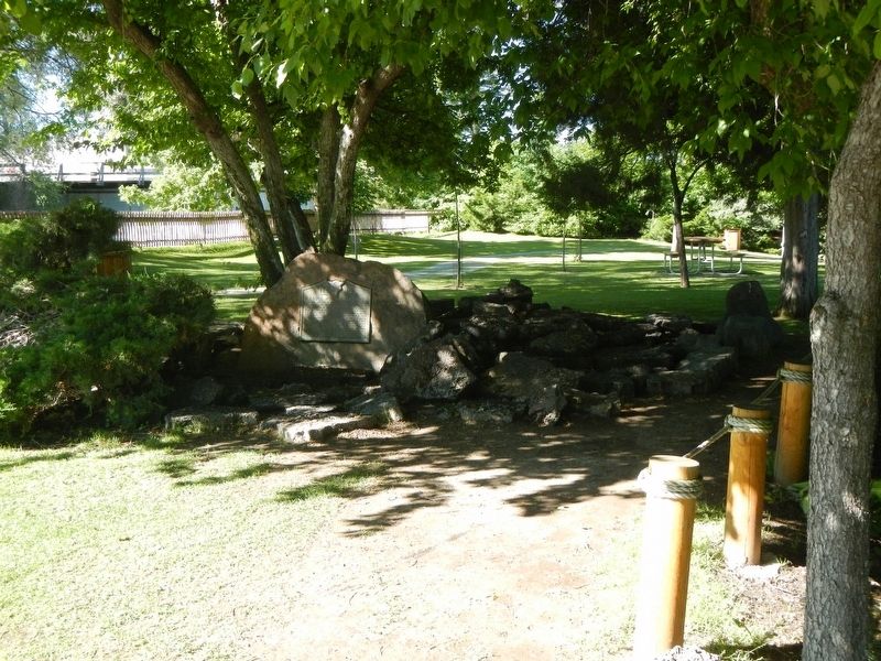
More about this marker. This marker is located in Sportsman Park, a peninsula in the middle of the Snake River. Access is by foot bridge found at the south side of Broadway Street.
Credits. This page was last revised on July 6, 2020. It was originally submitted on October 8, 2018, by Barry Swackhamer of Brentwood, California. This page has been viewed 511 times since then and 69 times this year. Last updated on July 4, 2020, by Tyler Thorsted of Orem, Utah. Photos: 1, 2. submitted on October 8, 2018, by Barry Swackhamer of Brentwood, California. • J. Makali Bruton was the editor who published this page.

