Near Petersburg in Dinwiddie County, Virginia — The American South (Mid-Atlantic)
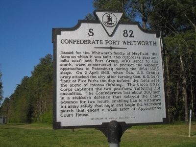
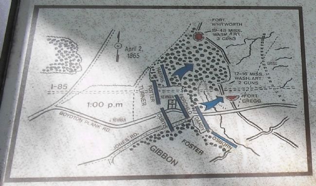
Confederate Fort Whitworth
Erected 1994 by Department of Historic Resources. (Marker Number S-82.)
Topics and series. This historical marker is listed in this topic list: War, US Civil. In addition, it is included in the Former U.S. Presidents: #18 Ulysses S. Grant, and the Virginia Department of Historic Resources (DHR) series lists. A significant historical date for this entry is April 2, 1865.
Location. 37° 12.309′ N, 77° 27.596′ W. Marker is near Petersburg, Virginia, in Dinwiddie County. Marker is at the intersection of Boydton Plank Road (U.S. 1) and Albemarle Street, on the right when traveling north on Boydton Plank Road. Marker is located on the northeast corner of the intersection of Boydton Plank Road and Albemarle Street. Touch for map. Marker is in this post office area: Petersburg VA 23803, United States of America. Touch for directions.
Other nearby markers. At least 8 other markers are within walking distance of this marker. Central State Hospital Cemetery (approx. 0.4 miles away); The Battle of Fort Whitworth (approx. 0.4 miles away); Southside Virginia Training Center (approx. half a mile away); Siege of Petersburg—Grant's Eighth Offensive (approx. 0.6 miles away); Confederate Fort Gregg (approx. 0.7 miles away); Fort Gregg (approx. ¾ mile away); Edge Hill (approx. ¾ mile away); Central State Hospital (approx. 0.9 miles away). Touch for a list and map of all markers in Petersburg.

Photographed By Bill Coughlin, April 23, 2007
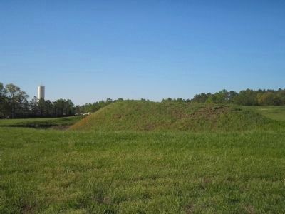
2. Confederate Fort Gregg
These are the remains of Confederate Fort Gregg, which was attacked along with Fort Whitworth on April 2, 1865 by Union forces. They are located about 400 yards to the south of the marker. The site of Fort Whitworth has since been developed.
Credits. This page was last revised on February 2, 2023. It was originally submitted on December 30, 2008, by Bill Coughlin of Woodland Park, New Jersey. This page has been viewed 3,067 times since then and 81 times this year. Last updated on September 1, 2021, by Bradley Owen of Morgantown, West Virginia. Photos: 1, 2, 3. submitted on December 30, 2008, by Bill Coughlin of Woodland Park, New Jersey. • J. Makali Bruton was the editor who published this page.

