Near Rogers City in Presque Isle County, Michigan — The American Midwest (Great Lakes)
Forty Mile Point Lighthouse / Lake Huron Graveyard of Ships
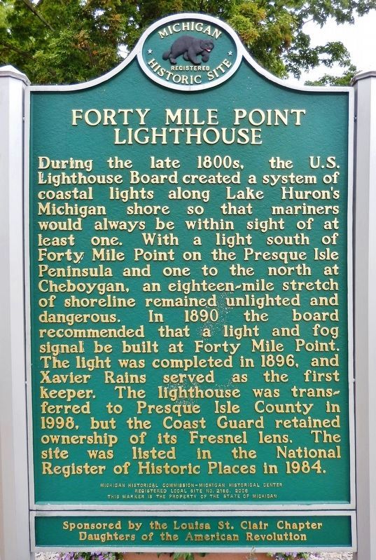
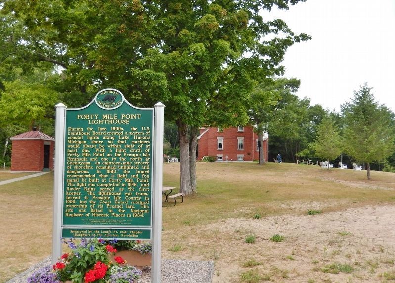
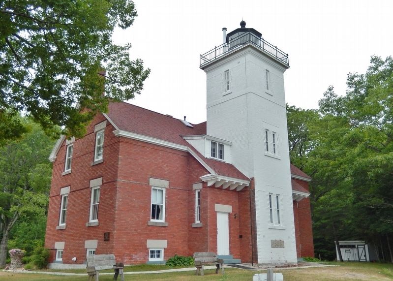
Forty Mile Point Lighthouse
During the late 1800s, the U.S. Lighthouse Board created a system of coastal lights along Lake Huron's Michigan shore so that mariners would always be within sight of at least one. With a light south of Forty Mile Point on the Presque Isle Peninsula and one to the north at Cheboygan, an eighteen-mile stretch of shoreline remained unlighted and dangerous. In 1890 the board recommended that a light and fog signal be built at Forty Mile Point. The light was completed in 1896, and Xavier Rains served as the first keeper. The lighthouse was transferred to Presque Isle County in 1998, but the Coast Guard retained ownership of its Fresnel lens. The site was listed in the National Register of Historic Places in 1984.
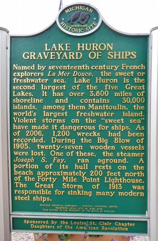
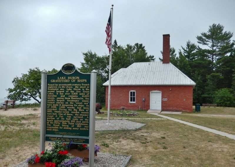
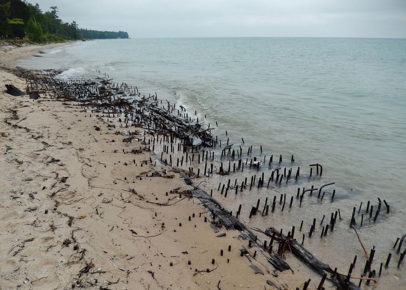
Lake Huron Graveyard of Ships
Named by seventeenth century French explorers La Mer Douce, the sweet or freshwater sea. Lake Huron is the second largest of the five Great Lakes. It has over 3,800 miles of shoreline and contains 30,000 islands, among them Manitoulin, the world's largest freshwater island. Violent storms on the "sweet sea" have made it dangerous for ships. As of 2006, 1,200 wrecks had been recorded. During the Big Blow of 1905, twenty-seven wooden vessels were lost. One of these, the steamer Joseph S. Fay, ran aground. A portion of its hull rests on the beach approximately 200 feet north of the Forty Mile Lighthouse. The Great Storm of 1913 was responsible for sinking many modern steel ships.
Registered Local Site No. 2186, 2006
This marker is the property of the State of Michigan
Sponsored by the Louisa St. Clair Chapter
Daughters of the American Revolution
Erected 2006 by Michigan Historical Commission - Michigan Historical Center and the Louisa St. Clair Chapter Daughters of the American Revolution. (Marker Number 2186.)
Topics and series. This historical marker is listed in these topic lists: Disasters • Industry & Commerce • Waterways & Vessels. In addition, it is included in the Daughters of the American Revolution, the Lighthouses, the Lost at Sea, and the Michigan Historical Commission series lists. A significant historical year for this entry is 1890.
Location. 45° 29.159′ N, 83° 54.776′ W. Marker is near Rogers City, Michigan, in Presque Isle County. Marker can be reached from County Park Road, 0.2 miles north of U.S. 23 when traveling north. The marker is located near the subject lighthouse, within Presque Isle County Lighthouse Park. Touch for map. Marker is at or near this postal address: 7323 US Highway 23, Rogers City MI 49779, United States of America. Touch for directions.
Other nearby markers. At least 8 other markers are within 7 miles of this marker, measured as the crow flies. SS Calcite (within shouting distance of this marker); International Shipmaster's Association (within shouting distance of this marker); The Bunkhouse (within shouting distance of this marker); 40 Mile Point Lighthouse (within shouting distance of this marker); S.S. Joseph S. Fay Shipwreck (within shouting distance of this marker); The Glawe School (about 600 feet away, measured in a direct line); Site of Frederick Denny Larke Home (approx. 6.4 miles away); Frederick Denny Larke General Store (approx. 6.4 miles away). Touch for a list and map of all markers in Rogers City.
Regarding Forty Mile Point Lighthouse / Lake Huron Graveyard of Ships. National Register of Historic Places #84001830. Michigan State Historic Site.
Related markers. Click here for a list of markers that are related to this marker. Forty Mile Point Lighthouse, Presque Isle County, Michigan
Also see . . .
1. A Brief History of 40 Mile Point Lighthouse. Major Milton B. Adams, Eleventh District Engineer selected and surveyed a site approximately 40 miles southeast of Old Mackinaw Point and 40 miles northwest of Thunder Bay. When
the materials arrived at the Detroit depot, they were loaded aboard the lightship, Amaranth, and arrived at 40 Mile Point on July 5, 1896. Work began immediately to construct a wood-framed building that would house the work crew during construction of the lighthouse and later serve as a barn for the keeper's horses. This structure still stands today and has been restored for use as a gift shop.
The main lighthouse structure models the Big Bay lighthouse which was being constructed simultaneously near Marquette in the Upper Peninsula. 40 Mile Point is a two-story duplex with a tower incorporated into the center of the side-wall facing Lake Huron. (Submitted on July 24, 2018, by Cosmos Mariner of Cape Canaveral, Florida.)
2. Forty Mile Point Lighthouse. A redbrick fog signal building, with a hipped roof covered in corrugated iron, was constructed near the shore to house ten-inch steam whistles. The lighthouse, also built of red brick, featured a twelve-foot-square tower centered on the lakeward face of a two-story duplex. Each of the lighthouse’s mirror-image apartments had six rooms and an iron door that led into the tower, where a circular, cast-iron stairway provided access to the octagonal lantern room. The tower stands fifty-two feet tall and originally housed a fourth-order, L. Sautter lens. Equipped
with six bull’s-eye panels, the lens revolved once every minute to produce white flashes spaced by ten seconds. (Submitted on July 24, 2018, by Cosmos Mariner of Cape Canaveral, Florida.)
3. Joseph S. Fay Shipwreck. On October 19, 1905, the wooden steamer Joseph S. Fay was downbound on Lake Huron with the schooner-barge D.P. Rhodes in tow. Both vessels were loaded with iron ore and were bucking heavy seas. When the ships rolled in opposite directions, the strain on the towline became too great, and the Rhodes broke free, taking a portion of the Fay’s stern with her. The captain of the Fay quickly turned the steamer landward, hoping to reach shore before sinking. When the Fay struck a sandbar, the forward portion of the vessel tore free and washed ashore with the captain and ten crewmen safely inside. The following account of the shipwreck was recorded in the keeper’s log at Forty Mile Point Lighthouse: “At 8:30 p.m. last night the steamer, J.S. Fay, came ashore here in a sinking condition. She soon broke up. Most of the crew came ashore on the Pilot House. Three men swam ashore, the mate was drowned.” (Submitted on July 24, 2018, by Cosmos Mariner of Cape Canaveral, Florida.)
Credits. This page was last revised on April 30, 2023. It was originally submitted on July 24, 2018, by Cosmos Mariner of Cape Canaveral, Florida. This page has been viewed 330 times since then and 25 times this year. Last updated on April 30, 2023, by Carolyn Sanders of Plano, Texas. Photos: 1, 2, 3, 4, 5, 6. submitted on July 24, 2018, by Cosmos Mariner of Cape Canaveral, Florida. • J. Makali Bruton was the editor who published this page.
