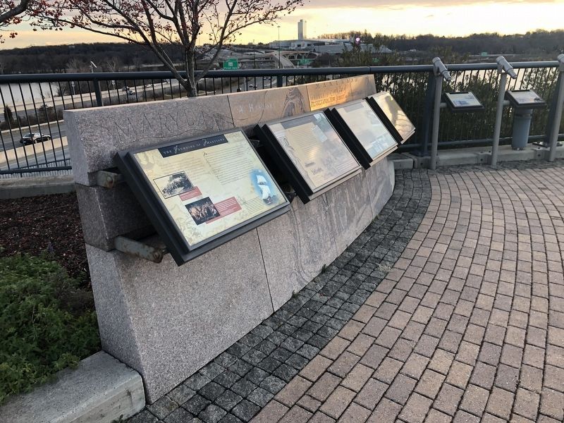
National Harbor in Fort Washington in Prince George's County, Maryland — The American Northeast (Mid-Atlantic)
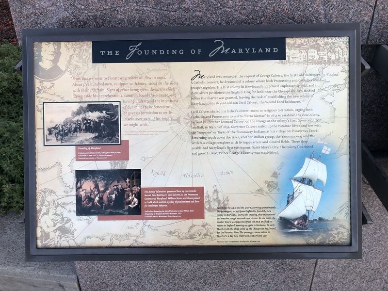
The Founding of Maryland
"From this we went to Piscataway, where all flew to arms. About five hundred men, equipped with bows, stood on the shore with their chieftain. Signs of peace given them, the chief, laying aside his apprehensions, came on board the pinnace, and having understood the intentions of our minds to be benevolent, he gave us permission to settle in whatever part of his empire we might wish."
-Father White, a Jesuit priest, reporting on the reception given to Leonard Calvert by the Piscataway Tayac, 1634
Maryland was created at the request of George Calvert, the first Lord Baltimore. A Catholic convert, he dreamed of a colony where both Protestants and Catholics could prosper together. His first colony in Newfoundland proved unpleasantly cold, and in 1628 Calvert petitioned the English King for land near the Chesapeake Bay. He died before the charter was granted, leaving the task of establishing the new colony of Maryland to his 26 year-old son Cecil Calvert, the Second Lord Baltimore.
Cecil Calvert shared his father's commitment to religious toleration, urging both Catholics and Protestants to sail to "Terra Mariae" in 1633 to establish the new colony. He sent his brother Leonard Calvert on the voyage as the colony's first Governor. Upon landfall, in March 1634, Governor Calvert sailed up the Potomac River and met with the "emperor" or Tayac of the Piscataway Indians at his village on Piscataway Creek. Returning south down the river, another Indian group, the Yaocomacoes, sold the settlers a village complete with living quarters and cleared fields. There they established Maryland's first settlement, Saint Mary's City. The colony flourished and grew. In 1696, Prince George's County was established.
Founding of Maryland
Original painting by H. Sander, etching by Xavier Le Sueur
The Acts of Toleration, presented here by the Catholic Second Lord Baltimore, Cecil Calvert, to the Protestant Governor of Maryland, William Stone, were laws passed in 1649 which outline a policy of punishments and fines for intolerant behavior.
Acts of Toleration to Gov. William Stone
Oil painting by Tompkins Harrison Matteson, 1853
Two ships, the Ark and the Dove, carrying approximately 140 passengers, set sail from England to found the new colony in Maryland. During the crossing, they encountered bad weather, rough seas and even pirates. At one point, the smaller Dove was separated from the Ark and had to return to England, meeting up again in Barbados. In early March 1634, the ships sailed up the Chesapeake Bay, bound for the Potomac River. The passengers came ashore on March
Topics. This historical marker is listed in these topic lists: Churches & Religion • Native Americans • Settlements & Settlers • Waterways & Vessels. A significant historical month for this entry is March 1634.
Location. 38° 47.56′ N, 77° 1.456′ W. Marker is in Fort Washington, Maryland, in Prince George's County. It is in the National Harbor. Marker can be reached from Capital Beltway (Interstate 95) west of National Harbor Boulevard, on the right when traveling east. Touch for map. Marker is in this post office area: Oxon Hill MD 20745, United States of America. Touch for directions.
Other nearby markers. At least 8 other markers are within walking distance of this marker. Neighbor to the Nation's Capital (here, next to this marker); The Tobacco Economy (here, next to this marker); The Growth of the Black Middle Class (here, next to this marker); College Park (here, next to this marker); Hyattsville (here, next to this marker); Andrews Air Force Base (here, next to this marker); Bladensburg (here, next to this marker); Laurel (here, next to this marker). Touch for a list and map of all markers in Fort Washington.
Credits. This page was last revised on March 3, 2023. It was originally submitted on December 23, 2018, by Devry Becker Jones of Washington, District of Columbia. This page has been viewed 258 times since then and 24 times this year. Last updated on July 25, 2022, by Carl Gordon Moore Jr. of North East, Maryland. Photos: 1, 2. submitted on December 23, 2018, by Devry Becker Jones of Washington, District of Columbia.

