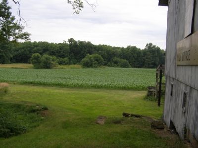
Near Perrysville in Ashland County, Ohio — The American Midwest (Great Lakes)
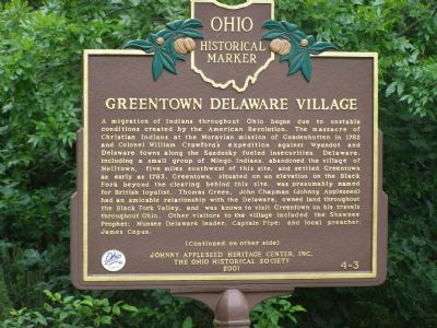
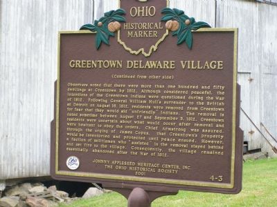
Greentown Delaware Village
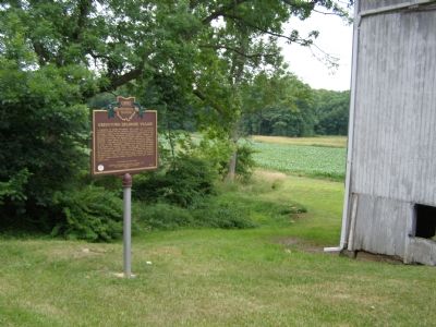
A migration of Indians throughout Ohio began due to unstable conditions created by the American Revolution. The massacre of Christian Indians at the Moravian mission of Gnadenhutten in 1782 and Colonel William Crawford’s expedition against Wyandot and Delaware towns along the Sandusky fueled insecurities. Delaware, including a small group of Mingo Indians, abandoned the village of Helltown, five miles southwest of this site, and settled Greentown as early as 1783. Greentown, situated on an elevation on the Black Fork beyond the clearing behind this site, was presumably named for British loyalist, Thomas Green. John Chapman (Johnny Appleseed) had an amicable relationship with the Delaware, owned land throughout the Black Fork Valley, and was known to visit Greentown on his travels throughout Ohio. Other visitors to the village included the Shawnee Prophet; Munsee Delaware leader, Captain Pipe; and local preacher, James Copus.
Observers noted that there were more than one hundred and fifty dwellings at Greentown by 1812. Although considered peaceful, the intentions of the Greentown Indians were questioned during the War of 1812. Following General William Hull’s surrender to the British at Detroit on August 16, 1812, residents were removed from Greentown for fear that they would aid “unfriendly” Indians. The removal is dated sometime between August 27 and September 3, 1812. Greentown residents were uncertain about what would occur after removal and were hesitant to obey the orders. Chief Armstrong was assured, through the urging of James Copus, that Greentown's property would be inventoried and protected until peace ensued. However, a faction of militiamen who “assisted” in the removal stayed behind and set fire to the village. Consequently, the village remained essentially abandoned after the War of 1812.
Erected 2001 by the Johnny Appleseed Heritage Center, Inc. and The Ohio Historical Society. (Marker Number 4-3.)
Topics and series. This historical marker is listed in these topic lists: Native Americans • Settlements & Settlers • War of 1812. In addition, it is included in the Ohio Historical Society / The Ohio History Connection series list. A significant historical month for this entry is September 1762.
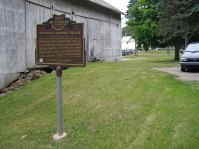
Location. 40° 41.895′ N, 82° 19.576′ W. Marker is near Perrysville, Ohio, in Ashland County. Marker is on Ohio Route 39, on the right when traveling west. It is between the towns of Perrysville and Lucas. Touch for map. Marker is at or near this postal address: 2488 Route 39, Perrysville OH 44864, United States of America. Touch for directions.
Other nearby markers. At least 8 other markers are within 7 miles of this marker, measured as the crow flies. Johnny “Appleseed” Land Lease and Nursery (approx. 1.7 miles away); Perrysville Union Cemetery (Veterans Memorial) (approx. 3 miles away); Frontier Violence During the War of 1812 (approx. 3.3 miles away); Louis Bromfield / Malabar Farm (approx. 5 miles away); Pleasant Hill Dam (approx. 5.2 miles away); Historic Mifflin (approx. 5.6 miles away); Hayesville Town Hall and Opera House (approx. 6.2 miles away); PFC Terry L. Schaub (approx. 6.2 miles away). Touch for a list and map of all markers in Perrysville.
Credits. This page was last revised on January 26, 2023. It was originally submitted on June 26, 2007, by Christopher Light of Valparaiso, Indiana. This page has been viewed 4,525 times since then and 159 times this year. Last updated on March 16, 2021, by Grant & Mary Ann Fish of Galloway, Ohio. Photos: 1, 2, 3, 4, 5. submitted on June 26, 2007, by Christopher Light of Valparaiso, Indiana. • Devry Becker Jones was the editor who published this page.
