Villa de Reyes, San Luis Potosí, Mexico — The Northeast (and Central Highlands)
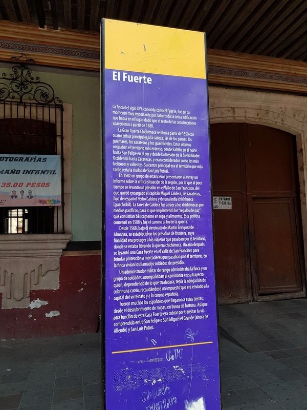
The Fortress
La finca del siglo XVI, conocida como El Fuerte, fue en su momento muy importante por haber sido la única edificación que había en el lugar, dado que el resto de las construcciones aparecieron a partir de 1580.
La Gran Guerra Chichimeca se libró a partir de 1550 con cuatro tribus principales a la cabeza, las de los pames, los guamares, los zacatecos y los guachichiles. Estos últimos ocupaban el territorio más extenso, desde Saltillo en el norte hasta San Felipe en el sur y desde la división de la Sierra Madre Occidental hasta Zacatecas, y eran considerados como los más belicosos y valientes. Su centro principal era el territorio que más tarde sería la ciudad de San Luis Potosí.
En 1582 un grupo de estancieros presentaron al virrey un informe sobre la crítica situación de la región, por lo que al poco tiempo se levantó un presidio en el Valle de San Francisco, del que quedó encargado el capitán Miguel Caldera, de Zacatecas, hijo del español Pedro Caldera y de una india chichimeca (guachichil). La tarea de Caldera fue atraer a los chichimecas por medios pacíficos, para lo que implementó los "regalos de paz" que consistían básicamente en ropa y alimentos. Esta política comenzó en 1588 y fue el camino al fin de la guerra.
Desde 1568, bajo el virreinato de Martín Enriquez de Almanza, se establecieron los presidios de frontera, cuya finalidad era proteger a los viajeros que pasaban por el territorio, donde se estaba librando la guerra chichimeca. Un año después se levantó una Casa Fuerte en el Valle de San Francisco para brindar protección a mercaderes que pasaban por el territorio. En la finca vivían los llamados soldados de presidio.
Un administrador militar de rango administraba la finca y un grupo de soldados acompañaban al caminante en su trayecto quien, dependiendo de lo que trasladara, tenía la obligación de cubrir una cuota, recaudándose un impuesto que era enviado a la capital del virreinato y a la corona española.
Fueron muchos los españoles que llegaron a estas tierras desde el descubrimiento de minas, en busca de fortuna. Así que otra función de esta Casa Fuerte era cobrar por transitar la vía comprendida entre San Felipe o San Miguel el Grande (ahora de Allende) y San Luis Potosí.
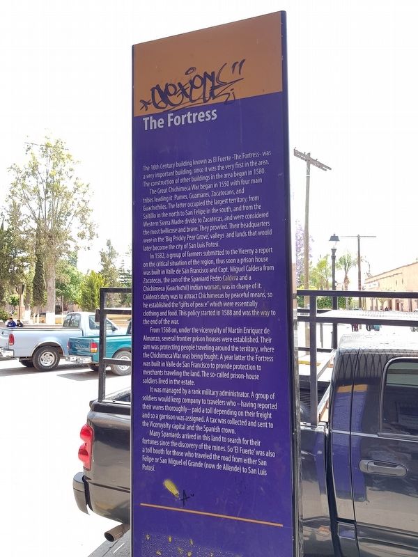
The Fortress
The 16th Century building known as El Fuerte - The Fortress – was a very important building, since it was the very first in the area. The construction of other buildings in the area began in 1580.
The Great Chichimeca War began in 1550 with four main tribes leading it: Pames, Guamares, Zacatecans, and Guachichiles. The latter occupied the largest territory, from Saltillo in the north to San Felipe in the south, and from the Western Sierra Madre divide to Zacatecas, and were considered the most bellicose and brave. They prowled. Their headquarters were in the ‘Big Prickly Pear Grove’, valleys and lands that would later become the city of San Luis Potosí.
In 1582, a group of farmers submitted to the Viceroy a report on the critical situation of the region, thus soon a prison house was built in Valle de San Francisco and Capt. Miguel Caldera from Zacatecas, the son of the Spaniard Pedro Caldera and a Chichimeca (Guachichil) indian woman, was in charge of it. Caldera's duty was to attract Chichimecas by peaceful means, so he established the “gifts of peace” which were essentially clothing and food. This policy started in 1588 and was the way to the end of the war.
From 1568 on, under the viceroyalty of Martin Enriquez de Almanza, several frontier prison houses were established. Their aim was protecting people traveling around the territory, where the Chichimeca War was being fought. A year later the Fortress was built in Valle de San Francisco to provide protection to merchants traveling the land. The so-called prison-house soldiers
lived in the estate.
It was managed by a rank military administrator. A group of soldiers would keep company to travelers who -- having reported their wares thoroughly -- paid a toll depending on their freight and so a garrison was assigned. A tax was collected and sent to the Viceroyalty capital and the Spanish crown.
Many Spaniards arrived in this land to search for their fortunes since the discovery of the mines. So ‘El Fuerte’ was also a toll booth for those who traveled the road from either San Felipe or San Miguel el Grande (now de Allende) to San Luis Potosí.
Topics. This historical marker is listed in these topic lists: Colonial Era • Native Americans • Settlements & Settlers • Wars, Non-US. A significant historical year for this entry is 1580.
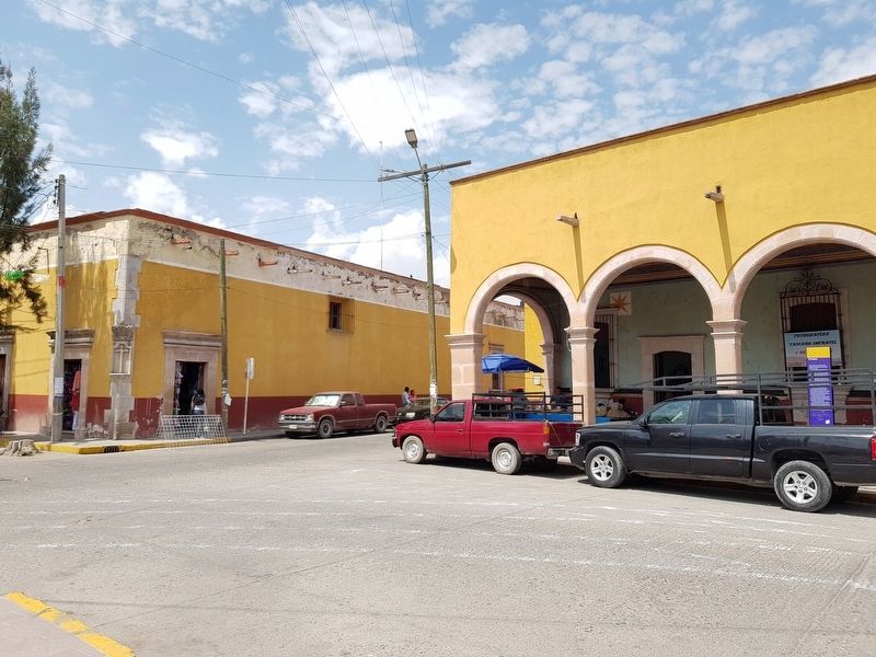
Location. 21° 48.224′ N, 100° 55.969′ W. Marker is in Villa de Reyes, San Luis Potosí. Marker is on Calle Principal just west of Mercado, on the right when traveling west. Touch for map. Marker is in this post office area: Villa de Reyes SL 79500, Mexico. Touch for directions.
Other nearby markers. At least 8 other markers are within 21 kilometers of this marker, measured as the crow flies. The Viceregal Powers in Villa de Reyes (about 120 meters away, measured in a direct line); First Centenary of the Land Restitution Decree (about 120 meters away); Saint Francis of Assisi Parish (about 120 meters away); Tourism Office (approx. 20.2 kilometers
away); Foundation of Santa María del Río (approx. 20.2 kilometers away); City Hall (approx. 20.2 kilometers away); Purísima Chapel (approx. 20.2 kilometers away); Otomíes and Guachichiles (approx. 20.2 kilometers away). Touch for a list and map of all markers in Villa de Reyes.
Credits. This page was last revised on May 20, 2019. It was originally submitted on May 20, 2019, by J. Makali Bruton of Accra, Ghana. This page has been viewed 109 times since then and 9 times this year. Photos: 1, 2, 3, 4. submitted on May 20, 2019, by J. Makali Bruton of Accra, Ghana.


