Marshall in Fauquier County, Virginia — The American South (Mid-Atlantic)
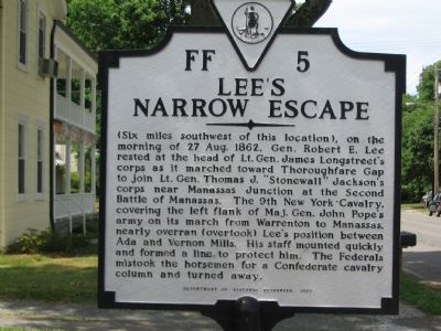
Lee’s Narrow Escape
(Six miles southwest of this location), on the morning of 27 Aug. 1862, Gen. Robert E. Lee rested at the head of Lt. Gen. James Longstreet’s corps as it marched toward Thoroughfare Gap to join Lt. Gen. Thomas J. “Stonewall” Jackson’s corps near Manassas Junction at the Second Battle of Manassas. The 9th New York Cavalry, covering the left flank of Maj. Gen. John Pope’s army on its march from Warrenton to Manassas, nearly overran (overtook) Lee’s position between Ada and Vernon Mills. His staff mounted quickly and formed a line to protect him. The Federals mistook the horsemen for a Confederate cavalry column and turned away.
Erected 1997 by Department of Historic Resources. (Marker Number FF-5.)
Topics and series. This historical marker is listed in this topic list: War, US Civil. In addition, it is included in the Virginia Department of Historic Resources (DHR) series list. A significant historical date for this entry is August 27, 1862.
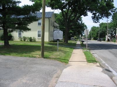
Location. 38° 51.813′ N, 77° 51.596′ W. Marker is in Marshall, Virginia, in Fauquier County. Marker is on West Main Street / John Marshall Highway (Virginia Route 55), on the right when traveling east. Touch for map. Marker is at or near this postal address: 8405 W Main St, Marshall VA 20116, United States of America. Touch for directions.
Other nearby markers. At least 8 other markers are within 3 miles of this marker , measured as the crow flies. Campaign of Second Manassas (here, next to this marker); Mosby’s Rangers Disband Site (about 800 feet away, measured in a direct line); Salem (approx. 0.3 miles away); McClellan Relieved From Command (approx. 0.4 miles away); Mosby’s Rangers Disband (approx. 0.4 miles away); Confederate Memorial (approx. 1.3 miles away); Number 18 School (approx. 1.6 miles away); Oak Hill (approx. 3 miles away). Touch for a list and map of all markers in Marshall.
More about this marker. The marker is in the parking lot for the Marshall United Methodist Church.
Also see . . . Salem - Lee’s Narrow Escape. Civil War Trails Marker nearby that details the same incident. (Submitted on June 26, 2007, by Craig Swain of Leesburg, Virginia.)
Credits. This page was last revised on April 19, 2024. It was originally submitted on June 26, 2007, by Craig Swain of Leesburg, Virginia. This page has been viewed 2,018 times since then and 53 times this year. Last updated on February 25, 2021, by Carl Gordon Moore Jr. of North East, Maryland. Photos: 1, 2. submitted on June 26, 2007, by Craig Swain of Leesburg, Virginia. • Bernard Fisher was the editor who published this page.

